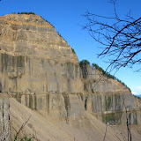
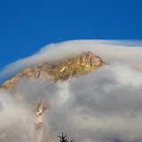
Table Mountain, Dec 6th

This was another one of those really long, hard and very rewarding hikes. Not only is a lengthy trail but it is also very steep. Table Mountain, as you might imagine is a mountain with a flat top, but that’s not the most interesting feature. It is located on the Washington side of the Columbia River Gorge. The south face (towards the river) is a 2000’ vertical wall that was formed when the mountain collapsed. All the debris from the mountain formed a stretch of land that for some time stopped the Columbia River forming a natural bridge that the Native Americans named Bridge of the Gods. In that stretch is where the bridge with the same name is today. Being a very long hike, we decided to start really early so we got to the trail head right after sunrise. The trail took us on the same path I had done just a couple of week ago when I went to Gillette lake and the Greenleaf Overlook so the first part of the trail was very well known to me. After walking in a relatively easy slope for about 5 miles we got to the trail junction where the “Heartbreak” trail starts. At that moment the name sounded funny but we did learn shortly afterward that is a very appropriate name for this trail. To get an idea, from that point it is a little over a mile to get to the summit but the elevation gain is over 1500’. That makes this portion of the trail very steep. After an arduous climb we got to a ridge that gave us the first really impressive view of the mountain wall right in front of us and the valley formed when it collapsed. From that point on, the trail travels away from the ridge and then turns up again through a steep rocky slope that has to be climbed using both feet and hands. Not long after that grueling section, you reach the summit and descend a bit to the actual peak of the wall. As you can imagine, the views from that point are simply breathtaking, so we decided to stop for lunch. For the return we had though doing the same trail, but on the way back we noticed a second trail on the ridge that continued north on top of the mountain. After a short walk, we came to the other side of the table with incredible views towards Mt Rainier. We continued on that trail that started descending on the east side of the mountain. This trail proved to be as difficult as the trail we used to climb up. For a long time we were just traversing on loose rocks. After that hike down and reaching the main trail (a portion of the PCT) we realized that we were about a mile further north so we had about 6 miles to go to get to the car. That hike down was really beautiful as it offered all the changing colors of the sunset until we got to the car in the dark.

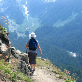
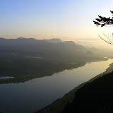
Hike to Angel’s Rest, Nov 30th

Weather was looking pretty good for the weekend so I decided to do the classic Angel’s rest hike. Instead of doing it in the morning as usual, we started it in the afternoon. My idea was to get to the viewpoint at the top, make some hot cocoa and enjoy the sunset. The hike up was very nice with great views of the Gorge as you can expect from this trail, but once we got to the ridge, we were almost blown away, literally. Although it was mostly calm at the trailhead, it was windy enough at the top that we were not able to go all the way to the viewpoint. We ended up sitting behind a big boulder so we could get some cover from the wind and light up our stoves to heat some water. After the hot coca with marshmallows and whipped cream, we decided to head back down rather than wait for the sunset with those conditions. Once back at the trail head, with a smaller group of people, we decided to head to the Vista House and enjoy the sunset from there. As you’ll see in the pictures, the sunset from Angel’s rest would have been much better although it was still very good.

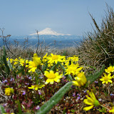
Mt Mitchell, Nov 29th

Not much to tell about this hike except it is the second time I’ve been there and still haven’t got the famous views your are supposed to get. The trail to the top of the mountain goes through a very dense forest that opens up at one point with a supposedly, great view of Mt Saint Helens. Further up, once you get to the ridge, there’s a big rock formation where an old fire lookout used to be. Some remains are still in the area. What’s most impressive is the view from the top. Looking north you are supposed to see Mt Saint Helens right in front of you and the Swift Reservoir down below. As you will see in the pictures, we didn’t get to see anything. I guess I will have to do it again; maybe third time is the charm.

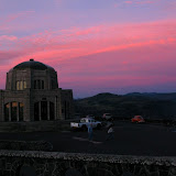
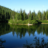
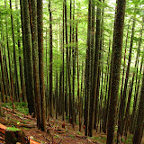
Hike to Gillette Lake and the Greenleaf Overlook, Nov 23rd

This was a little hike that Mike organized and I decided to join. This trail is located in the Washington side very close to the Bridge of the Gods and is actually part of the PCT. The hike itself was very moderate passing by a small lake before reaching Gillette Lake. After a short stop to let the dogs go for a swim, we continued up through a dense forest to an opening that was not very pretty. We didn’t know at the time, but this trail crosses a section of the forest that’s being logged. That open area, besides being kind of ugly, was very windy. After that, the trail continued into the forest with a very mild ascend and offering some really nice views of the Gorge. At some point we decided to stop for lunch and head back out. We don’t really know if we got or even passed the overlook since there was no sign or indication of it. Besides almost loosing a hiker on the way back, I made a second stop at Gillette Lake just to let Shia swim some more. In the end it was a nice day with an ok hike.

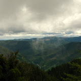
Hike to Silver Star, Nov 15th

This is a hike I had in the books for a long time and finally got the chance to do. Silver Star is a peak in the Washington side that offers great 360 degree view of the cascades. I did try this peak once before but on a much larger and difficult trail, this time; I took a rather large group of people up on Ed’s trails. This route is by far the most traveled to the summit. What makes this hike interesting is that after a short hike up, you reach the mountain ridge and the trail mainly continues on the ridge with great views of the Star Creek to one side and the Columbia Basin to the other. On the trail, we passed through some interesting rock formations which include a natural arc. Once at the summit, we stopped for lunch and to enjoy the great views. Even though it was mid November, we were blessed with a spectacular day. In the pictures you’ll see that we had complete views of St Helens, Adams, Rainier and Hood. After that break, we continued further for a bit less than a mile to the Indian Pits. These are holes in the ground made from rocks. Nobody knows for sure what or how they were used, but certainly they were made by Native Americans as they went to this place on a vision quest. To get back, we did the same trail which, besides offering great views, gave us some really nice afternoon colors.

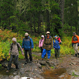
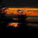
Eagle Creek, Benson Plateau, Ruckel Ridge loop, Nov 9th

After all the hikes I planed in October, I was kind of tired so my original plan was to stay home for the weekend, but when Lisa called me on Saturday to go on this hike, I wasn’t able to say no. I think I needed a long hike like this with just a couple of friends. The plan was to climb Ruckel Ridge to Benson Plateau and come back down to Eagle Creek. In total this hike is about 15 miles and climbs a bit over 4000’. Lisa did mention that the original plan was the “easier” way to do it, but since we didn’t find the trail head to go up Ruckel Ridge, we did it in reverse, the hard way. As you may remember, I did Eagle Creek a couple of weeks ago and one of the nice things is that it climbs gradually. After 4 miles in, the elevation gained was not much but considering we were going to Benson Plateau, which could only meant that we were up for a steep climb. Once we got to the turn out, it was like going up a fire ladder. That climb took us about three hours almost non stop until we cleared the trees. We rested for a while and then continued back into deep forest. By then it was already getting dark so I didn’t take more pictures. Lisa did comment about a cougar sighting in the area so we did the entire Plateau singing and making noises. The descend on Ruckel ridge was as grueling as the ascend with the added bonus of darkness. Hiking back out in the middle of the night looking at the lights in the Gorge was simply magnificent.

Computer is back!

Finally my computer is back and running. For those of you that might read my posts regularly, you may have noticed that I didn’t post anything for about two weeks. That does not mean I haven’t been doing anything, I have. My computer broke down and it took me a while to get it up and running again. The process included changing a hard drive and reloading everything… not a lot of fun. But I’m back and there are, as of today, three hikes I have to tell you about. I’ll do my best to post the first one tomorrow, so until then…

Backpacking clinic at Nesika Lodge, Nov 1st

This was a great event planned by Linda from the Trails Club of Oregon which included people from TCO, our group and others. The idea was simple, hike up to Nesika Lodge in Multnomah falls, have a full afternoon with backpacking classes, tips and tricks, enjoy good food and good company, stay overnight and do a couple of hikes. I took a small group of five with me to the lodge on a very nice hike up the Multnomah trail, once at the lodge and after lunch, we started with the classes. First was Ron Moak, the owner and gear designer of Six Moon Designs, a company dedicated to ultralight backpacking gear. He showed us his line of tarptents and backpacks and talked about the materials he likes to use. After that, Laurie did a small presentation on Hypothermia and I followed first with proper clothing and then with sleeping bags. After a short break, we continued with some presentations on food and cooking tips on the trail which were very useful. Later in the afternoon we had a great dinner before calling the night and going to sleep. On Sunday I woke really early, in part because of the change in time and in part because it was my turn to cook breakfast. After that, Lisa and I took a small group on a hike to Cougar Rock and around where old houses use to be. We saw many areas where is easy to see some remnants of those. This short hike took us about two hours, just enough to get back to the lodge in time for lunch. Before heading out, we sat together and brought up ideas that we tried this year. The best ideas were awarded with prizes and all of us got a Tyvek suit that can be used in emergencies. All in all it was a great weekend. Did I mention it rained the whole time?

Coastal hike, aquarium Halloween party and kayaking, Oct 25th

If you got the idea from the title that we did a lot of stuff this past weekend, you are absolutely right. In the hiking group I lead, we encourage people to become hike leaders. Part of that process requires that they organize and lead a couple of events with our help. This time, I helped Laurie organize this weekend that she decided to pack with multiple adventures. First we drove to the coast and did a hike to Harts Cove. This is a promontory that overlooks the ocean. It’s a short/easy hike to a beautiful meadow where, weather permitting, you can sit, relax, have a bite and enjoy the view, which we did. She even opened this event for dogs so we had plenty of four legged friends. After the hike, part of the group headed back home while with the others we went to a nice restaurant to have diner. From there, Laurie took some of us (the overnighters) to the aquarium where she is a volunteer diver. She gave us a behind the scenes tour and took us up to the diving platform. That night was the Halloween party so not only visitors were dressed up but divers were also wearing costumes and diving in the tanks with all the little critters. Once Laurie went in, we went down to take pictures from the other side. It was packed with people but we had a great time. Later that night, back at the bed&breakfast where we stayed right in front of the beach, we got in the hot tub to soak for a while. I guess it doesn’t get much better than that. On Sunday we had a great breakfast and then headed out for another adventure. We stopped at a place to rent Kayaks and went paddling for a while. For me it was a real adventure. Although I’ve been in kayaks and canoes before, I’ve never done it with Shia. It took me a while to get her in the boat but after a while she was fine and even falling asleep while I was doing all the work. In the pictures you’ll see we had amazing weather conditions considering it’s the end of October, and we certainly took advantage of it.

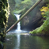
Hike to High Bridge in Eagle Creek, Oct 19th

Being the leader of the Hiking Meetup group, I’ve been getting emails recently requesting shorter, closer to town, later, easier hikes. Knowing I was going to be a bit tired after the 25 mile bike ride on Saturday, I decide to finally go to Eagle Creek and take a group up to High Bridge. Eagle Creek is, next to Multnomah falls one of the most visited trails in the Columbia Gorge. Unless you do this trail in the middle of the night, you can be certain you will see other groups of people. Not only that, this trail offers the opportunity of making it as long or as short as you want and you still can get beautiful views. For this group High Bridge sounded like a perfect distance and elevation gain. So we started at around 11AM doing a nice stroll alongside the Eagle Creek. Soon after starting, we noticed that the trail is actually carved from the hillside rocks. As you climb, there are portions of it with a cable hand rail and sheer cliffs that overlook the gorge formed by the creek. One of the big features of this hike is Punchbowl falls which you can descend to. Once down at the creek level, you can admire the rock formations on both sides and the waterfall up ahead. This waterfall is also visible from above. Continuing on, you get to High Bridge which is a bridge (duh) that crosses the gorge. Once you look down from it, you’ll realize where the “high” comes from! It even makes you wonder how where they able to put it there. This bridge just hangs from both side of the gorge which is formed by two vertical rock walls that drop a couple hundred feet to the creek down below. In one of the pictures you’ll see the bridge on the top part and the creek all the way to the bottom. Really impressive. After a lunch break we headed back to the cars doing the same route.

Mountain Bike Ride along the McKenzie River, Oct 18th

There are a couple of really interesting things that I wanted to see along the McKenzie river, one was a couple of really beautiful waterfalls, and the other is Tamolitch pool. This pool was formed thousands of years ago when lava coming from a volcano cut the flow of the river. Now the river disappears under the lava flow and reappears from underneath in this pool. Problem with organizing this was that doing the whole trail to see them all, required walking about 26 miles one way. Add to that the drive to get there which takes about three and a half hours and it becomes clear that is not an easy thing to do. Doing a bit of research, I found that the same trail can be used for mountain biking. Furthermore, if you take it in one direction, the whole thing is downhill, so I thought that it could be doable as long as we had one car at the end and another at the start. So that was the plan. Well, I learned that 25 miles downhill on a trail is a lot longer than 25 miles downhill on a road. Now don’t get me wrong, the trail is fantastic with ups and downs and turns and twists and rocks and roots, but 25 miles of it is a lot. The one thing that makes this trail even more difficult is the beauty of the place. It is almost impossible not to stop every so often to take pictures and see the river, the waterfalls and all the fall colors. The only bad thing about this day was that at some point, we missed the trail and had to get on the road for a couple of miles and missed Tamolitch pool. Oh well, nothing is perfect. I guess I will have to do it again

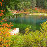
Hike to Cast Lake, Oct 11th

Another trip that was supposed to be a backpacking trip but it wasn’t. Still it was a great scouting trip and now I know I can camp out there. The only problem of doing this in a single day is, well, that you have to do the whole thing. In this particular case, that translated to 13 miles and almost 3000’ elevation gain, certainly not an easy hike. We started on the Cast creek trail going up on a very dense forest so much that, for a while, we did not get any sun and the temperature was rather cold. After a couple of hours of grueling ascend, we finally got to a clearing with a magnificent view of Mt Hood. This time it looked much better because we got some snow a coupe of days ago. From that point on, we started getting some snow on the trail all the way to the lake. The lake itself is in a basin which shelters it from wind. It was not surprising that the temperature was a bit higher there. The lake itself is really beautiful with a small peninsula in the middle that almost divides it in two. We circled the lake to get to a sunny spot where we stopped for lunch and then continued around to get back on the trail. For our return, instead of doing the same trail, we all decided on the longer route just to complete the loop. I guess nobody was expecting that we would be climbing even more before heading back down. Luckily, for me I guess, we got to a couple of very nice view point near the summit of ZigZag Mountain. The views we got from there was a nice reward for our effort. After that, it was a long descent into the deep forest back to the road and to the cars. A very long hike that ended at sunset, just in time to get dinner.

Hike to Lemei Lake, Oct 4th

I was originally planning on doing this as an overnight trip but weather didn’t allow me to do it. Up to certain point, I’m glad it didn’t. Not only was it raining all day but all trails were flooded and al campsites where muddy. Still, it was a great adventure. Even with the rain, we were able to enjoy some really nice fall colors, eat wild berries and cross numerous streams. This hike was in the Indian Heaven wilderness, a place that always surprises me with its beauty and the number of lakes. In the almost 8 miles we did, we passed by a couple of ponds with no names, Junction lake, Lemei Lake, Clear Lake and Bear Leak (I think). Sum to that about 7 or 8 stream crossing and you get the idea. I think the pictures will tell this story better than I can.

Walk with the dogs at dog heaven, September 28th

When you get a beautiful, sunny and warm day when it is supposed to be cold and rainy, you have to get out. So we took our fellow four legged friends to Dog Heaven for a long walk and swim. It was a fantastic day, dogs had a lot of fun playing in the river and we got a long walk. It was very interesting to see the water level a couple of feet below normal. We walked a long section of the river that’s normally under water!

Hike to Ramona Falls, September 27th

This was a long overdue hike. I did try to do Ramona Falls last year but a mud flow in the Sandy River washed out the bridge so there was no access to the trailhead. I new this hike was on the easy side and also one of the most popular in the Mt Hood area. Most descriptions say this is the most beautiful waterfall in Mt Hood and maybe the whole state. I can certainly agree that it is magnificent. The hike up is fairly easy going next to the Sandy River. The river itself doesn’t offer much, but the carved terrain from the mud flow is just incredible. At points, it’s hard to imagine the amount of water and debris that must have come down to cause the amount of destruction you can see. After crossing the seasonal bridge, the trail enters into the forest with a steady, uneventful uphill until you reach the waterfall. Upon getting there, you realize why this hike is so popular. Certainly this is a waterfall you can’t get tired of looking at. After a quick bite, we started o a long loop towards Bald Mountain. Unluckily, we had to turn around as we encountered some washed out areas that made passing a bit difficult. Once back at the waterfall and after taking some extra pictures, we continued down on the opposite side of the river. This trail ended up being just amazing. Beautiful forested areas protected by a huge rock wall on one side and the little stream running thru it. To top it all off, we had an amazing weather with sunny, clear and warm skies.

Camping at Wapiki Lake, September 20th

This is the same trip I did by myself about a year. Back then I had an excellent weekend with fair weather and incredible views. This time I was not as lucky. Although weather forecast was calling for a passing shower, we had cloud cover, mist and rain all weekend long. So much that we were not able to see the other side of any of the lakes. As you can imagine, there are not that many pictures, in fact, I didn’t take any on Sunday. Still, it was a great weekend with some good friends. We did have a great time and the highlight was provided by Rosario. When we were unpacking and setting up camp, she started taking out what she thought was her sleeping bag. The surprise was that, by mistake, she took a bag full of scarves, hats and even an umbrella! In the pictures you’ll see the whole thing. If you want to see what we were supposed to see, follow the link to last year’s pictures.


Last year's pictures are here

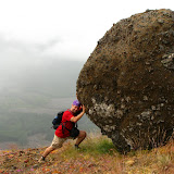
Backpacking in the Goat Rocks Wilderness, Aug 30th

I’ve had Goat Rocks wilderness in my agenda for a long time but knowing that just getting there takes about 4 hours, I knew I needed a long weekend. This past holiday weekend was ideal for that trip. We met early Saturday morning for the long ride to the trail head, once there, I did notice a lot of cars and a lot of people which didn’t give me good vibes on how much solitude we were going to get. Weather was not very nice but descent for a backpacking trip. We started our hike on the Snowgrass trail towards the mountain. This trail started in a very dense forest that started to thin out as we were gaining altitude. We passed numerous streams and meadows on the way full of wildflowers. The original idea was to get to the Bypass trail and take that towards the PCT and find a camping spot along the way, but since there were so many campers, we decided to continue further up. I’m glad we did. Soon after, we reached a plateau and a huge meadow with great views of the mountains ahead and numerous potential campsites. Being so open and windy, it was a bit cold so we left our packs in a potential campsite and went looking for a better one. After a while, Chris found the perfect spot. It was a little valley surrounded by rocks on two sides and trees on the other. That gave us some protection from the wind so we decided to stay there and set up camp. That evening, we got a little glimpse of the sunset and great views of the valley we went thru to get there. Later that night, both Jake and I provided some entertainment to the rest of the group while trying to hang our food. We started throwing a rope tied to a stick that was not working for us, so Jake proposed to use his Nalgene bottle. On the first try, the bottle not only when above the branch we were aiming for but landed on another branch and stayed there. We gave it a strong pull which made the bottle fly back at us and almost hit us. If that wasn’t funny enough, on the second try, we hit the branch but the bottle actually went around twice tying itself to the branch. At that moment Jake and I were thinking that we had lost the bottle and the cord. It occurred to me to throw the other end around to try to untie it and it actually worked. On Sunday, we woke up to a magnificent sunny morning. After a nice breakfast and getting our gear ready for a long day, we started our hike on the Lily Basin trail towards Goat Lake. This hike took us thru so many creeks, valleys and meadows that I even got tired of taking pictures. As you’ll see in the pictures, there were so many flowers that it was almost unbelievable. As we were ascending, the fabulous sunny day started to change rather quickly to an overcast day. Clouds were moving so fast it was almost scary. We got to Goat Lake which is just gorgeous. We did take some pictures there and enjoyed the views for a while before continuing on. By that time it had already started snowing. A bit after the intersection to go to Hawkeye point we decided to turn back. On one side, conditions were getting worse and there were some snowfields up ahead. On our way back, we had continuous snow showers all the way back to camp. Once back, the girls decided to pack up and leave and we boys decided to stay the night and do the full loop the next day. That evening was rough. We stayed mostly under a shelter with continuous snow that turned to hail and sleet. I did wake up in the middle of the night and noticed that it had stopped snowing. When I got out of the tent, I saw the most amazing sky, there were no clouds at all and full of stars. An incredible night. Monday morning was colder that Sunday morning but clear and promising a great day. Before we could head out, we had to hang our gear in the sun to dry and melt all the ice. After packing and having breakfast, we took the same route towards Goat Lake. This time, on a much better day, we saw the north side of Mt Adams behind us and also a lot of wild life. On our way up, we saw numerous Marmots running around and got to a point were two other hikers had spotted a black bear. We stayed there for a while enjoying that view and taking some pictures of it until it turned around, saw us and ran away. We then continued up until we got to Goat Lake. What a difference! The lake was just magnificent. We also saw mountain goats right above the lake. We then continued up on the same trail we used the day before until we got to the intersection with the Goat ridge trail that goes back towards Jordan Creek. This portion of the trail was as beautiful as the other one with incredible views of valleys and meadows reaching as far as the eye could see. On our way down we did hear a couple of bears playing and soon after we did see two cubs running around. Just a couple of seconds after, the mother popped her head up, saw us and started running in the opposite direction with the cubs right behind her. It was an incredible sight that happened so fast we were not able to take pictures. The rest of the hike was arduous and beautiful with different scenery as before. We got more green and more forest that the other side of the ridge but still very pretty. Goat rocks ended up being more than what I expected. Knowing there are a lot of trails in the area, you can be sure I will go back to explore some more.

Meetup Picnic at Champoeg Park, August 24th

Ok, you’re right, this is not a hiking or backpacking trip, but it is an outdoor event. Does it count? Either way, I just wanted to share the story because, among other things, I took a really nice picture of Shia. This event was organized by fellow hikers Marci and David and was held at a near by park called Champoeg. They arranged with the park to reserve one of the big picnic areas just for us that included running water and a sink, a BBQ and enough tables to sit about 100 people. Pretty nice when you consider it’s only 3 dollars per person. The park is close to the river and has some really nice pathways to go for a hike or bike ride which we didn’t do. We just spend the time cooking, eating and having a fun time. Towards the end of the afternoon, I did go to the river to let Shia go for a swim and take some pictures. After all the strenuous activities I’ve been doing, it was nice to have a fun and relaxing day with friends.

Hike to Devil’s Peak, August 23rd

What a steep hike! Although it does not top the hike to Elk Mountain I did some time ago regarding how strenous it is, it’s very close. The only worse part is that, as soon as you hit the trail, it starts going up on a very steep incline. There’s no warning, warm up or anything. After about one hour we got to a turn where it seemed that it would level off a bit. It didn’t, it was just a turn. The trail continued like that until we reached a ridge that opened the views of Mt Hood. Being such a beautiful, clear day, the mountain looked really great. Further up in the ridge, just above tree line, we got to a point were we could see all the way north. From this point, we could clearly see Adams, Rainier and St Helens. With such a wonderful view, we decided to stop for lunch. After that short break, we continued our ascend to the fire lookout. Strangely enough, the views from the lookout were not as good as the views we got from the ridge. The lookout itself was very well maintained and fully equipped so some of us are thinking of doing a trip there in the middle of the winter and staying overnight at the lookout. Our return was uneventful doing the same trail and enjoying the same views we got on our way up. Another excellent day in the mountains.

Hike to Bald Mountain, August 16th

This hike was done on one of the hottest days in the summer. Perhaps that’s why only six of us showed up for it. Luckily it was a short hike so it wasn’t that bad. We did a short trail that goes around Bald Mountain right in front of Mt Hood (actually part of the Mt Hood Wilderness). If some pictures look a bit similar to last week’s pictures, that’s no coincidence. This trail is the same section we did on the last portion on our way down last Sunday. This time though, we did it in reverse. Also, instead of doing the Top Spur trail to get to it, we did a portion of the PCT. Overall a very nice hike, enough to get the weekly dose of nature.

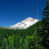
Hike to Mt Hood, Aug 10th

This hike was originally called Ice Caves in Mt Hood, but I had to change the name of it since we did not get to the intended destination. Still, it was a great, long and very strenuous hike. Probably the longest I’ve done so far. We started at the Top Spur Trail up in Mt Hood climbing steadily to McNeil Point. As we climbed up the views behind us started opening but we could not see the mountain in front of us. After a short stop at McNeil, we continued our ascend to a point were we veered of the trail and started crossing sideways towards the snow fields. This part of the hike was both beautiful and difficult since we were bushwhacking all the time. We passed a meadow before climbing to the next ridge that opens the views to the upper side of the mountain and the snow fields. From that point on, we had some hard sections with loose rocks and gravel and also ice fields that we had to cross. While we were doing this portion of the hike, the weather started acting strange with fast moving clouds. We went thru periods of sun and heat and clouds and cold. We then continued thru a second ridge and a second snow field before getting close to the ice caves. Unluckily there was a third snow field and ice on the other side separating us from the cave. Since we did not have proper gear to cross and it was already getting late, we decided to turn and head back. Trying to avoid the hardest part of the bushwhack we did on our ascend; we took a different route straight to the trail crossing two ridges. From there it was just following the trail back to McNeil and then back to our cars. We did take a little detour at the end though. We did a small loop that gave us wonderful views of the mountain and the valley in front of us. All in all, this hike was excellent. Is not everyday that you get the chance to see mountains, falls, flowers, snow, ice, clouds, blue ski and meadows all at the same time!

Hike to Burnt Lake, August 3rd

Finally back to Mt Hood. It’s been a while since I’ve been there. On one side well there’s not enough snow to go skiing but on the other, there was too much snow to do anything else. But now it seems like finally we get to enjoy this beautiful place. We started our hike right above Lost Creek on the Burnt Lake trail. This trail goes all the way to the lake ascending about 1500’ in a bit over 4 miles. It is a gorgeous trail with plenty of green and lots of water. A true vision of spring and summer. Once we got to the lake we took a short walk trying to get around but were not able to pass thru some big patches of snow. After a short break next to the lake and enjoying the view, we continued further up on the Zigzag mountain trail to a fabulous view point that not only gave us a magnificent view of Mt Hood but also of the northern cascades. From that point we were able to see Mt Adams, Mt Rainier and Mt St Helens right in front of us. At that point we decided to head back down and made a stop again at a hollow tree to take some pictures. We did notice in that area a lot of old burnt trees, perhaps that’s were the name of this trail and lake comes from.

Flugtag, August 2nd

Ok, this is not a hike or camping trip but still worth mentioning just for the fun of it. This past weekend was the second time that Red Bull brings to Portland the Flugtag. For those of you who have never heard of this before, this is a competition style event where teams of five people have to build a flying machine. Then, the day of the show, the get to do a little sketch on the platform before pushing their contraption on a 100 feet deck to try to make it fly as far as it will go (pilot included) until it lands or crashes into the water 30 feet below. The idea is to fly as far as they can. Most of them actually crash making it very funny. Just take a look at some of the pictures and you’ll get an idea.

Hike to Saddle Mountain, July 26th

This weekend I was supposed to climb Mt Adams but as you can see from the title, that didn’t happen. For those of you that don’t live in the area, there’s a huge fire in the area and all access roads to Adams are closed. As a second choice, we were thinking about backpacking to Trapper Creek but that didn’t happen either. Lastly, I joined Kristin, a long time friend to go camping and hiking to Saddle Mountain in the coastal range. Some of you might remember or have seen pictures of this place before. That is no coincidence. Saddle Mountain was my first hike here in Oregon. I knew there were some camp sites and recalled this place of being somewhat remote and quite; well, not anymore. Saddle Mountain has become probably the most visited hike in the coastal range. Not many people camp there so finding a big spot was not difficult. After dealing with the campsite “host” and since it was drizzling a bit, we decided just to do the hike and set up camp on our way back. The hike itself, as expected, was beautiful despite the fact that there were no views at all. For me, it was really interesting to see how this area has changed in a little over a year. Some parts of the trail don’t exist anymore and some others are brand new. We found a lot of blow down and fallen trees. I have to say though; the Forest Service has done an incredible job maintaining this trail. The only thing I didn’t like is that being the most visited trail in the area, well, you get a lot of people. A lot of noisy people. On our way back, the drizzle turned to rain so staying overnight didn’t seem very appealing. The first plan was to put up a tarp and wait while we cooked dinner or something like that, but after seeing that the weather was not getting any better, we decided not to camp. Instead, we drove to Camp18, a nice restaurant resembling one of the old logging camps. There, we had a nice dinner before heading back home to the comfort of our beds.

Camping at Crater Lake, July 18th

I can’t start this post without mentioning first that this is probably the most beautiful place I’ve ever been to. Ever since I moved to Oregon, I’ve been wanting to go to Crater Lake as it is one of the “things to see” here. Crater Lake, as its name indicates, is a lake in the crater of a volcano. Just with that description you would imagine it must be interesting. Well, that’s just for starters. The lake is located at the top of Mount Mazama, a Volcano that erupted about 7700 years ago. According to studies done, with all the material that was blown away, the mountain was not able to hold itself so it just collapsed forming a deep basin or caldera. Smaller eruptions followed later that formed what today is Wizard Island (which looks like a little volcano) and some other structures that today are under water. This basin was then filled with water from melted snow and ice. As you’ll see in the pictures, the deep blue/turquoise color of this lake is just incredible. The reason for this color is the purity of the water. Being at 6000 feet above sea level, this lake doesn’t have rivers or creeks that feed it or come out of it. All the water comes from melted snow. Some other key facts are that this lake is not shallow; in fact, this lake is 1943 feet deep, making it the deepest lake in the US. It isn’t small either at roughly 6 miles in diameter. Nothing but impressive.
Our trip started early Friday. Driving there from Portland takes about 5 hours. After a long drive thru central Oregon and entering the park, you’re presented some magnificent views of Diamond peak just before driving thru Pumice Dessert. After that, the road starts ascending without any hint of when you’ll get to the lake. At some point the road ends in a view point across from the Rim drive, a highway that circles the crater. You actually have to get out of the car and walk up a bit to get the first view of this incredible place. Besides being almost stunned by the beauty and color of the lake, the crater itself is also interesting as it is steep all the way around the lake. There is only one access point to get down to water level. From there we continued around stopping at various view points that offered different perspectives of the lake on our way to the campground. Setting camp and lunch followed before heading out again to explore a bit. We drove around to Cleetwood trail, the only access to the lake. Not only we wanted to get to the lake but also get information on the boat rides to Wizard Island. This walk and proximity to the lake was great. To top all that, that first night we had a full moon, so we went up to one of the view points to enjoy the spectacle and take pictures. The following day was hazy so views of the lake where not as good as on Friday. Still, we decided to go for a hike to Mount Scott, the highest peak in the Crater Lake National Park. This trail starts at about 7200 feet and goes up to about 9000 giving some incredible views of the park, the lake and surrounding areas. The hike itself was strenuous as expected but beautiful. On the way back to camp, we continued around the rim stopping at more view points. One of them gave us a clear view of Phantom ship, a rock formation that resembles a ship in the lake. Truly an amazing view. After dinner and having enjoyed the moon the previous night, we went to the same spot to enjoy the sunset. Finally on Sunday, after breakfast and packing we drove around and took our last peeks at the lake before heading home. You’ll see in the pictures that we took a small detour to Crescent Lake; a smaller lake outside the park with boat access. A nice place to rest before the last portion of the trip back home.

Work weekend at Nesika, July 12th

Although this was not a hike or camping trip, it’s worth mentioning. This past weekend we drove up to Nesika Lodge and spent the weekend doing some maintenance. After enjoying the lodge more than a couple of times in the past few months, it just made sense to volunteer to do some work. We got there Saturday morning and after unloading everything, I was given a chain saw and sent out to cut trees. I thought this was not a hard thing, but after a while, you get the clear message it is. We did clear a big portion of the mountain cutting off all the smaller underbrush, mostly for fire prevention. While we were hard at work, the girls were in charge of kitchen duties. It was a laborious day that ended with great food. We did go for a hike after that and found ourselves walking thru an orange lit forest that was unreal. We did continue working on Sunday morning until noon when we packed, cleaned and went back home.

Camping at Orcas Island, July 3rd

Taking advantage of the long weekend and an extra day, we went camping to Orcas Island. Orcas is one of the San Juan Islands of the coast of Washington just east Vancouver Island. Since we were a big group, we had multiple starting points depending mostly on who was riding together. After a four hour drive north, we got to the port of Anacortes were we took a ferry to cross to Orcas Island. Once in Orcas, we drove to the Moran State Park and then to our specific campsites. This park is located on the east side of the island and has, within its boundaries, some really nice lakes and Mount Constitution, the highest peak in the island. After setting up camp and resting, we made a nice dinner and enjoyed the rest of the day. That night, at around three in the morning we got a visitor. I got a glimpse of it and was actually able to take a picture. I guess that’s why they recommend putting the food away. On Friday morning, it was my time to make breakfast for the group. I went with Arepas and Perico, a nice way to start the day. During this very relaxing day, we did a hike around the north side of Cascade Lake (The lake right next to our campsite) all the way to some pretty waterfalls. We got back to camp and had an early dinner prepared by Jeff before going to town to check the 4th of July fireworks. It was a very nice time. Saturday morning was time for Holly to prepare breakfast with the help of Tim, Dean and Lisa. She made some really tasty French toast with bacon and sausage. After that big breakfast, it was time for a longer hike. This time, we went in the other direction, passed the cascades trail head and continued our way to Mountain Lake; the idea was to hike around the lake but not before the girls could enjoy the water for a while. After soaking for a couple of minutes they decided to go for a swim (sorry, no pictures!). From there we continued around the lake on a long and beautiful hike that took us the rest of the afternoon until we got back to campsite. That afternoon, the sky was clearer than the previous day so I went to Mount Constitution to take some sunset shots. In the pictures you’ll see why I’m glad I did. Sunday, being our pack and leave day, we started with breakfast and a quick tear down and pack. Knowing that everybody would be looking at the same ferry we wanted to take, it was a matter of getting there in time. Unluckily we didn’t make it on time for the noon ferry and were in line for the early afternoon one. That gave us a chance to walk around Orcas Village, lie down in the sun and just enjoy ourselves under the sun. We were not able to resist the temptation of doing the crazy shots in the ferry before saying goodbye and taking the long drive back home. Definitely a great weekend in the company on good friends in a great place, what more could someone ask for.

Hike to Silver Star Mountain, June 29th

I have to start by saying the name of this hike is wrong. Not because that is not the name of the mountain we were trying to climb but because we got somewhere else. I though of changing it to the correct name but I couldn’t find it in my maps. Any way, when I decided to join Jason and Kristin on this hike, I though we were doing the normal and very well known trail that goes thru a rock arch and then to some old Indian burial pits. But no, Jason had a different plan. The idea was to take a north trail that should have taken us all the way to the summit of Silver Star Mountain. After a somewhat rough ride we got to the end of the road, next to a river (which I believe is the Star Creek). From that point we started and as soon as we crossed the bridge, we started ascending on a very steep trail. Under normal condition this would get you tired quickly, but if you add the hot and humid weather, well you get the picture. The trail itself follows an old logging road up the side of the mountain with limited views. The first portion of the trail is just undergrowth the covers pretty much everything. After a long while, we crossed to a section of the trail that opens up to a very dense forest. It doesn’t get any easier or less steep from here on though. There was on point in this section were you can get a glimpse of Mt Hood but this is just that, a glimpse of the view later on. We got to a point were de trail seemed to start descending a bit which was contrary to our heading, so at that point we went off the trail and up the mountain. For a while we did some bushwhacking until we got to the snow. Yes, snow, in June, with 90+ degree weather, there’s a picture to prove it. From that point on, we continued our hard climb with a nice view of St Helens and Rainier in the distance. Shortly after passing the snow, we finally made it to the summit. That’s when we realized we were not in Silver Star Mountain since we were looking at it right in front of us. Still, reaching this summit was not bad at all. We got to a small patch without snow, just wild flowers and 360 degree views. Sitting up there and being able to see St Helens, Rainier, Adams, Hood and Jefferson all at the same time is simply breathtaking. We also saw a couple of falls on the north side of Silver Star that were incredible. On the upper portion you can clearly see two, almost identical falls. The flow continues down where you can spot two or three more falls down below and then a very impressive water jump to a deep creek. After resting for a while and realizing that the weather was turning on us, we started our way down which was as treacherous as the way up. In the end, it was a very long and hard hike but very well worth it.

Hike to Elk Mountain, June 22nd

The original plan for this weekend was Cairn Basin up in Mt Hood but due to snow, again, I had to change my plans. I decided on a trail on the Oregon coast that looked really nice on paper. Don’t get me wrong, it is, but it’s also the hardest that I have ever done. With the information I had, I knew there where a couple of possibilities all starting from the same trail head. One was going up on the Elk Mountain Trail and coming back down on the Elk Creek trail. The other, much larger option was to continue to Kings Mountain and back down to the Wilson River Trail. All these trails are in a wilderness area in the Tillamook County. At the end, I started on the Elk Mountain trail and waited until I got to the intersection to make a decision whether to continue to Kings Mountain or go back down on the Elk Creek trail. The trail started in a very dense forest with a steep climb that I thought wouldn’t last long. I was very wrong. The first part of the trail, a bit over a mile and a half, is a very steep ascending from 900’ to about 2700’. Views are incredible all the way thru until you get to a false summit with a sign that says 2500’. From there the trail descends abruptly only to come back up to the real summit at which point you tongue is reaching you belly. Even with a cloudy day, as you’ll see in the pictures, it was a fantastic view. From the Summit I still had to go 2 miles to reach the intersection where I could decide to continue or go back. I though that since I was at the summit, there was no more going up… wrong again. That couples of miles are like a roller coaster, it goes up and down abruptly. Most of this portion of the trail you find yourself either jumping a couple of feet down or climbing a rock that required bringing your knees to your chest. I felt really out of shape when a group of three trail runners passed me running in the opposite direction wearing their tight Spandex. Finally I made it to the intersection and stopped for lunch. A couple of hikers I meet in the way recommended me not doing Kings because it was already late to complete the loop from where I was, so I took the Elk Creek trail back. The hike back was not as difficult although equally steep. The trail follows and old logging road next to the creek al the way down back to the parking lot. I found a lot of washed out portions and the creek itself had lot debris, trees and rocks. It was very interesting and a great hike, although I’m still feeling the consequences.

Hike to Hidden Falls, Jun 14th

This is one of the best hikes I’ve done so far. I found the information on this area by accident and decided to take a group there. I knew from the beginning it was going to be a long and hard hike with a lot of bushwhacking. The reason is that trails do not appear in any map. Not only that, some of the falls in the area, don’t appear in maps or satellite images either. The idea was to do a full loop towards hidden falls then go around the power lines and descend on Archer Mountain. Originally I had planned to go see Cable Falls that doesn’t appear in maps either but that would have taken much longer. Getting to the trailhead was easy and we were greeted by a deer close by. After getting thru a portion of the forest road and enjoying the views of the valley and the tall wall with the cross, we went down to a river and then started climbing up on the other side. All this area was a very dense forest making it very difficult to pass. A bit later we found a wall of loose rocks that had to climb and then continue on a section on our hands and knees. Eventually we got to a really nice view point. From there we headed north towards the power lines and found an old logging road that took us there. The views from up there were truly amazing, but at that point we still had a bit to go to reach hidden falls. When we got there we couldn’t see much but could hear the fall right in front of us. After going around we found the crack between the rocks were the fall is. This was truly unbelievable. The fall itself is probably 100’ but you can’t see the bottom. Not only that, you can go down the crack and get really close to it. AS you’ll see in the photos, sunshine was shinning thru illuminating the fall while we were there. From there we continued on the service road for a while until we had to veer of towards the river. We did a bit of bushwhacking until we found the edge of the canyon. A bit after that we got a nice view of Archer falls. This fall was also amazing falling over 200’ down to the valley. There’s the possibility to go down to the base of this fall, but that takes a bit of skill and time. From there we continued and eventually found the ridge trail that took us down to a huge rock formation right on top of the cross. After enjoying the views and resting for a bit, we continued on the trail that descended quite abruptly back to the car. Truly an amazing hike that left some unexplored areas for future hikes.

Hike to Larch Mountain, Jun 7th

Larch Mountain, at a bit over 4000’, is the highest peak in the Columbia River Gorge area. It was jus a matter of time until we tried to do this hike. Unluckily, we found some snow on the top and were unable to pass beyond a certain point. Still it was a great hike. Sean and I combined people from Meetin and MeetUp and were also joined by four people from the Mazamas. The first portion of this hike is the Multnomah trail which is the same we do every time we go to Nesika. After passing the rough and hard first section, we continued our way up passing some open areas with rocks as well as dense forests. On the way down, just to add a couple of extra miles to make up for the summit we didn’t reach, we took the Wahkeenah loop. There wasn’t as much water as there was a couple of weeks ago, still, the stream and falls were beautiful as always. In total we did about 12 miles which was not bad at all.

Walk with Dogs at Dog Heaven, June 1st

On Sunday I took a group of people and dogs to dog heaven for yet another fun day. We tried to do the same route we did last time when we went all the way to the river but found that half or more of the park was completely flooded and there was no access to the river on any of the three or four trails we tried. That wasn’t a problem for the dogs though. They were very happy to go try every single pond, puddle, flooded area or anything with water. It was a lot of fun seeing Vento and Shia running after a toys and logs while Dusty waited for them to get back and jump all over them. Roscoe and Chewbacca also had a lot of fun running unleashed in grass much taller than them while Maddy was trying to find her way. Even with a little drizzle, it was a nice couple of hours in the park.

Hike to Hamilton Mountain, May 31st

Another great hike that I’ve done before. Hamilton Mountain is a big boulder ridge on the Washington side right behind Beacon Rock State Park. I organized this hike not only because it has a lot to offer but also to train a bit for the Adams adventure in July. The forecast did call for clouds but there was no mention of rain. Just when we were starting our hike, we got a bit of a drizzle that disappeared shortly after. Rodney falls looked really nice with all the water coming down from the mountain and the falls between the rocks were just as amazing. Weather got a bit better when we got to the ridge where we went out to take some pictures. Although this is not the highest point of this hike, certainly is the one with the better views. We then continued our ascend thru countless switchbacks until we got to the summit. We made a stop at the summit for lunch and to enjoy the views. After that, we headed back doing the longer, easier trail. Wonderful day.

Backpacking at Herman Creek, May 17th

This is the same trail I backpacked with Linda back in February. Back then, we set up camp at Herman Camp, the first camp site in the trail. On a day hike we went up to Casey Creek where we found snow. This time, the original idea was to go all the way to Noble Camp, the fourth campsite after passing Herman, Casey and Cedar Swamp. The first part of the trail was the same we did back then with different colors. Now it’s a lot greener with lots of wild flowers. Creeks were bringing down a lot more water than in February. After a short stop at Casey creek for lunch, we continued up and entered the old growth forest part of the trail. This section is basically forests that have never been logged with Douglas firs, Hemlocks, Noble firs and Cedars of incredible size. You’ll see a couple of pictures were we look really small against the trees. After passing numerous creeks and falls and climbing nearly 2600 feet, we got to Cedar Swamp. We encountered some hikers coming back down that told us that beyond that point, the trail was covered in snow which we confirmed. We also found that the complete Cedar Swamp campsite was already taken by boy scouts. At that point we decided to backtrack a bit and go of the trail looking for possible spots to camp out. We found the perfect spot clear off the trail, with enough flat spots and space to build a fire. Saturday’s weather was so hot that during the night, temperatures didn’t go very low. It was a great night. On Sunday we had originally thought of doing a loop and coming back down via the Nick Eaton Trail but since I was not feeling very well, we did the same trail back. Weather was nice and not as hot as Saturday so the whole hike back was very enjoyable. We did not get to Noble Camp, but that doesn’t take it of the list.

Hike to Boulder Ridge, May 11th

This was the first on a series of training hikes in preparation for the Mt Adams summit later this year. As you’ll see in the pictures, weather did not cooperate that well with us this Sunday. Still, a large group got together to try this. The trail took us on constant switch backs immersed in deep forest until we started to hit snow. We found a lot of blow down trees and not that many views. After passing the snow level the trail became almost invisible so we ended up cutting the hike short. On the way back, it tried to clear up a little bit and I was actually able to take a couple of pictures with a bit of light between the trees. It might not be the most photogenic trail I have done, but the forest was beautiful.

Celebrating 5 de Mayo at Nesika, May 3rd

Another weekend at Nesika. This time Lisa planned a potluck to celebrate 5 de Mayo, so we all brought ingredients to make some Mexican dishes and share. The hike up was beautiful as expected. With the spring and all the snow melting at higher elevations, streams, rivers and falls are incredible. The new green and flowers added a lot to the beauty of the area. We got to Nesika at around noon, perfect timing to do lunch. The original idea was that everybody would take care of their own lunch and the potluck was for the night, but since everybody brought a lot of food, we decided to share some of it for lunch. Marci made a great 7 layer dip that got devour in a couple of minutes. In the afternoon we did a small loop hike to Franklin Ridge. This trail was the same we did back in January when it was all covered in snow. It was really interesting to visit the spot were we sunk to our waist in snow and see it in full bloom. Back at the lodge we spent some time at the view point enjoying the views and then it was back to cook. We made tortillas, guacamole, taco salad, fajitas and all sort of Mexican plates, it was a lot of food. The following morning, I woke up really early and went to the view point to enjoy the sunrise. In the pictures you’ll see how beautiful it gets early in the morning. After a nice breakfast with Pan de Jamon and pancakes we took off on our way back. Instead of going down straight to the parking lot, we hiked to Devil’s rest and then cut back to Wahkena falls and back to the parking lot. This hike was long and beautiful with great views of the Gorge and tons of flowers.

Wild Photo Frenzy at Columbia Hills, April 26th

Another hike on the eastern side of the Washington state. Michael, an avid hiker and photographer organized this hike that originally was planned for the Tom McCall preserve in the Oregon side. Since spring has been delayed quite a bit due to weather, we found there weren’t that many flowers at McCall. Luckily Michael had a plan “B”. We drove for about half an hour to the Washington side to a trail called Columbia Hills. This trail is a service road that climbs to a ridge were a lot of FAA navigation antennae and beacons for air traffic control are located. Being farther East than even the Klickitat trail which I did last week, the scenery was completely different to what we’re used to. This time we found ourselves doing a soft climb with incredible views of the valley of the Columbia and also to the north towards Mt Adams. As the name of the hike states, this one was not for the views (which were pretty amazing anyway). It was all about the wild flowers. As you’ll see in some of the pictures it almost seems there were none. That wasn’t the case. All the flowers in this album, with just a few exceptions, where very small. Taking the pictures required getting down to your stomach or knees and very close. On the way back, instead of walking back down the road, we decided to cut thru the open field. That’s where we took the majority of the pictures. We also found some rolls of barb wire that made an excellent opportunity for some experimentation. At the end, we all ended up with some bruises on our knees and legs, dirty clothes, maybe a couple of ticks here and there and more than a handful of real good flower shots.

Hike the Klickatat trail, April 19th

This was one of those hikes that you either love or hate. Hate because is about 12 miles so you can’t stop frequently to take pictures but love because the scenery is beautiful. Hate because the trail is nothing more than an old rail track so it’s covered with small rocks large enough to slip but love that it goes down next to a creek. This trail is located in the Washington side all the way up in the high desert. As you will see in the pictures, the scenery is completely different to all the other hikes I have done in the past. It’s dryer and certainly there aren’t that many mountains. Vegetation is also very different. The whole trail is about 31 miles and is the old rail tracks that connected the cities of Lyle and Goldendale. The train tracks are no longer there, only the bridges and iron pieces from the tracks. We started by driving to the end of the trail near Klickitat where we left half of the cars. From there, we shuttled in two cars to the point where we started the hike. Although it was a bit cold and windy, it was a fabulous bright sunny day. This was very lucky for us since there was a snow advisory for the Columbia River Gorge and the Portland area. According to the forecast, it was supposed to snow and rain all day long. Not for us, we only got a bit of hail with full sun. We started the trail at an open field walking next to the river that soon took us to the canyon. Along the way we found many interesting things. Although hunting is not allowed in the area, we did find a couple of carcasses, probably from small animals. Further down, vegetation changed a bit and we did enjoy the flowers and the new green fields. For a long while, everything was pretty much the same. Great scenery mixed with new flowers and bright colors. The trail got a bit weird after a turn where we found a wood burning stove in the middle of the trail next to a sofa. There was some other stuff near by. As we continued walking, we found a couple of RVs and old construction debris. It seemed to us that someone lives there although we did not see anybody. Further down, we found another set of RV’s and signs of people living there. On this second place, it was a bit stranger. On one side, there was a boat converted into a house. On the other side of the trail, there was a bus converted into a house. Weird. Our final reward for the day came when we drove back to get the cars at the trail head. The looks of the valley and the weather systems moving in were just incredible. It was a very interesting hike which will probably never be repeated.

Hike to Tamanawa Falls, April 13th

This was a short hike that ended up being a bit more challenging than expected. It was about 5 mile round trip with an elevation change of no more than 600’ which on its own sounds pretty decent but adding the fact that it starts at 3000’ makes a big difference. With all the snow we’ve had this past winter up in the mountain, snow at this altitude is still pretty thick so the whole trail was covered. It wasn’t bad but enough to make it slippery. This trail is located on the eastern side of Mount Hood and follows the cold Spring Creek up the mountain. The trail started right after crossing a wood bridge over the creek. From that point on we walked all the way with the creek and some beautiful little falls on our side. Clearly spring is pushing in but it hasn’t got here yet. Views were very nice all the way up to a point were it seemed we couldn’t continue further and reach the falls. At that point everybody turned back except for Paddy that was already far ahead. Chris and I went looking for him and at the turn of a ridge we met up and he mentioned that we were very close to the falls. We decided at that point to head on (just the three of us) and get to the falls. That ended up being a great decision. This waterfall is probably one of the prettiest I’ve seen so far here in Oregon. Or our way back, we stopped at Full Sail in Hood River for some food and drinks.

View pictures of the hike

Walk with Dogs at Dog Heaven, April 12th

This was a walk that Shia planned and asked me to lead. We went to dog heaven, a big extension of land where dogs can run free, play and get dirty. You might recall this place since I wrote about it some time ago. This time, with much better weather, turned out to be a fantastic day. We took a different route than last time that took us directly to the Sandy River. On the way there, Shia found a mud puddle that was too good to miss. You’ll see in the pictures what I mean by that. She was a very happy dog. From there we continued to the Sandy river where we stopped for a little while to enjoy the views and take some more pictures while Shia went for a swim and cleaned herself up a bit. We then crossed the fields towards the Columbia where we found a shady spot to have lunch and enjoy ourselves. On our way back, we circled around were the Sandy river meets the Columbia and went all the way back. It ended up being a great day for the dogs and ourselves.

View pictures of the walk

Dress to Kill hike, April 1st

This was the first theme hike the group has ever done. To celebrate April fools day, Jeff decided to organize this short hike which he called the Dress to Kill Hike. The rule was very simple; wear anything that you would never wear on a hike. On that thought, the first thing that came to mind was cotton. But after thinking about it for a while, if we were already dressing for it, we could do much better than just wear jeans. Most people that showed up had similar ideas so everybody was dressed “appropriately” for the hike. About 45 people showed up for the hike that took us from the Zoo to Pittock Mansion in Forest Park. Besides all the costumes and funny dresses, we had lost hikers, beverages and cake served at the mansion and numerous photo shoots. It was a great event and most probable the first of many to come. We’re already thinking Hallowing!

View pictures of the hike

Hike Leaders hike to Forest Park, March 15th

This is a hike that I wasn’t going to mention for several reasons. For starters, it was a fairly short walk we did on Saturday afternoon. In addition, we were just hike leaders and the reason for the hike, was to discuss certain club matters. In fact, I had my camera but did not use it and ended up snapping photos with Marci’s camera. Since the pictures came out pretty good, I decided to share the experience. That morning, Jeff, Marci and I did the CPR/First Aid training curse, which Marci and I needed to have to begin organizing events. After the class, we met the rest of the leaders at Forest Park to do a short hike to the water tank and then rest for a while discussing in the Saloon. Arriving in Forest Park, it started hailing which almost made us cancel the hike. As almost always, hail stopped as soon as it started. The walk was short, but with very beautiful views. With the cool mist and fog, the brightness of trees and views of the woods were just beautiful. When we got to the tank, we took several pictures of the group and enjoyed some treats. From there we went to the Saloon where we spent some time discussing group issues. Upon our return, we went to the Lucky Lab, our place of choice, to continue the meeting and have dinner.

View pictures of the hike

Celebrating my birthday at Tyee Lodge, March 8th

This weekend, which coincided with my birthday, we went to Tyee Lodge in Mt Hood to spend the night. This stay was originally planned by the Trails Club together with the Hiking Group. From the beginning we knew that there would be a good amount of people and that we (at least Marci, Jeff, Lisa and I) had to help with household duties and take care of one meal. For some time I had offered to make Arepas with Perico (a Venezuela dish), and that was the plan for Sunday. As it was a relaxed trip, we went on Saturday morning without much trouble. Upon arrival at the Lodge, we chilled for a while before going out to enjoy the spectacular day. First we started digging three snow caves with the idea to connect them in the middle. We thought about spending the night in them but since the temperature was rather high, there was the possibility of high humidity, so the plan was scrapped. However, we managed to dig three caves of considerable size and joined them. All that digging made us spend a lot of energy. We then went in to enjoy delicious pasta with Pesto that Marci and David made. The afternoon went by with more playing in the snow. Just about when the sun started going down, I decided to climb for a while to enjoy the sunset up in the mountain. I took the Alpine Trail along some of the ski routes that go down to Government Camp. The climb was somewhat steep but the views were incredible. As you will see from the photos, I had the opportunity to enjoy the colors of the sunset and be above the clouds, all accompanied by silence. A unique experience. Going down was as entertaining while it was getting dark. Coming back to the lodge, I found a couple of very interesting views of the snow in front of the windows. Once inside we sang and ate birthday cakes. Apart from my birthday, we were celebrating Jeff, Mike and Lisa’s which are also in March. Marci’s cake was delicious as well as the cupcakes that Chris brought. The next day, we woke up early to begin with the task of preparing breakfast. The first was cutting onion which Jeff and Mike did while I started working on the Arepas. Marci helped, first preparing a fruit salad and then with the Arepas. After cooking for 30 people, we enjoy a delicious breakfast that apart from having fruit salad, Arepas and Perico, had avocado and cheese. After cleaning the kitchen, we went on a hike quite similar to the one I did the previous day; this time under a hot and radiant sun. The views were equally amazing with very interesting shadows and clouds covering the top of the mountain. You’ll also see in the pictures that we encounter some rabbit tracks. On our way, almost getting to the lodge we finally got the opportunity to see one. I think this weekend could redefine the concept of birthday party. The last photo was taken on our way back when the clouds made a quite peculiar shape.

View pictures

Backpacking at Herman Creek, February 23rd

Our first backpacking trip of the year! This trip was organized by Linda from the Trails Club but also included people from the Hiking Meet up group. The group was rather small, only 6 people, but perfect for a backpack trip. Herman Creek is a route in the Columbia River Gorge just past Bridge of the Gods. This route offers several camping sites at different altitudes and different trails to hike during the day. On Saturday morning, we met under the bridge. Although the weather forecast was not very good and promised rain, the day was completely clear and cloudless. After arriving to the trail head, we began our ascent. About an hour in, we came to a fork with the first camp site on the trail. The original plan was to camp further up, but not knowing if we would find snow, we decided to stay there. We unpacked and set up camp. After that, we went on a hike to Indian Point. This is a point in the trail where a rock comes out with a view of the Columbia Gorge. The road was somewhat tortuous especially with the snow. Although it was not too deep, it was soft enough to sink in it. That wasn’t much of a problem but it was laborious. For Shia was somewhat more problematic. Every step she took on soft snow would make her sink to her chest making it very difficult to walk. Despite that, she kept her good attitude and energy. Reaching Indian Point gave us mixed feelings. Yes, the views are fantastic (as you will see in the pictures), but the famous rock was unreachable and very unsafe given the conditions. The wind at Indian Point was strong enough to not let us get close to the rock. Upon our return to campsite, the first thing was starting a campfire. Drying wet boots and socks was the first priority. Then followed dinner where we shared the food we had. Linda and Glen offered ribs, Blake offered beans with rice and I offered a cucumber salad with some Tandoori chicken. There was no reason to eat badly. The night ended with us playing around with fire and flashlights. Since I learned how to do these tricks, you will see long-exposure photos in my albums more often. The next day, after a rich breakfast, we went on a different hike. This time, we took the Casey Creek trail, which took us to the campsite we originally thought of using. At that point, there are several trails to different places. We did a backcountry hike descending to a point were both creeks come together. This portion of the hike ended being very difficult and steep. There was more snow and it was deeper than on the way to Indian Point. After descending for a while, I realized that Shia, even though was not complaining, was not doing very well. As she was climbing down and sinking in the snow, she was getting snow between her toes. Seeing that it was getting worse, I decided to leave the group and return to the campsite where Glen was waiting. The climb back was really incredible, not because of the climb itself, but because of Shia. As soon as I told her to go back, she turned around and went ahead as she always does. The incredible thing is that she took me back, retracing every step back to the upper campsite. As you will see in the pictures, there was no trail or marks to follow. Even at a point where I took a small shortcut, she stayed back looking at me as if asking "so, where are you going?” When she saw I got back on track, she took the original route back and continued up. When we got to the upper campsite, we found Glen starting a fire to warm up a bit before returning. That’s when he taught me to use Pitch to start a fire! After a short break, we returned to campsite to pack up and head out. It was a great weekend with a lot of activity.

View pictures