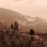
Saddle Mountain, Jun 20th
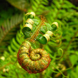
Mt Hood summit, Jun 12th

After that, we took another break at the Hogsback while we were hearing chunks of ice breaking up in the rocks nearby. That was a clear signal that we needed to start descending. As we did, the day got hotter and hotter, something completely unexpected and for something I was not prepared. Halfway down I started feeling a bit dizzy and nauseous so I had to take a couple of stops to cool down a bit. At around 5PM we got out of the mountain, tired but with a sense of accomplishment that you can’t take away. I guess I have even more respect now for Mt Hood than what I had before.
Hells Canyon trek, Jun 10
Early Sunday morning at Wallowa Lake

After that we had a big breakfast and got on the road to Imnaha and then the trailhead to start our trek. The first portion was a relatively simple hike up thru numerous switchbacks to the Freeze out Saddle. Upon reaching the Saddle, we were welcomed with a vast view of the Canyon ahead although we could not see the river. The trail continued on the other side going down to a fork that connects the Bench trail and the Snake River Trail. At that point we made the decision to stay on the Bench Trail and leave the brutal climb for last rather than have 3 or 4 days of steady climb towards the end of our journey. Looking at the map, we thought that the rest of the hike for the day, after that fork was going to be an easy walk. We were very wrong. The trail was not difficult, it was just muddy so it was hard just to keep balanced and avoid slipping. The other thing is that, although you can see roughly were you are going, the trail snakes around the mountains as it follows the contour of the canyon. Distances are not what they seem in there. After more than a couple of hours hiking and a light drizzle, we came to the conclusion that there was no way for us to reach the first intended point. So we decided to stop at the first place we found, a roughly flat area with water nearby to spend the first night. Reading the map we figured we were about two miles behind, with an early start we thought we could get back on track. The weather did not change much that night thru the following morning. We had lots of cloud cover with some passing showers. Not only that got some of our gear wet but made the already muddy trail even muddier.
First campsite

The following day, after a good breakfast and packing our gear, we continued on and reached Hat Creek, our intended first night camp, in a couple of hours. Weather was not changing one bit but we were determined to get back on track. With a long day still ahead of us, we continued and soon afterwards came to the real first impressive view of the Canyon. As soon as we went around the northern side of Hat Creek, the trail turned back West opening up in front of us. Unfortunately clouds were moving in fast so the views were a bit obscured. As we continued, we crossed several creeks, saw fascinating little waterfalls, saw passing showers and hiked and hiked and hiked. It seemed it lasted forever. To give you an idea, these pictures were all the same day
First view of the Canyon

One of the many waterfalls, maybe on Sluice Creek

Right after a passing shower

Later in the afternoon we finally got a glimpse of Winsor Place, our target for the day. The bad news was that we still needed to go around a small mountain and then climb down to the valley to get to it. We still had a long way to go. The good news was that the weather actually gave us a small break. As we were going around the mountain to start climbing down, we got some magnificent views of the ridge across the Snake River all the way to Idaho.
Finally some good views

As with all other cases, the rest of the trail was longer (or that’s how it seemed) than what we expected. The other thing we were not expecting was a creek crossing right before reaching our campsite for the night. Temperance Creek was running a bit higher than usual due to all the rain. Since it was already dark and our shoes were already wet, there was no point in taking the off so we just crossed and went to set up camp. Dinner that night went fast and quiet as we were all exhausted from the long hike.
The third day started with some drizzle but not enough to prevent us from starting a fire. Not only we wanted to warm up a bit but we needed to dry our shoes a bit before continuing. As we were having breakfast, we talked about the rest of trip and decided that, given what we had done so far, it made more sense to cut it short and try to do less distance per day. Looking at the map, Echo and I figured that we could take the Temperance Creek trail all the way down to the Snake River cutting about 20 miles of the trip. We also figured that we could re-arrange the intended campsites to do about 6 or 7 miles per day and come out still in 7 days total. Once we made the decision, it was time to pack and head down to the Snake River. The first part of this trail was ok and by that, I mean the first half hour on it. After that, we started descending deeply into the canyon following a very narrow trail bordering the creek all the time. Once again we were surprised when we got to a point where we needed to cross the creek. The first couple of times we actually took our shoes off to keep them dry, but then, realizing we would have to do that plenty of times, we just decided to keep going and get our shoes wet again.
One of the many creek crossings were the creek was actually running on the trail

The other thing that we knew we were going to find was poison ivy. The whole trail was covered with it so it took us a bit longer to navigate thru that trying not to touch them. Perhaps the rushing water of the creek help a bit as none of us actually got any. After a while of this jungle trekking, we finally made it to the river we our sense of solitude was broken for a while. Right at the base of the Temperance Creek rail, there is a house used by the forest service whenever they work on the trails. That house is part of a big farm so there were a couple of barns around. That didn’t bother us much and we continued to the river where we set up camp for the night. As we were resting, A.J. got his fishing pole out and caught a couple of trout that made for a nice appetizer. The following morning I was woken up by some animal noises on the other side of the river. I got out of my tent to be surprised by a unique spectacle. A river otter had caught a big salmon and while it was trying to eat it, a raccoon was trying to steal it. Nature at its best. That morning, as if we were not used to it already, it was raining. By then we started asking ourselves if we were really in the desert because it certainly didn’t feel like it. Once the rain stopped, we started hiking to our next stop following the river south. Just as we were starting, another nature spectacle, a bold eagle passed soaring right above our heads. Seeing an animal like that in the wilderness is a complete different experience. The first part of the hike on day 4 was uneventful as we had to cross a huge meadow under the rain. Later that afternoon, we got deeper into the canyon with tighter walls on both sides. For a while it did stop raining and we had a bit of a view of the canyon ahead of us but then the rain came back pretty hard. Unable to stop, we continued until we got to Hat Creek where we looked for a place to set up camp. We found an old horse camp under some trees which worked fine that night.
Hiking up the Canyon towards Hat Creek

By the fifth day, weather was taking a serious toll on the group. Once again it was raining so we had to wait for a while to pack our gear. That day we were not too worried as we knew it was only 5 miles to Saddle Creek so starting a bit later was not much of an issue. When it finally stopped raining, we started on the trail and finally we got a descent break in the weather. That day we actually had a bit of sun which elevated the temperature quite a bit but also made the day kind of muggy. The trail continued on its ups and downs and around following the river upstream. It was very weird that, although most of the trail was almost hard to find under the bushes, we had a section that looked almost like a sidewalk. I guess we all needed that to lift our spirits a bit for the rest of the trip.
On the way to Saddle Creek

Being a rather short hike, we got to Saddle Creek early in the afternoon. Since it was still a dry day, we took our time setting up camp and letting our gear dry a bit but looking at my barometer, I knew our luck would not last that long. We noticed some dark clouds coming in from the South so later that afternoon, our trip companion was back. Rain continued on and off all night long and well into the morning forcing us to stay in our tents until later in the morning. By the time we were able to have breakfast and pack our gear, it was almost noon. By then, the decision to hike all the way out was made. In the modified plan, the idea was to get back to the fork with the Bench trail and spend the last night there before heading out. With all the rain and wet gear, all of us had the same things in our minds: food, shower and bed. After checking that we were not leaving anything behind, we started our brutal climb towards the saddle. Not long after we started, we found what was probably the biggest obstacle of the trip. We need to cross Saddle Creek which in normal conditions would have not been any different than the other creeks, but with all the rain, it looked almost impassable.
Crossing Saddle Creek


Then the rain stopped for a while as we hiked up and up. For a moment we thought we might actually have a really good hike day and strangely enough, the first part of the hike did not feel as hard as it was. Once we got to the fork with the bench trail, we took a longer break to refuel and eat. It was final decision time; we needed either to gather our strength and continue 4 miles with a lot of up and down or stay the night and live thru one more day of misery under the rain. Out it was. Perhaps it was a test but as soon as we started climbing towards the saddle, a big, black cloud started looming on top of us. Just a couple of minutes after that, rain. If that wasn’t enough, this time wind started blowing really hard and we even had some hail. You’ll see in the pictures that after we ate, there are no more pictures until we are coming down on the other side of the saddle. Luckily our minds were set on the goal, get out. The problem was that once we got to the Saddle, despite the fact we were climbing rather fast, we were all freezing cold. The weather cleared at that moment (maybe we passed the test) so we were able to change into dry clothes before heading down to the parking lot. We thought we would not have more inconveniences but discover that, with all the rain, the Imnaha river was about to overflow forcing all the ranchers to move their cows to the mountain side. Now this might not seem like a big deal but hiking thru a lot of cows with their calves can be dangerous.
Cows on the trail

But then, we finally got out after 6 days. We did have some extra rewards on the way to Joseph that night that you’ll see in the pictures. First it was the sunset after the storm, then seeing the Imnaha about to overflow and then a deer with its newborn.
Although the rest of the story is not part of the backpack itself is worth telling. After an hour of driving, we got to Joseph and got to the hotel before heading out to dinner. The guy at the hotel recommended a place good for burgers and beer which happened to be the party place of the town and that night, being a Friday, it was party time. Wow, what an experience. Most of the town was in the bar singing karaoke. Obviously being the outsiders everyone was giving us the look but not in a bad way. Actually we had several people come by our table to talk to us. It was definitely a very welcoming place and a good end to our trip.
The following day, as we were leaving town and remembering all the bad weather we had, we looked back at a crisp blue sky. Maybe it was a test.
Storey Burn Loop, May 23rd
Subscribe to:
Posts (Atom)