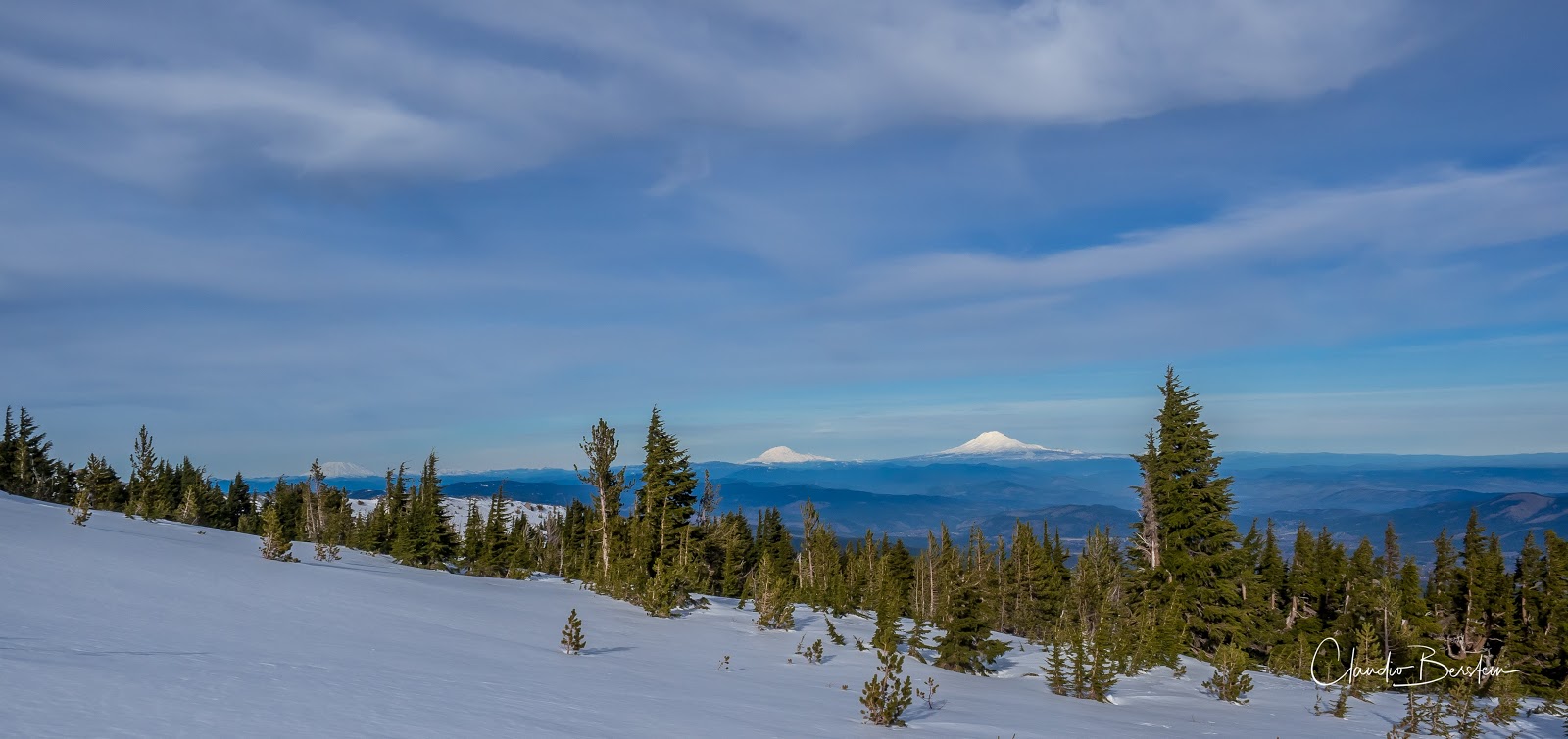
With cold weather and nice days, I was itching to go snowshoeing. The only problem was lack of snow unless you went high up, or so I thought. So, looking at my options, I decided to head up to Tilly Jane and maybe continue up to the rock shelter. What I didn’t think off though was that I would find ice which ended up being a pain for me. All the way from the trailhead, we found a thin layer of solid ice. Wearing snowshoes for that works but it’s uncomfortable and noisy. Everyone else in the group had the great idea to bring spikes besides the snowshoes except me. At first, I thought I could start without the snowshoes and put them later but that changed quickly as I slipped and landed on my ass just before the turn to get on the trail. With that clear message I put on my snowshoes and we headed uphill. My thought was that at some point we would find deeper snow but as we gained elevation the contrary was true. The ice got thinner and eventually disappeared in sections of the trail. It was quite sad to see the trail and the mountain so bare of snow in January. Rather than take the normal Tilly Jane trail up, I decided to veer off and take the Pollalie Ridge trail instead as it offers much better views as you climb the ridge line. As we climbed, we passed several viewpoints that opened to the Pollalie Creek valley. At one of those, we hear a low rumble and noticed a rock/ice slide on the other side. Towards the top of the ridge, we made a turn back towards the forest and finally got to the A-shelter. This shelter used to be open, but people were not keeping it clean and it was even get vandalized so now there’s an iron gate and you need to get permits to go in or stay the night. We stopped for a bit to have a byte and voted together to continue up towards the rock shelter. As we came out of the forest, we found ourselves in a white hard covered surface. With the sun to the south, the ice was even shinning on us as we continued up. Hard as rock. Close to the junction with the Timberline trail, we saw a couple of skiers fly down scrapping their skis. We got to the rock shelter where we took another break to enjoy the views which, needless to stay were spectacular. From our point of view, we could see clearly Mt Adams, Mt Rainier and Mt St Helens.

On our way down, we did pass again by the shelter but instead of taking the Pollalie Ridge trail we continued straight down the valley on the Tilly Jane trail.
You can see the rest of the pictures here
Interactive map
To see the full map, click
here