Wauna Point, Jun 26th

I believe I’ve done this hike a couple of times in the past. The first time, if memory serves me well, we got to the junction with the unofficial path to the viewpoint but didn’t go there. Then, back in December of 2014 we hiked up there with our fried Erin on a very cloudy, misty day – it was December after all. We did get all the way to the view point but with all the clouds and rain, we didn’t get many views. Not saying it was not a spectacular hike that time though. Watching the clouds as the crawl up the mountain side over the trees is always a nice site. From the viewpoint, things were a bit different as there was only a grey void. It looked like this.

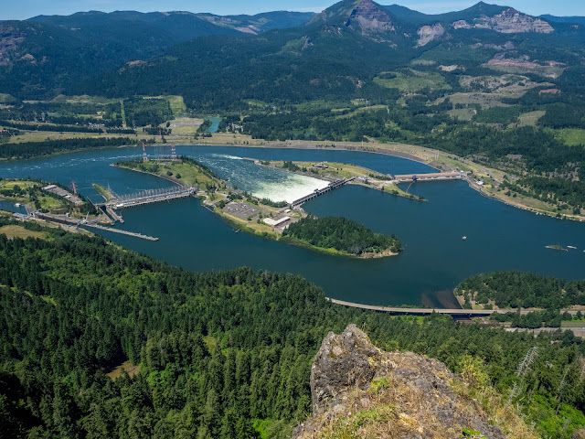
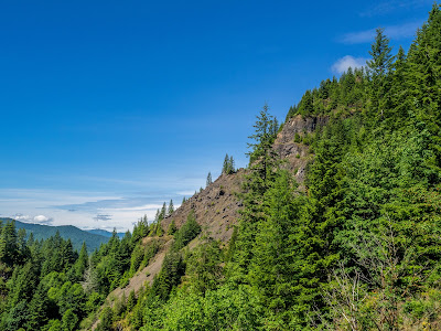
This time, Val and I did the hike on a warm, sunny day without a single cloud on the sky. I didn’t take a lot of pictures because most of the hike is very forested and steep so you’re huffing and puffing your way up the mountain. There are only a couple of spots where you can see the Columbia River and Mt Adams on the other side. Then we took the trail that goes to the view point and started getting hints of the reward we would get. I remember a section where the trail descends on a saddle to go over a second know before descending a bit to the viewpoint. Back in December of 2014, with the clouds, the knob looked like a mysterious island in the sky. This time the view might not have been as magical but still cool.

Then we hiked down on a very narrow user path to the very end of the ridge where a very stop drop off would make very bad news. The difference is that this time we finally, finally! Got the spectacular views and the reward for the almost 3500’ of elevation gain. Yes, the hike is long and has a lot of elevation gain but oh man is it worth it. 


You can see the rest of the pictures here

Interactive map

To see the full map, click here

Elk Mountain – Elk Creek loop. Jun 12th

Whenever Val and I need to get out and do a training hike, Elk is one of the hikes that comes in the list. Part of it is because it’s a short drive from home and doesn’t require, for us, to cross the city and it doesn’t get as crowded (yet) as other hikes in the Gorge. The other is because, even though it’s not that long, it has a section with good steep elevation gain. This hike is one of those that you don’t get to warm up. AS soon as you hit the trailhead, it starts going up, quickly. The advantage is that it doesn’t take long to get to a very descent viewpoint. On this particular day, we know we would good views as the sky looked clear towards the ocean. As we gained elevation the views got better and the weather hotter. Along the way we saw wildflowers in bloom which is always an extra treat. We reached the summit pretty fast and got a real nice view of the coast and a darker blue line that could be the ocean, or maybe not, you be the judge.
From there the trail becomes a roller-coaster of ups and downs as it travels on the ridge. It’s interesting that this hike passes over the Elk summit yet there are points on the ridge that are higher than Elk. It’s very weird. IN any case, right after the highest point, the trail descends to an old forest road and a junction. We wanted to make a stop there for lunch but the sun was beating on us so we continued on the road towards Elk Creek until we found a shaded spot to sit and have lunch. From there we continued on the shaded road for quite a while passing a fork that leads to the creek. At you continue, the road starts to thin out until it actually disappears and you are left on a trail. I guess not too many people take this route as the bushes are pretty high in places. There’s no good views of the creek but at least it offers a relief from the sun as heat until you get all the way down back to the parking lot.


You can see the rest of the pictures here

Interactive map

To see the full map, click here

Neahkahnie Mountain, Jun 4th

Neahkahnie is one of those places that has some interesting history. It’s a small peak along the Oregon Coast that offer magnificent views of Manzanita from its accessible summit. The name, as far as I know, comes from the Tillamook language meaning “The Place of the God”. Just with that, you can imagine there are some stories there. More recent stories though mention a treasure buried somewhere in the mountain. Artifacts have been found but no treasure. Being part of a state park prohibits excavations so no more treasure hunting unless you are looking for the view from the top. Hiking has several options. There are two trails that go to the summit, one from Hwy 101 on the west side and the other from the Neahkahnie trailhead road on the south side. Both are about the same distance but the first has the option of adding a trail on the 3eother side of the highway to get a bit more distance (it also is the better known approach for this hike). Starting from the day parking area in Oswald State Park, you head down towards the beach. IN the park, there are multiple trails that go different places which can be a bit disorienting at first. The easiest way is to head south until eventually you reach a hanging bridge over the Necarney Creek. At that point you are officially on the Oregon Coast trail. From there, the trail quickly gains elevation traversing a very lush forest with some pretty huge trees and fern covered grounds. After the first switchback, you find, at least for me, one of the interesting points of this hike. There’s a huge tree that from the distance looks like a Brachiosaurus crossing the trail.
The roots are so immense that look like legs while the trunk looks like the long neck that goes up to a head you can’t even see. As you get closer, you realize it’s in the middle of the trail so you get to pick whether you want to walk around the front of the “legs” or under its belly. Passing that, and taking the obligatory pictures, the trail continues up until it plateaus. The forest changes to something completely different. It’s still very shaded but no more tall trees. At points it’s kind of eerie and you feel like a deer will jump out of nowhere at any time. But then, you come to the last tree and come out to the open to find an open field that extends to a drop down to the ocean. You can recognize the spot even if you are not looking as the temperature rises several degrees as you walk out of the forest. At the other end of the meadow, you can see the Devil’s Cauldron viewpoint, a rock outcrop that overlooks the ocean and a small bay where waves crash into rocks. Along the trail there’s an unmarked junction to head to the view point. It’s worth taking the time to go there and check it out, it won’t disappoint. Once back on the trail you head east and end at a trailhead along Hwy 101. On the other side of the road a small trail sign marks the beginning of the Neahkahnie Mountain trail. So cross with care and start climbing. As you gain elevation you pass low vegetation and heat before entering into the forest. It’s usually hot up there. From about half way up, when you enter the forest though, views pretty much disappear until you are very near the top. You notice when you’re close as the bare rocks loom on your left. There are multiple footpaths that people take to scramble to the top from this side but the trail actually goes around and comes back up from the east side, a much easier approach and less damaging to the vegetation. Once there, the big reward. The views of Manzanita are just incredible. Returning is easy enough as you just retrace your steps all the way to the parking lot. There’s of course the option to make a quick stop at the beach though.

You can check the pictures here

Interactive map

To see the full map, click here

Alpe di Siusi, May 26th

For our last hiking day in Val Gardena, Val and I picked a shorter and easier loop on the other side of the valley. Looking at the maps, Alpe di Siusi seemed to fit what we wanted, the only thig was that we needed to hop on a lift to get up there. Once at the station, we considered our options to come back down which included taken one of the several trail or, ride the lift back down. At the station we learned that they do this intelligently. If you buy the round trip, it’s cheaper than getting a single leg, so buying only the way up and then deciding whether we wanted to take the lift down, would have cost us much more. With that, we just got a pair of round trip tickets and got on the little red gondola that would take us up. The ride was smooth and on the way we got really nice view of the city. Towards the top we could see clearly the entire Resciesa Ridge that we had hiked the previous day. Once we got off the Gondola, we walked to a completely different scenery. Certainly we had the huge peaks all around us, but just below we had an immense expanse of rolling meadows. It almost looked like a postcard. The first part of the loop started but going down the hill and passing several hotels and refugios marketed for winter sports even though several had summer activities as well. One of them had a petting farm with Lamas, Cows and Ponies while another had a pool. A lot of these places had even their own lifts so we guessed that in the winter, you just hope on, and sky around the area trying not to land in the lobby of one of these establishments. The hike was easy and picturesque with wildflowers on the ground and immense rocky peaks in the distance. It was certainly different from what we expected but beautiful none the less.

You can check the pictures here

Interactive map

To see the full map, click here


Resciesa Ridge, May 25th

After a couple of days with clouds in the sky and even some rain and snow, we finally got a clear day. From the forecast we knew this was probably going to be the best day during our stay in Ortisei so it was time to head out to do this loop. While planning for it, I had seen numerous pictures and descriptions indicating the ridge trail had spectacular views. I did start with some views in my head that I wanted to see but wasn’t sure if those were on this particular route. So after a hearty breakfast we walked out of the apartment where we stayed and started heading east. I must say that walking out the door and start hiking, whether on a trail or to it, makes a big change. Originally we thought we had to go down to town and then pick up the trail from there, but as we walked on the streets, we noticed little signs painted on walls indicating the trail. After a couple of turns, always going uphill, we finally found the trailhead and got into the forest. The trail at first was a bit different than what we expected. It was a very wide, rock covered path. Although I couldn’t find information to corroborate this, it seems a lot of the trails in the area are old cart routes that give access to little churches and refugios perched on the mountains. This is kind of corroborated by the frequent religious markings along the trail. As you follow the route, you pass by logs with carved images of different passages of the bible that seem to mark the trail and maybe even distance (although we didn’t see numbers). Most of the trail at lower elevation is a dense forest without a lot of views. There are some opening here and there that allow you to have a limited view of the valley below and the most prominent peaks on the other side, Sassolungo and Sassopiatto. As you gain elevation, the forest starts to thin out and at a certain point, the trail joins a dirt road. There you have the first really big view of the valley. While admiring the views though, you might hear a buzz to the side when the futuristic funicular zooms by taking tourist all the way to the top – the easy way. A couple of long switchbacks later, the trail comes out of the forest and you see the first refugio in the distance. AS you get closer, you start seeing people that took the easy way up having coffee and strudel or simply sunbathing while having a beer.
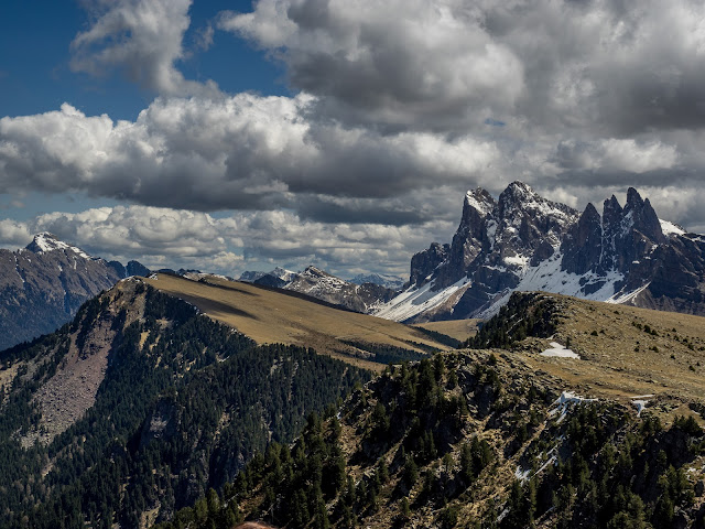
We didn’t make a stop at the refugio as that was not our intent so we continued on towards the edge of the ridge where we found a tiny church. At this point the views were simply breathtaking. On one side we could see the entire Val Gardena valley, on the other side of the valley was Alpe Suissi, our next hiking destination. To the east a clear view of the Sella Group and Seceda. To the west Ponte Gardena and more mountains. Around the church we found a big group of tourists that we quickly left behind as we climbed a bit more to Resciesa Dedora, the tip of the ridge whit a big wooden crucifix. From that point on, the trail would take us east heading towards the Ogle Group leaving tourists behind. The views only got better as we passed by one of the many places I had seen in pictures. AS you detailed the terrain, you can almost imagine the cataclysmic events that shape these mountains. Part of the terrain almost looks like it was flat at some point and a gigantic force lift it from one side making it look like it does today. As we walked, some puffy clouds started appearing giving more excitement to the scenery. Once we got to the junction with trail #9, a possible route to go back down, we stopped to eat lunch. Since the day was spectacular and we were enjoying the hike, instead of heading down, we opted for a longer route continuing east and take a different route down. The ridge was very enjoyable and the big Odle in front of us getting bigger and bigger as we got closer to it. Finally, we got to the junction with trail #5, the route we would take back down. From the junction there was a path down to Rifuguo Odle which we could see from above, and another trail that continue even further east. We took a last look at the path we had come from and could see out in the distance a little dot where the crucifix is. On our way down, we were accompanied by the incredible rock walls of Seceda painted in multiple colors. We had to jump off the trail a couple of times as mountain bikes came flying down the trail. I guess rules are a bit different and you are the one expected to get out of the trail. Finally, the trail become again an old dirt road that took us around some old houses and then the trailhead. We still had a bit over a mile to walk back home which was a bit tiring, but after enjoying a spectacular hike, we didn’t have much to complain about.


Interactive map

To see the full map, click here