
Indian Heaven, Aug 29th

Olympic Coast Backpack, Aug 21st
Morning from our first campsite

On Saturday, we woke up to a sunny clear day. Right after breakfast we discussed the viable options to finish the weekend which included going back home, staying where we were one more night or moving to Third Beach and stay the night there. The general consensus was to move to Third Beach, so we packed everything, hiked back to the trail head, went to pick up the cars, brought them back, picked up everybody and drove back to Third Beach. In the end we got to a campsite at Third Beach at around 3PM. After setting up camp and having a light lunch, we went for a hike to the end of the beach, over the headland all the way to Second Beach. This hike ended up being the highlight of the weekend. The views were magnificent and walking on the sand in the low tide was just incredible. The amount of life and little creatures you see is phenomenal. As time was moving, we hiked back right before sunset getting to camp in time for some Frisbee and more sunset pictures.
Sunset reflection

That night we had a nice fire by the beach with good food and some smores that helped release some of the built up tensions from the last couple of days.
Campfire

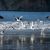
The last day, before packing up and heading out, I went for a walk to the north side of Third Beach. It was a very nice walk and I got to enjoy some really nice sky reflections on the sea and seagulls taking flight right in front of me (with a little running and yelling on my part). After that, we hiked out and went for lunch at a little place in the town of La Push.
Mt Hood Ice Caves, Aug 15th
Finally some sunshine

With blue skies ahead, we continued our hike up on the Vista Ridge up to a point where we made a quick stop to put on our Gaiters. We then headed of trail traversing a meadow towards the next ridge. I recalled this section as one of the most difficult last year due to heavy bushwhacking. This time, we took off higher so we bypassed that area. The hike continued pretty much the same, traversing a couple of meadows and climbing a couple of ridges until we got to the ridge on one side of the muddy fork. From that point on, there was no more vegetation, just loose rocks, sand and snow. The good part is that we had the cave right in front of us.
There’s the cave

After a bit of a scramble, we got to the entrance of the cave which is larger than what it appears to be. We took a small break to gear up again to go in. Although it was a bright sunny day outside, inside the cave was colder and there was water falling everywhere. Besides using rain gear, we were also wearing helmets just in case rocks or chunks of ice fell off. While gearing up, the cave proved the necessity of it. Every couple of minutes we saw a bunch of rocks sliding and falling of the sides or the top of the entrance. Watching that, we went in one by one as quickly as possible while I was in the back watching for falling rocks. Once in, it was only water falling from the ceiling. What was really incredible though, was the magnitude of the cave. When you stand outside, it doesn’t seem to be that big but once you step in, it all comes into perspective and you realize how high the ceiling is.
Entering the cave

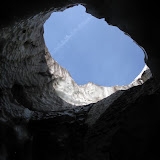
On the right side of the entrance, there was a big hole up in the ceiling that was letting some light in and illuminating the side of the cave that had some very interesting shapes and holes. As we hiked in, we saw another big hole straight up to the sky and then darkness. WE did go as far as we could, always climbing up on very loose gravel, rocks and a flowing river, a very interesting experience. Once back out, we took a break to have lunch before heading back. In order to avoid some of the heavy bushwhack, we climbed higher towards a ridge thinking the trail would be there. It wasn’t, instead we ended up high above a small peak with very steep inclines on both sides. Since scrambling down on loose rocks didn’t very safe, we continued on traversing a big snow field that was pretty steep. After that, we found our trail and headed back down to McNeil for a short rest and then all the way down to the parking lot which was still under the clouds.
Mt Adams Summit, Aug 7th
The climbing party

The first part of the hike was very similar to any trail in the upper section of Mt Hood, rocky and sandy with low vegetation. As you climb up, tress become scarce and you get more rocks and loose gravel which makes the hike a bit more difficult. Not only you have to climb up, but you have to avoid sliding down. This first portion was very arid and we found several campsites along the way wherever we saw trees. After a while, we finally made it to the ridge where the hike starts to get more intense. After a couple of hours of huffing and puffing we got to the top of the ridge right where the bottom of Crescent Glacier is. From that point forward, up to Lunch Counter, our destination for the day, most of the hike is on snow and ice, so it was time to try my new MicroSpikes. Walking over ice made the hike a bit more pleasant as it was a lot cooler that what it was going over the ridge. During our climb, we saw clouds moving in and out from the summit offering clear views at times and none at others.
Reaching the top of Crescent Glacier

After reaching the top of Crescent Glacier, we veered east towards Lunch Counter and started looking for some good camping spots. We spent some time setting up camp and resting while trying to acclimate to the high altitude. Although you don’t feel much, the low oxygen becomes very apparent when you kneel and then quickly stand up. It took us a while to adapt to that. Once camp was set, we went on an exploring hike around Lunch Counter. Waling all the way to the East and crossing over an ice shelve with a lot or running water, we got to the Suksdorff Ridge that overlooks the Mazama Glacier and the Ridge of Wonders in the distance. As you can see from the pictures, the views where just magnificent.
Panoramic view from the Suksdorff Ridge

Back at camp, we had a nice dinner and then got ready for a magnificent sunset. By that time, we had rested a lot and happiness was just around us and everybody else in the area. You’ll see a series of goofy pictures that prove the point. Sunset above the clouds was as expected, incredible.
Sunset from Lunch Counter

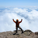
On Sunday it was rise and shine early in the morning. We had talked about being ready to hike by 7:30 which meant breakfast done and all gear packed. At roughly 8 in the morning we were already on the trail on our way to the false summit first and then the real summit. To Pikers Peak (the false summit), most of the climb is on a glacier which in not as difficult provided you have some sort of traction device. My MicroSpikes came in very handy. It was just a long hike up where you just need to pace yourself so you don’t run out of air. As you go up, the views get better and better. You are constantly surrounded by glaciers, rocks steep inclines and the cloud cover. Once you get to Pikers Peak, you finally get a clear view of the actual summit. From the false summit, the trail descend a bit towards an ice shelve before starting to climb again passing on the upper side of the Mazama and Klickitat Glaciers. The Crevices on the top, up close and personal are just incredible. It’s actually hard to imagine how all that ice is holding in the mountain and not just sliding down. Roughly about an hour after reaching Pikers Peak, we made it to the summit reaching an old shelter. Obviously the first thing you do is just stand there and do a complete 360, I guess is that reassurance that you are there and there’s nothing higher. If you’ve ever been on the top of a mountain, you probably know what it feels like to get there, but if not, you can probably imagine the views you can get from there. Here are just a couple of examples


We stayed at the summit for about 45 minutes until the cold air was getting to us. The hike down follows the same path you use to go up so it’s basically the same views. There’s a highlight though. It takes a bit over two hours to hike up the 2700 feet of glacier from Lunch Counter to the false summit. To get down, you simply sit and slide all the way down… fast…very fast; in fact, it takes about 10 minutes to descent the whole glacier…. Yes, it’s a lot of fun. We did a short stop at Lunch Counter to pick up our gear, change clothes and have a bite before continuing our hike down towards the campground.
McNeil Point, Jul 18th
Incredible Mariposa Lilies

We took a short break at that point and then continued up doing the short rock scramble to the shelter were we stopped for lunch. On the way back, we crossed the snow fields on our way towards the Cathedral Ridge from where you can descend to Cairn Basin or head down back to Top Spur. At this point the group was a bit tired so we headed back down crossing the McGee Creek and back to the Timberline Trail on our way down. Once down in the forest, I stopped and offered the loop around Bald Mountain to get our final views of Mt Hood before heading out. Everybody agreed to that so we did the short loop. As you’ll see in the pictures, it was well worth the extra effort
Subscribe to:
Posts (Atom)