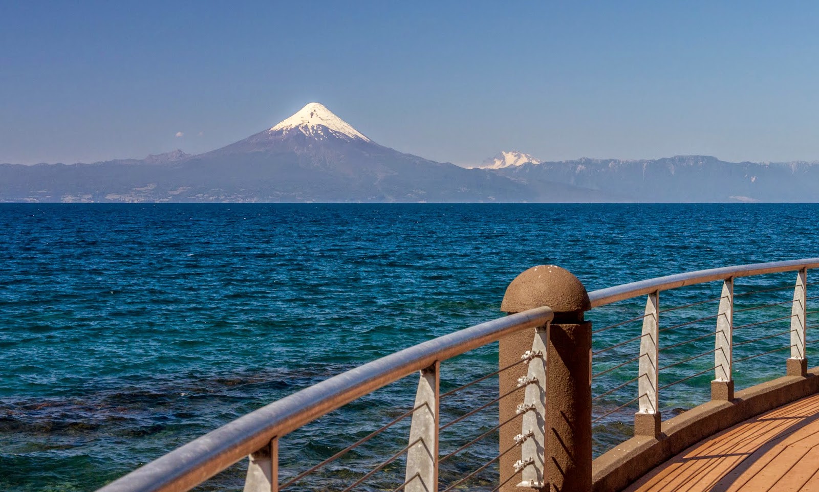
Being in Chile for about a week was a perfect opportunity to add some hiking and discover new areas. After our visit to the coast, Val and I flew to Valdivia and then drove to Puerto Varas taking the route around Lago Llanquihue. That day we got the best possible weather with deep blue skies and no clouds. It was perfect to get a full view of the volcanoes across the lake which include Volcan Osorno, Volcan Puntiagudo and Volcan Calbuco (that recently erupted).
We were hopeful to have the same weather for our hike so we could go all the way to Paso la Desolacion (Desolation Pass) that offers up close and personal views of Volcan Osorno but our luck didn’t extend that much. We woke to an overcast day and a mountain not to be seen. We still went out for a hike in the area but we took it leisurely. Our drive there took us thru the Petrohue river canyon all the way to Lago de Todos los Santos (Lake of the Saints) from where we would start our hike. We were a bit surprised that at the end of the road there’s a lodge and some services to take you to Margarita Island in the middle of the lake or even to the other side. There was little indication of where the trail started. That made us park in the wrong spot and then find out, so we had to move the car. Finally parked in front of the entrance to the camping area, we started our hike and passed by an entrance hut with nobody in it. We found a sign with directions so we were set, or so we thought. After about 10 paces, a guard came running asking us where we were headed. He then told us we needed a permit – something that is not posted anywhere. So we went back to the car, drove around a bit until we found the park ranger house where we got the permits. It was a bit annoying as it took a good 45 minutes before we were ready to hit the trail again. This time though, we almost ran for it, just to make certain we wouldn’t have to stop or return for anything else. By then the clouds were moving above us and it looked like rain was coming. We decided to go for it and play it by ear. The first part of the hike climbs very slowly over a wide sandy trail. Even though there wasn’t a lot of elevation, it was still a bit of a workout because our shoes were sinking in the soft sand. Trail was very easy to follow even at a couple of spots were it crossed “aluviones” (Alluvium).

These are carved sand valleys where water has come rushing down. They were dry but you can see how much gravel and sand the water can carry. After the last aluvion, we finally started gaining some elevation. Thru the vegetation we could see the lake behind us and some of the mountains around it. To the south the view was just splendid even though it was very limited. It almost looked like a small volcano with its crater being rained on. The trail opened up at a point where we imagined the views of the mountain would have been just incredible. A bit further up, we found Mirador La Picada. It’s a small rock outcrop that overlooks the lake. We took some pictures and the fell the first drops of water so we started our hike back hoping not to get drenched. We didn’t. Instead of going all the way down, I saw there was a route that followed one of the aluviones down to the lake, so we took that route instead. The bottom was dry but it still had the shapes left behind by the water. It was almost like a petrified creek. Towards the end we found some interesting rock formations that have been probably carved by water. I imagine there being some small waterfalls in the winter or earl y spring. Once at the lake, we followed the coast line back to the trailhead. The going was slow as we spent our time admiring the scenery. Even though we missed the mountain due to clouds, it was beautiful out there.
Interactive map
To see the full map, click
here

No comments:
Post a Comment