Jones Creek to King’s Junior, Nov 14th

Also known as the Lester Creek Trail, this trail is actually a section of the Wilson River trail in the Tillamook Forest. What makes it appealing though is that this is the only section of the 30+ miles of the Wilson River trail that doesn’t run next to the river or highway 6 as it has to go around some private property. Since it was only three of us, we decided to start from the Jones Creek trail head rather than Diamond Mill. Not only it added a bit of distance to our hike but also, it was easier and faster to reach. The first part of the hike, going towards Diamond Mill was a nice walk thru dense, fern covered, coastal forest. Along the trail we could hear the North Fork of the Wilson River until we got close to it and spotted a small waterfall. We found a side trail to a view point right across the river with a clear view. There was a way to get closer but with the wet terrain and mud, it would have ended with us falling in the river. Around the corner from that point is the famous (or so they say) hanging bridge over the Wilson River. In season it’s easy to spot Salmon as they swim against the current. After the bridge, we started climbing thru more dense forests and very limited views due to the weather. We found a spot that probably has some impressive views of the Lester Creek Valley but, as you’ll notice in the pictures, we only saw clouds. As this spot was not good for a rest stop, we continued up on the muddy trail until we got to the next opening. From there we could barely see a huge rock formation which I believe is the Lester Pinnacles. My original intention was to just make it up to that point and then turn back, but since it was so anti-climatic, we decided to continue on for a while. In the map I had, there was a short trail connecting the Wilson River trail and the King’s Mountain Trail that went over King’s Junior Mountain starting from one of the ridges. We started looking for the trail as we went over the ridge and were not able to see it on the first pass. Noticing that we were already heading down on the other side and that we had missed the junction, we turned around and headed back. This time, we did notice a very faint path going steeply up the ridge. We took the turn and started heading up. This section was not long but it was definitely steep, so much that at the top we found a sign naming the trail the Coronary Ridge. Obviously we didn’t get the views although I bet they are fantastic which is why I will have to try this again. After a short lunch we turned around and hiked back the same way.


You can check the pictures here

Twin Lakes from Barlow Pass, Nov 13th

First snowshoe of the season so I guess winter is here. This was kind of last minute hike that I decided to join and ended up leading it. This event was originally posted by Susan but since she was feeling a bit sick, I took over. The original plan was actually to do the lakes look from Frog Lake but I was a bit distracted while driving so we ended up in Barlow Pass which gave us access to the same trail but from the north end. The first part of the trail was an up and down roller coaster ride thru the dense forest without a lot of views. Part of it was because we didn’t have the best of weather. In fact, my camera was in my backpack at the time. The snow wasn’t great either as temperature was still a bit high so snow was melting fast so it was more of a slushy mix than anything. We got to the fork that heads to the lakes and continued to them doing the whole loop around Upper Twin Lake and then continued to Lower Twin Lake. We thought about doing the entire loop reaching the second fork with the PCT to head back up to Barlow but with the weather and lack of scenery, we decided to head back the way we went. As you’ll see in the few pictures I was able to take, there’s already a winter feeling despite the fall colors around the lake. It was still inspiring


You can check the pictures here

Cripple Creek and Serene Lake Loop, Nov 6th

With all the crazy weather around here, I started looking for something further south to go explore and found this very nice loop in the Roaring River Wilderness. This hike combines several trails to form a double loop that climbs up via Cripple Creek, then goes around Serene Lake and the trails to the Rock Lakes and then comes back down on a different trail to the starting point. What all that means is that this trail offers a wide variety of scenery and features. The drive there was kind of tricky as this trail is not at the end of a road with a well marked parking spot, in fact, as we were driving we spotted a trail sign between the trees which made us stop, get out of the car and go check it out. So after getting ready for our 11 mile journey, we started meandering thru the forest and passing by a couple of open meadows with shallow lakes. A bit after that, we came to the much bigger Cripple Creek Lake which gave us the first fall color display of the hike. After circling one side of this lake, we continued up to a bigger meadow where a second faint trail joined our trail and then seemed to disappear. The meadow was an interesting sight with lone trees and islands of shrubs on a yellow grass field. From the guide, I knew we had to just continue straight, thru the bushes to find a campsite which is on the Serene Loop Trail. Not only we found the campsite but also the tree eating the trail sign!

Hungry tree


At that point, we had the option to go clockwise or counter clockwise. We opted for the clockwise as that would give us better views along the way. We hiked up thru a dense forest for a while until we reached a clearing and a fork. There was no indication of which way we needed to go so we kept straight as that went out into the clear. That was not the trail, but it was the viewpoint that offers the best view of Serene Lake down bellow. Even with a cloudy weather, the view was fantastic. We then traced back to the fork and took the other route which started descending on the back side of the ridge towards the North end of Serene Lake. Once there, we explored a couple of campsites and then continued North to the end of the lake where a small creek comes off. Then we started climbing again on the other ridge and passed thru several almost flooded areas and small pools that eventually took us to a four way fork where you can veer off to any of the Rock Lakes. We decided there to go check at least one of these so we headed off trail towards Middle Rock Lake which, in my opinion, was a lot more scenic than Serene. Once there, we took a break and explored around for a while before heading back to the main trail.

View of Middle Rock Lake and the pyramidal rock


The trail then continues up until it ends at the other entry point for this loop at Frazier Camp. That spot was a bit disappointing not only for the rutted trails and roads but also because the next couple of miles were on an old service road. At some point the road becomes a trail again and we you least expect it, you start getting a familiar scenery as you approach the Cache Meadow on that faint trail we saw on the way up. We did some fooling around in the area (that you can see in the rest of the pictures) and then continued down on a different uneventful trail back to the car.


You can check the pictures here

Tom, Dick and Harry and beyond, Oct 31st

Tom, Dick and Harry is a hike I’ve done a couple of times both in the winter and in the summer. On a clear day, this hike is fantastic as it offers one of the best views you can get of Mt Hood as it towers up right in front of you. This hike also passes via Mirror Lake which, also on clear days, reflects the mountain on its waters. To spice this hike a little bit, I studied the map and noticed an old trail behind the ridge of Tom, Dick and Harry with two lakes. IN the map they show up as Slide Lake so I wasn’t sure which one was it. My idea was to hike the ridge, find these lakes and then head back out. With three other brave souls, we started our hike early in the morning and at a very brisk pace. We got to Mirror Lake almost in record time and were surprised to see that the weatherman had been a bit wrong predicting the weather. Originally it seemed it was going to be cloudy and maybe even rainy, but once in the lake, we were welcomed to patches of blue sky and sun. Since James had not seen the lake before, instead of taking the quick route that meets the trail to the summit, we did the loop around the lake and then continued up. As I remembered from past trips, the hike up is just that. A trail that circles the mountain with several nice views of the valley and the highway down bellow until it switches back on the ridge and continues to the summit.

View of Mt Hood and Mirror Lake from the summit


After a quick lunch, we continued, traveling east on the rocky ridge of Tom, Dick and Harry. This portion of the trail was all new to me so I was pretty amazed with the views of the mountain, the rock walls and the ridge itself. While traversing the ridge, I noticed a small valley down bellow with several frozen lakelets that I didn’t know about. According to the map, a creek starts from there but the lakes are just tiny blue dots. We continued on the ridge until we got to the top of one of the Ski Bowl ski lifts. In a map nearby I learned that those lakes and the basin it’s known as the five lake basin which made wonder if there was a way to hike thru there on our way back. We continued for a short while on the back side of the ridge and at some point decided to veer off and start navigating towards the lakes. At some point we discussed turning back as we were not having any luck in finding the lakes and we were descending quite a bit. Just when we were about to do that, I noticed an opening in behind some trees and there it was, Slide Lake. This was probably one of the most beautiful scenes I’ve seen as the lake was not completely frozen but had a snow cover. That gave the lake a flat grey color that was just amazing.

Slide Lake


From there, we started circling the lake looking for an easier way up back to the ridge. Coincidentally, that travel route was roughly in the same direction to the second lake so we almost stumped on it. This time though, we were not able to get close to it so we continued our way up to the ridge. After a while we finally made it back to the top of the lift and, as we were hiking back started looking at the Five Lake Basin with the same idea I had earlier in the day. We studied the map a little and decided to go off trail again towards the lakes and the cut to the west to head back towards Mirror Lake. All that sounded really good in paper so we just started heading down. That’s where the hard part of the day started. First we had to go down on a very steep, snow covered, rocky slope that eventually got us to the lake basin. On that slope we managed to sink in almost every single posthole there was, so it was not easy going. Finally at the basin we walked thru these lakes admiring the beauty of the area.

One of the lakes in the Five Lake Basin


We then continued descending thinking we were going to find an easy path towards Mirror Lake, wishful thinking. At some point we found ourselves looking down on a very steep drop off so we had to turn back and retrace part of our steps moving farther west which in turn made us go to another abrupt edge with a big drop off. By then it was already getting a bit late and the sun was quickly moving down. To make it worse, there were some menacing grey clouds moving in the area as well. So our best bet was to just bushwhack down towards the highway thinking that our worst case scenario was a long walk on the road. So after figuring out a good direction, we opted for the one that offered better chances for us to grab to something, which meant going down slopes covered in Rhododendrons. I have to say that we got to love those trees. They are flexible yet very strong and don’t snap back at you that bad. Still, a machete would have been a good thing to have for a change. We finally made it to the lower forest and taller trees which made moving much easier and quicker. By then it was almost dark so we shoot a straight line towards the creek that runs alongside highway 26 and followed that back to the car. We finally got out of our adventure with enough light to get in the car and just minutes before the rain started. That’s what I call an awesome day!


You can check the pictures here

Siouxon Creek, Oct 30th

With a rainy day on the forecast, I started looking for a good forested hike and decided to visit the Siouxon Creek up in Washington. I already knew the area a bit as I hiked a portion of this trail when I did the Huffman Peak hike a while back, but back then, it was already dark and we were on our way out from a very long day. This trail, instead of doing the hard climb to either ridge on the side of the creek, just follows it for pretty much as long as you want to follow it. Wanting to do a somewhat easy hike, we started from the middle trailhead that quickly descend thru the forest and gets to the creek. This part of the hike was thru a very dense and dark forest full of ferns and the smell of wet wood. Being a gloomy day, it gave this area that eerie look that was very nice. Once we got to the creek, we started following it upstream and getting only small glimpses of it. As we meandered thru the forest, we got some nice views of the creek and some of the waterfalls but not that turquoise color you usually get on sunny days. That was compensated by the immense variety of mushrooms on the trail though. My initial plan was to head up and find a bridge to cross the creek and then continue towards Wildcat Falls to stop for lunch but we never found that bridge. After exploring possible routes to take and finding that any would have required fording the creek, we decided to turn back, stop in one of the campsites for lunch and then head back to the cars.


You can check the pictures here

Owl Point and Perry Lake, Oct 17th

Having done a lot of the hikes in the books, I’ve started to research some not so common places by looking at maps and other sources. This hike is one of those forgotten trails which are only maintained by the few hikers that usually go there. I wanted to head there for two reasons, to check out the unusually view of Mt Hood from the north side and see one of the smallest named lakes in Oregon. Also, this hike offered a chance to do some route finding and bushwhacking. So we started from the Vista Ridge Trail Head and just before we got to the trail sign, I found the very faint route to Owl Point. The first part of the hike just meanders thru the forest without a lot of views but you know they are right there as light filters thru the trees. At about a mile from the trailhead, we found our first view point which gave us a view of the rocky edge at Katsup Point. My original plan was to explore that and also the Red Hill or our way to Owl Point so we took off the trail for a while following what looked like a foot path which didn’t go where we needed it to. So after circling around for a while, we got back to the main trail and shortly after found a trail sign for Owl Point. Not only the sign was unexpected but also that it was put here recently. We followed that path to a meadow with open views of the north side of Mt Hood, the Hood River Valley and Laurence Lake in the distance. We stopped there for a while to have lunch and enjoy the views before continuing on our way to Perry Lake. After getting back to the main trail, about half a mile further, we found Alki Point, another opening but this one looking north. From here, the views extend all the way to Mt Adams, Mt Rainier and St Helens. From that point on, there aren’t many views although the trail goes by the remnants of some old fire lookout stations. To get to Perry Lake from there, we followed an old 4WD road down until we spotted water to the side. As you’ll see in the pictures, Perry Lake looks more like a pond than a lake. I guess it has a name because it doesn’t dry up in the summer. On the way back I asked the group if they wanted to try to find Katsup Point but once we got there and started bushwhacking they changed their minds so we headed back to the cars. In the end, I left a couple of things unexplored so I guess I will have to do it again


You can check the pictures here

Thomas Lake to Blue Lake, Oct 16th

This is probably the best known route in the Indian Heaven Wilderness and a route I’ve done many times, not only as a day hike but also while backpacking in the area. Still, it had been a while since I’ve done it so I took the chance of co-leading the hike with Duane who’s training to be an assistant organizer in my group. The hike was as beautiful as I remembered it although it felt shorter. As we started from the trailhead, we quickly got to Thomas Lake and then passed thru several other lakes with beautiful scenery. We took the hike slow and easy with plenty of rest stops to enjoy the fall colors and the weather. Once we got to Blue Lake, half of the group wanted to do a little bit more while the rest stayed back. So I took them on a bushwhack climb following the ridge behind the lake. As we were gaining elevation, the view of the lake became better. We also got some nice views of other lakes in the area and Mt Adams peaking over the ridge. We did climb as far as we could but at some point, getting closer to the top, the ridge got pretty steep so we had to turn around.

Mt Margaret, Sep 25th

Mt Margaret has been in my radar for some time but I never thought about going there on a day hike. On one side, this area has a lot to explore making it better for a backpacking trip. The problem is usually getting permits as this fragile area is highly restricted. The other thing is that it could be a long day for just a hike. Mt Margaret is located on the north eastern side of Mt St Helens which is basically the blast zone of the volcano. The scenery is a bit eerie as all this area has been slowly recovering from the 1980 devastating eruption. You certainly find some vegetation and beautiful colors that are all contrasted by the thousands of downed trees. As you’ll see in the pictures, it almost seems that a gigantic comb passed thru the area leveling everything. So with nothing else to do on sunny day in September, I decided last minute to get my gear and head out there to check at least a section of Mt Margaret. I started hiking from the Norway Pass Trailhead, a pretty isolated area that gives you a quick hint at the scenery you’ll see the rest of the day. The first portion climbs on the boundary trail towards Independence Pass where several trails meet and you get the best view of the volcano. As you get there, the views open up in front of you with Spirit Lake at the foothills of Mt St Helens. I can safely say that this view is reason enough to hike this trail. You get views of new growth on the hills, the lake with its shore completely covered with dead trees from the blast and the immensity of the crater above.

View from Independence Pass


From the pass, the trail continues gaining elevation as it circles around the eastern side of the lake. As you do that, the other volcanic peaks start to show up behind the ridges. On the other side of the ridge, what is known as Mt Margaret Backcountry also starts to appear. This is a deep basin with several lakes and incredible scenery. From different points along the ridge, you can get some views of Shovel Lake down below and the rocky ridges that circle the area. The only common scenery is the pattern that all the downed trees create. It was incredible to see areas that were devastated and how they have recovered to beautiful postcard scenery. Along the ridge, I got a nice view of a small valley along a creek that flows to Spirit Lake that’s a perfect example of this

Postcard scenery


Shortly after that view, I got to the fork with the Whittier Ridge Trail. From pictures and reports I’ve seen, this is the hardest part of the Mt Margaret Backcountry loop. The trail follows the rocky ridge which has been blown or eroded. I decided to take a quick jaunt to check it out. I guess I didn’t do the whole thing or didn’t reach the hard section although I can say that the trail is not for the faint of heart. It does follow a very narrow line on the side of the ridge with a very steep drop off to one side. After a while and seeing that time was running by, I turned around and got back to the Boundary Trail. From there I continued for a while until I found the side trail to the top of Mt Margaret. I got there just at the time I had set up to start hiking back but with that scenery, I had to sit and enjoy it for a while. The views from up there included Spirit Lake, a clear view of the Crater, St Helens Lake and the volcanic peaks. Then it was the hike back. Being a bit late, I had to hike a bit faster to get back to the car before dark. Oh what a day!

West – East Zigzag Lookouts, Sep 11th

Besides getting the views of Mount Hood right from its base, there are numerous ridges and smaller peaks around that offer first row views of our magnificent mountain. One of those is Zigzag Mountain. Located in Zigzag (I don’t know if the town named the ridge or the ridge named the town), this ridge offers some of the best views of the South West side of the mountain. There are several trails that can go to either of these lookouts and one that connects them together giving the possibility of doing a loop hike. We started from one of the access points to Burnt Lake which is a steady uphill hike thru a dense forest without any views until you get to the ridgeline. Once there, the scenery just becomes fantastic as you get an incredible view of Mt hood. Down bellow, between the tress you can easily make Burnt Lake which is also a nice hike and even better spot to camp. From the junction we continued south until we got to our first stop, the East Zigzag lookout. It’s a rocky top with open views of the valley that extends to Mt Adams, Mt Rainier and St Helens. On the other side of the lookout, we started descending a bit and took a detour to Cast Lake. This lake is relatively close to Burnt Lake but not as visited. It does have some nice camping spots but people usually prefer Burnt as it offers a clear view of Mt Hood. Cast on the hand, is very secluded so you only see the trees around you. After a nice lunch, we headed back to the Zigzag Mountain trail on our way to the West lookout. After a bit of ups and downs and some meadows, we finally got to it. Although this lookout doesn’t have a clear view of Mt Hood, it does offer a good view of the towns of Zigzag, Rhododendron, Boring and the Hwy26 corridor. We also found the remnants of the old fire lookout that once stood here. Exploring around, we circled the ridge and found another good spot where we took our last pictures of Mt Hood before heading back down to the car.

Waldo Lake camping trip, Aug 29th

After taking a bit of time off from hiking, I was in need of some outdoor time. Also, since I did not spend a lot of time with Shia, it was time to something she could enjoy as well. Instead of planning something myself, I saw that Laurie had planned for that weekend a camping trip to Waldo Lake. She was actually going to be there for 5 days into the weekend so I decided to crash in Friday night and stay until Sunday. The other reason to go was to do a large mountain bike loop around the lake. Waldo Lake, located in the central cascades in Oregon, shares a lot of similarities with Crater Lake. It’s the second deepest lake after Crater and as Crater, doesn’t have a lot of organic material in it. That makes its waters extremely clear which can take a rich blue color on clear days. Unfortunately, I didn’t get a lot of that, as it rained most of the time I was there. On Saturday, after a rich breakfast under the tarp, Heye, Kim and I took our bikes with the intention of doing the whole loop. We started from our campground in Shadow Bay going north. The first part of the ride was thru dense forest with no views of the lake until you reach the north shore where there’s another campground. Kim decided to turn around at that point as she was a bit tired and it was raining. Heye and I decided to continue I bit further. The trail on the north side of the lake was completely different as it goes next to the lake and traverses an area that was burned many years ago. The views of the lake were pretty impressive despite the fact that it was raining and there was a lot of fog. We continued a bit further until we got to the northwest corner of the lake. At that point, it was pretty much the same distance continuing with the loop or turning around to go back, so we decided then to just continue and do the complete 22 mile loop. The rest of the trail turned to be much harder than the first section as it went thru multiple ups and downs, tight turns, rocks and roots and scree slopes. All that mixed with the non-stopping rain made it a good challenge that took most of the day to complete. That night, back at camp, we had to take “measures” to wake up free of pain on Sunday. Fortunately Sunday was a bit drier than Saturday so I went with Laurie and Shia on a short canoe ride. After that, I took Shia out for a short walk to the shore so she could jump in the water and play for a while as I enjoyed the little bit of sun we got.

The Enchantments, Aug 10th to Aug 14th

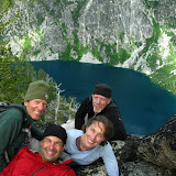
If you have seen my posts, you might remember I posted a five day trip to the Enchantments last year. Well, this is roughly the same trip again with a different group of friends and some more exploration. When I started planning this trip, I was saying to myself that after it, I would put the Enchantments on hold and maybe go back in two or three years. The first day in there, I came to realize that it will be impossible for me not to try to get permits again for next year. This place is still, by far, the most beautiful place I know. Yes, I have yet to explore a lot, but until then, the Enchantments is still on top of my list. So with that introduction, let me share a bit about this trip.
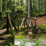
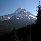
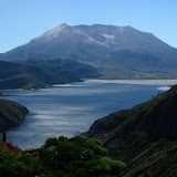
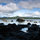
August 10th, the first day

After the long drive the night before, a good dinner and picking our permits early in the morning, we headed up to the Colchuck Lake trailhead. With a lot of energy we started our hike up thru the dense forest as it climbs gradually towards the ridge. The first part of the trail is very similar to a lot of other trails, but after crossing the second bridge, things start to change as Colchuck Peak and the Dragon Tail become visible. From there, it was a relentless hike up thru numerous switchbacks as we were quickly gaining elevation. Weather was not looking very nice so we did only one stop to rest and get the views towards the valley where Stuart Lake is. Soon after that, we got to Colchuck Lake and the first of many incredible views. We hiked around the lake until we found a nice campsite and, as we were setting up camp, the weather cleared up a bit.

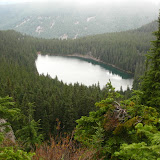
View of Colchuck Lake from our campsite


Having plenty of daylight, we started thinking about possible side trips we could do. One idea was to go explore Stuart Lake which we dismissed as we would have had to hike back up to Colchuck to return to camp. Looking at the map and around us, we saw the possibility of climbing a peak on the west side of the lake. From the map, we saw that it would be an interesting boulder field almost all the way up so we geared up and headed that way. Jocelyn, being a climber led the way thru the rock field and around the ridge to a point where it seemed we would be able to reach the intended peak. The climb was great and the views getting better and better as we gained elevation. Once we got there, we explored a bit enjoyed an amazing view of Colchuck Lake from above as well as the Dragon Tail. While we were up the weather kept changing with fast moving clouds and periods of sun, that gave some nice picture opportunities

Colchuck from the peak


After a little while, we started our climb down but instead of using the same route we took up, we went around and came back down on the back of the peak. That made us go thru some dense and steep terrain until we got to the boulder field and the trail back to camp just in time for dinner and a beautiful sunset.

View of Dragon Tail just before the sun went down


August 11th, the climb up Aasgard Pass

On Wednesday, we woke up to a bright sunny day with high level clouds. After a quick breakfast and packing our gear, we were ready to tackle Aasgard Pass. The hike around the lake and up the pass was beautiful and exhausting as expected. As we were climbing, it was hard not to turn back every second to enjoy the scenery.

Another View of Colchuck from Aasgard Pass


Once we reached the Pass, we were received by the welcoming committee. I’m not sure if it was the same lonely goat that received us last year but this one was really showing off the scenery and checking us out. The Basin looked a bit different as it was darkened by the moving black clouds. Weather was looking very menacing but fortunately we didn’t have any rain.

Welcoming goat


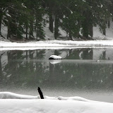
Isolation Lake and very menacing clouds


My original plan was to try to get the same camping spot we used last year as it was protected by trees and had some good views. Unfortunately, we could see in the distance that a group going ahead of us, had already grabbed that spot. As we were hiking thru the basin, we made a stop next to one of the small lakes that had a wide flat area perfect for camping. We left some of our gear there and split to go look for a better place. As we did, a goat and its kid started to look very interested in us or our gear so Jocelyn stayed behind to shoo them away. AS we continued thru the lakelets, we found a second camping spot that had better views and not as close to the water as the other one. So we decided to take the second option

The first campsite pick


Goats interested in us or our gear


That afternoon, after setting up camp and having lunch, we didn’t have any plans, so each one of us had our own free time. I took my camera, some water and food and decided to scramble up towards the ridge on the northern side of the basin. I was not able to find any names for this ridge other than Enchantments Peaks. As I was gaining elevation, the views of the basin were getting not only better but more expansive. At a point high up, I was able to see pretty much the whole extent of the Enchantments including Snow Lake. The following pictures is a short show of the views I got

Enchantment Lakelets


The Peaks, I climbed all the way to the peak on the upper left corner of the picture


Full panorama of the Enchantments, from left to right you can see Prusik Peak, Inspiration, Surprise, and Leprechaun Lakes, McClellan Peak, the Enchantments lakelets and Little Annapurna to the right.


The Enchantment peaks


On my way down from the peaks, I followed the ridge towards Aasgard. By then, the sun was already going down and the basin was starting to get dark so I got some nice dusk views before I got back to camp for dinner

The lakelets at dusk


Perfection Lake with a tent set up on the right side (that the first campsite we found)


August 12th, Exploring around Little Annapurna

Thursday was the peak day of our trip, not only we had planned a good exploration day and then move down to Inspiration Lake, but also we had a feast for the night. August 12th was the peak of the Perseid Meteor shower so with a clear day, we were definitely looking forward to seeing some shooting stars.

Early morning from our campsite


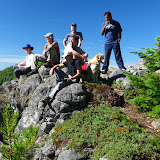
Right after breakfast, we packed most of our gear and took off on our day expedition. The first destination was Little Annapurna so we figured our way and started climbing. The views from up there were as fantastic as I remembered they were and both Brian and Mark were like little kids exploring all the different viewpoints you can stand on. We did see a family of Marmots enjoys the sun as we were there but being skittish as they are, it was difficult to get a good photo. Differently from last year’s journey, were we just went down the same way we went up, we checked our maps and decided to continue on the ridge towards Dragon Tail. That implied descending a bit to a saddle and then climbing up again to a peak on the other side. There we found some more interesting rock formation that looked almost like put there by giant hands. Jocelyn tried to get on top, but after seeing the steep drop off on the other side of the rocks; she decided to stay on the safe side. From that same point, we got a very nice view of Isolation Lake and the top of Aasgard pass

Jocelyn enjoying the view of Isolation Lake and Aasgard pass


From there, we started our descend and quickly found that it was going to be a bit trickier than expected. For starters, the hill was steeper and then you had some rocks and a lake down bellow. Obviously falling would not end up well. We did a bit of traversing which put us on a snow field from where we glissaded down as we could until we got to a small ridgeline between Isolation Lake and the other Lakelets. Back at camp, we had a late lunch and got ready to hike down to our next camping spot between Surprise and Inspiration Lakes. As we were walking out, Jocelyn turned around to check we were not leaving anything behind and by weird chance, as she was walking on a flat surface, she twisted her ankle. I was standing next to her so almost heard when it happened. Being a very experienced hiker, she took her boot off and quickly put her foot in the cold water to prevent swelling. She wasn’t feeling too bad but resting a bit was going to be better than forcing her to move. So Brian, Mark and I took off to look for the next campsite which luckily was not going to be too far away and then two of us would come back for her and her gear. All that took most of the afternoon but finally we were roughly in the same spot where I camped the previous year. We had a late dinner with wonderful color displays just in preparation for the meteor shower.

Sunset from our campsite, a good way to end the day


That night, once it got dark, all four of us took are sleeping pads and lay on the rocks looking up. We stayed there for more than a couple of hours as countless shooting stars crossed the sky.
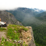
August 13th, hiking down to Snow Lake

Friday morning was another splendid day. Unfortunately, Jocelyn’s foot was not doing so great. After estimating how long it would take for us to hike down to Snow Lake, Mark, Brian and I decided to go for a short exploratory hike to Prusik Pass while Jocelyn stayed at camp resting a bit. The three of us hiked down to Inspiration Lake and soon took the trail up to Prusik Pass.

View from the trail junction to Prusik Pass


Once at the pass, we had a complete view of Shield Lake which might be a route worth exploring next time and Prusik Peak. We took a small detour to the ridgeline which gave us a view of Lake Viviane. We also noticed a rock climber on the face of Prusik Peak going up. It was far for a good picture, but it was interesting to see someone all the way up in a wall. On our way down back to camp, we made a quick stop at a little pond with no name to take a last look up close to Prusik Peak and the climber. Back at camp, we picked our gear and started our long hike down to Snow Lake. The going was slow, especially while crossing streams or climbing down from boulders as Jocelyn was being careful not to put too much pressure on her bad ankle. Still, the hike down was fantastic as we went around Inspiration and Leprechaun Lakes and then followed the creek down to Lake Viviane. In that section of the hike, we found a lot of day hikers coming up from the Snow Lake trailhead which was unexpected.

Our lunch spot on our hike down to Snow Lake


From Lake Viviane the trail changes completely as it follows the creek down to Snow Lake. This section of the trail not only gets steeper as it goes thru numerous switchbacks, but also gets back pretty quickly into deep forested areas. On more than a couple of places, we were able to get close to the creek and see the numerous waterfalls in the area. After a while, we finally reached Snow Lake and started looking for a campsite. AS it happened last year, pretty much every campsite was already taken, most by people going just for the weekend and entering from the Sow Lake trailhead.

Finally at Snow Lake


We continued around upper Snow Lake to the dam without any luck. At that point, our option was to find something around lower Snow Lake or, worst case, hike down to Nada Lake which would have taken us another couple of hours. Fortunately we did find a pretty secluded campsite on the north side of lower Snow Lake. Being a hot day and considering how tired we were, just after setting up camp, I jumped in to the lake not realizing it was much colder than what I thought. It still felt very refreshing after a long day.

Lower Snow Lake from our campsite


August 14th, last day

Morning view from our last campsite


Once again, we woke to a fantastic day with clear blue skies. Being the last day, the only plan was to pack and hike all the way to the car. I did remember from my previous time that this part of the hike was grueling. It wasn’t because it was long or steep but, as you climb down and the day gets hotter, your feet start to burn. By the time you make it to the river, it almost feels like you’ve been walking for a week on hot coals. In any case, the first part of the hike was pleasant, and we were very surprised when, after passing a bend, saw a big gush of water firing out of the mountain. At first we thought it was a waterfall that somehow had bored a hole in the rocks but after, realizing the pressure and how far it was going, that it had to be something different. At a point, we found a side trail that allowed us to get closer to the source where we found a drain pipe, probably from Snow Lake and a valve house. The pipe was fully open so the amount of water coming was nothing short of impressive.

Lots of water and lots of pressure


The trail then took us around Nada Lake which rarely gets any visitors despite the fact of being a very nice lake. Maybe this is due to the fact that Nada is the last (or first) lake from the Snow Lake Trailhead. It also might be because right after this lake, the trail changes one more time into a more arid and open area as it gets out of the deep forest and starts winding down the slope of Snow Creek all the way to the river. The first portion is not that bad with lots of vegetation and countless switchbacks as the trail gets closer to the creek a few times. Roughly half way down and half the distance, all this forest is left behind. The view in front is a huge canyon with some views of Leavenworth far in the distance. With some patience and the desire to get out of the heat, we got down early in the afternoon. We went to the car were we dropped our gear and then headed back to the Icicle river to jump in for a refreshing bath before heading back to town for well deserved meal and the long drive home.

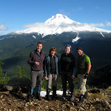
Back at the Icicle river


What more can I say about this fantastic trip and great companions.

Sunrise and Jumbo Peaks, Aug 7th

There’s a section of forest between Mt Adams and Mt St Helens known as the Dark Divide. This roadless area is a bit of a strange thing. Numerous trails cross thru it but the majority have been taking by bikers and others have been left to disappear under the forest. One long trail in the area follows a ridge line north to South known as the Juniper Ridge. Along this trail, there are numerous smaller peaks and entry points offering diverse hiking opportunities. While studying the area, I found two interesting peaks, Sunrise and Jumbo. These two peaks are relatively close to each other so I decided to do a long hike and cover both in one day. The scenery in this area is magnificent and the views outstanding (or so they say). Thanks to the weather, we only enjoyed the scenery; the low clouds cover prevented us from seeing the vast forest of the Dark Divide. We started the hike from the Sunrise Peak trailhead which just goes up in a straight line until it reaches, at about a mile in, a view point. From there we turned at the first fork towards Sunrise which we reached shortly after. As you’ll see in the pictures, there used to be a lookout up there but now, the only remains are the tie points and a handrail. Despite the low clouds, we still got a pretty nice view of the forest below us. After a short break, we continued our hike down towards the Juniper Ridge Trail and then followed the side of the canyon towards Jumbo Peak. Along the way, we got impressive views of the McCoy Creek Valley and a massive rock wall on the other side. Half way to Jumbo, we got to a Saddle that opened the views to the East. On clear days, Mt Adams is in the center of that view, but we had to use our imagination that day. As we continued towards the second saddle, we were surprised to find some Mountain Goats on the trail. In that same area, we saw a foot path towards a peak right behind us. Not knowing that it was not Jumbo Peak, we decided to go up and explore just to realize we were not where we wanted to be. Still, on top of this peak with no name, we found fantastic views of the McCoy valley to one side and the Dark Meadow to the other. As you’ll see in the pictures, the cliffs from this outcrop were just incredible and certainly not for the faint of heart. We then climbed down and continue until we reached Jumbo Peak which is a massive rock formation. To the top of it, there’s no actual trail so we first walk around it to the other end where we got a good view of the Juniper Ridge trail as it goes south towards Dark Meadow. While heading back, we found a foot path and took it to the top of Jumbo. This route required a bit of scrambling but nothing major until we reached the top of the bare peak. Unfortunately, we didn’t get a lot of views as the clouds descended on us blocking pretty much everything. As we were heading down, on the North side of the peak, we found a big patch of delicious wild strawberries. Most of the time the rewards for a hike is the views, but sometimes dessert is not a bad second.

Mt Adams climb, Jul 31st

Can a mountain be so different from one year to another? I guess it can. This is the second time I do Mt Adams and it was completely different than last year. On one side, we did not get any views from the top and on the other, we had a lot more snow so glissading down was a lot of fun, even more than last year. This time, I took a group but we were joined by another group so we had a lot of people for this trip. I also knew that my good friend Sean was going to be there with his group. The other change we made this year was that, instead of heading there Friday night, we went early on Saturday. So, after picking up permits and having a quick breakfast on the way, we got to the trailhead mid morning. By the time we were all ready to go it was almost noon so we decided to hike at our own pace so we could stake some camping spots up in lunch counter. Soon after we started, we were surprised to find snow at lower elevations. That changed the hike a bit as there were several sections that required a much steeper climb. Once on the ridge, we followed it up towards the glacier. From there on, it was only snow until we got to Lunch counter. Pete had already gotten there and staked several spots so as the rest of the group got there; we started filling our space in the mountain. That evening, after dinner we went a bit off to enjoy the sunset and the magnificent view of Mt St Helens. On Sunday, we woke up early and started getting ready for the climb. After having breakfast and packing everything, we got to the base of the glacier, got our crampons on and started climbing. For about half the morning, the weather was looking great with nice blue skies but as we were approaching the false summit the blue sky started to change. A heavy haze started lifting blocking almost all views around the mountain to the point that not even the valleys bellow were visible. That actually made it good for some interesting pictures where all the climbers look like ants following in a straight line in the distance. Early in the afternoon, we made it to the summit. Up there we spent about an hour taking pictures, resting and enjoying the limited scenery. Then came the fun part of getting down. With so much snow, we actually started glissading from the very summit until we got level with Piker’s Peak. We hiked that portion and then it was a single slide from there all the way down to our campsite. What had took us about 3 hours to climb up, took us about 15 minutes to get back down. Last year, when I did this trip, that’s where the fun ended, but this year, we grabbed our gear, and continued glissading most of the way down. It was certainly a great weekend with good company.

Cooper Spur, Jul 18th

100 years and 1 day after the historic first climb to Cooper Spur, I decided to take a group up there. The idea was not to celebrate the 100 years though, that happened by chance. The idea behind this trip was to train for the Adams Climb planned for the end of July. I was hoping to get most of the group that had already signed up for Adams but instead, I got a mix with some other folks that were not doing Adams. This hike, which I have done at least three times in the past, it’s a grueling climb from the Cloud Cap Inn in Mt Hood to the base of the Elliot Glacier at 9000 feet. The first part of the hike goes thru some switchbacks in the forest but quickly comes out of it and for the rest of the day; you are out in the open. This can be good and bad at the same time. As you’ll see in the pictures, the good thing is that you get amazing views that just get better and better as you gain elevation. The bad thing is that you have either the full sun on your back, cocking your brains or, on cold and windy days, the wind. Also, when you come out of the forested area, the hike is over a barely noticeable trail that goes over scree and mountain ash. This makes the hike a bit harder as every step up you take, you slide down a bit. With all that, we marched on at a steady pace towards our goal. In several places, we took the standard route doing switchbacks thru the snow but on some others we took the harder/shorter route following the ridge. The view where outstanding as we got up to the low section of Cooper Spur. At that point, we decided to stop for lunch and enjoy the views and then some of us continued a bit higher to the point where you need to put crampons on to continue. The wind was blowing hard so we didn’t stay there for long. On our way back, we stopped at the famous rock with the inscription done 100 years ago before heading down. Once we got back to the ridge line, we saw a group of people heading down over the snow field. That seems to be more fun that hiking down the scree so we traversed a bit to the east and glissaded most of the way down. After all that fun, we, the ones that were signed up for Adams, knew e were ready for that challenge.

Table Mountain, Jul 10th

The grueling hike to table mountain is one of those that, after you’ve done it, you really think about it before attempting it again. To get to the summit, there are several routes, the short and hard, the long and hard and the approach via Aldrich Butte (also hard). For this hike, I was just following the directions of Zach, a new hike leader in the group. He decided to take the Aldrich route via a connector trail that shortens the approach a little bit. We started on a gorgeous sunny day thru the forested area that leads to the Trail of Two Chiefs and soon departed on the PCT towards Table Mountain. This first section, been all under the canopy, doesn’t offer a lot of views until you get to the ridge. Once there, you are welcomed with a nice panoramic view of the Columbia River and Mt Hood peeking between the trees. After a short brake, we continued up the hill to the ridgeline and found the spot where Kate Huether had an unfortunate accident and fell, a clear reminder that you have to respect the outdoors always. Soon after that, we came to the rock field, a section of the trail where it’s better to put your trekking poles away and use your hands and feet to scramble up the rocks. The jaunt doesn’t stop there though. AS you pass the rock section, the trail continues up steeply until it reaches a saddle with the top of Table Mountain to the right and wonderful vistas that include Mt Hood, Mt Adams, Mt Rainier and Mt St Helens. We followed the ridge to the top of Table and unexpectedly were welcomed by an incredible flower bed. That plus the views of the Gorge from the edge were just fantastic. For the return, we hiked back up the ridge line to the back of Table Mountain to do the north trail which is almost as steep as the south trail but offering a different panorama of the area. Just before heading down though, we decided to stop for lunch at that end, enjoy the views and the sun. Yes, my knees were hurting a bit the following day!

Quartz Creek, Jul 3rd

While researching some trails, I found a bit of information on Quartz Creek which caught my attention. This creek, located in the Dark Divide, seemed to be exceptionally beautiful but seldom visited. I found conflicting information about the state of the trail so I didn’t know what to expect. Most reports did say that the trail was unmaintained but I also read that it was a backpacking possibility. Not wanting to experiment that particular weekend, I decided to take a small group on an exploratory hike up the creek to find out. Getting to the trailhead went smoothly and easy as this trail starts from the upper Lewis River. As soon as we found the trailhead, we were surprised to see it was well marked and clear. The first part of the hike was like hiking on any other trail although we crossed a couple of bridges that haven’t seen a bit of care. Things started to change as we got closer to the first obstacle. We knew that we needed to cross Straight Creek that has on bridge, but just before that, we found the first blow down. It wasn’t that bad but a sign that things would change after that. We took a small detour to an overlook of the Quartz Creek before continuing on to the creek. Straight Creek was unexpectedly beautiful. The river bed was a yellowish rock which made the whole section look golden. At that time we didn’t want to get our feet wet so we hiked upstream and found a log pile that made it easy to cross although we had to pay the price for that afterwards. The short section we hiked upstream on one side of the creak was a heavy bushwhack on the other side to get back on the trail. Once there, we started ascending and found the first campsite. From there, all things changed. What seemed to be a well maintained trail changed to a seldom visited place. First we started finding some blowdown trees that as we went on, became larger and more frequent. We even got to a section where we found to old growth trees, one on top of the other, crossing the trail. Once we climbed over those two trees and found the trail on the other side, we came face to face with three more crossed old growth trees. Some later sections were even more challenging as the trail became invisible for more than a couple hundred yards. At some point we got to the second creek which was one of my intended turn around points. This creek, the Snagtooth Creek, is much smaller than Straight Creek and, although there’s no bridge, it’s much easier to cross jumping from rock to rock. Being in the shade and cool, we decided to stop there for lunch before continuing. From Snagtooth Creek, we continued up until we found a fork. At that point, the trail can continue up to the boundary trail o veer to the right down to Quartz Creek and then to the Quartz Ridge trail on the other side. We decided to continue towards the creek where we found a third campsite. We stayed there for a while before heading back out the same way we came in. On the way back, the only change was that we actually crossed Straight Creek instead of walking on logs. Damn that water was cold.

Ape Canyon, Jun 26th

Ape Canyon, located on the south side of Mt St Helens is one of the clear signs of the destruction caused by the volcano when it erupted in 1980. The hike is nothing but impressive as you get the full view of Mt St Helens and the mudflow. Soon after starting we got our first glimpse at the vast section of rocks and dirt and the first peek at the mountain. The trail followed the forested ridge climbing fast but always with clear views of the mountain up to a view point that opens up the whole scenery. Not only the mountain is impressive but you can see the muddy river in the middle and the vast destruction of the mudflow. From that view point, the trail cuts to the east side of the ridge, giving you a complete different view. On that side, there’s no destruction but the green valleys of the Dark Divide. Soon after that scenery, we got to the Lowitt trail (the trail that goes around Mt St Helens). With plenty of time, we decided to continue on towards the Plains of Abraham, a huge plateau on the south-east side of the mountain. That place was from another world. As we got in, the only thing we could see was a vast flat area covered with rocks and dirt, nothing more. WE crossed the plains until we got to the fork with the Windy Ridge trail where we stopped for a short rest. While some took the time to take a nap, I went up the side hill to take some higher elevation photos. I was surprised by the views I got. Not only was I able to take in all the plains, but also look to the other side, towards the Dark Divide and even South to Mt Hood.

Saddle Mountain, Jun 20th

They say third time is the charm… well not this time. Jessica, A fellow hiker wanted to do this hike as one of her qualifying hikes to become an assistant organizer in the group. She picked Saddle Mountain as it’s not that far but offers some great views. Saddle is a big rock formation close to the coast. From the top, on clear days, you can see all the way to the ocean and sometimes even the snow peaks of the cascades. Well, this is the third time I’ve been up there but still haven’t seen those views. In fact, we had a very misty day so the only views we had were of things right in front of our noses. Still it was great to be out so here are the few pictures I managed to take under the rain.

Mt Hood summit, Jun 12th

Yes, the summit of Mt Hood! I guess this is one of the many dreams of anybody that hikes in the Pacific Northwest. Having done a lot of high elevation and steep hikes, it was time for me to try this. A friend from work, who is an avid climber that has done Hood at least 7 times, invited me to join him on a weekend with spectacular weather. We noticed that the avalanche forecast was not looking very good but with a warm sunny day, it was worth the try. Instead of what most people do, start climbing at around 1AM to be at the summit by dawn, we started from Timberline at 7:30AM. The first part was the same hike I did when I attempted the Hogsback a while back. We basically followed the snowcat tracks towards the top of Palmer lift. On that uphill, both Michael and I set on a slow steady pace trying to save as much energy as possible for the final push. On the way up we did a couple of stops to eat and recharge before continuing. The views were just amazing with a clear blue sky, so much that I had to remove the polarizer filter on my camera in fear that all my skies would turn out black. As we were climbing and after passing the top of Palmer lift, we met with the last group coming down from the summit. From that moment on, the mountain was ours alone. We continued the hike up thru some wind until we reached the same elevation of Illumination Saddle. At that point, the slope itself covers you from the wind so the day turned into a warm almost mid-summer day. The climb didn’t get any easier as the first goal was getting closer and closer. Early in the afternoon we got to the Hogsback, a ridgeline right after crater rock where you have to gear up for the final push. At that point we took a long rest and then got our crampons on and switched our trekking pokes for the ice ax. As you’ll see in the pictures, from that moment on, there are no pictures until the summit as Michael asked me to put the camera away so I could concentrate in the task at hand. The climb was not difficult but needed a lot of effort and concentration. Each step involved kicking hard to make a hole and secure a step before moving the other foot while the ice ax was buried deep into the ice. It was a very rhythmical dance that you could easily put music to. After about half an hour, we got to the top and to an incredible wow experience. Not only we had a magnificent 360 view but also we got lucky with the weather. We had about 70 degrees and no wind which is extremely rare up there. After enjoying the summit for a while, Michael told me that we were going to use ropes for the way down. With a hot day as we were having, the top layer of snow was getting soft very fats so getting a secure footing was getting difficult. Once with a made up harness and a rope, I started first while Michael was belaying me. Once I got to the end of the rope, it was time for him to descent to where I was. I took my chances and kept the camera out so I could shoot some pictures while he as descending. As I was doing that, I realized how steep the wall was. Certainly a fall from there would have not been fun. After a couple of cycles, we got to a softer slope so we decided we didn’t need the rope anymore. From that point, we continued down doing a very similar rhythm as the one we did on the way up. At some point I turned to take a couple of pictures and then, upon restarting my dance, I accidentally hit the camera with the ice ax. The camera survived (which is proved by the rest of the pictures) but I broke the wide angle converter. It was very frustrating as I saw it hit the snow and slowly start to roll down the mountain. It never stopped until it got next to a small crevice next to fumaroles. In the picture set you’ll see one with a black dot in the middle… yes, that’s the lens.
After that, we took another break at the Hogsback while we were hearing chunks of ice breaking up in the rocks nearby. That was a clear signal that we needed to start descending. As we did, the day got hotter and hotter, something completely unexpected and for something I was not prepared. Halfway down I started feeling a bit dizzy and nauseous so I had to take a couple of stops to cool down a bit. At around 5PM we got out of the mountain, tired but with a sense of accomplishment that you can’t take away. I guess I have even more respect now for Mt Hood than what I had before.