Main street in Leavenworth

Day one, The approach to Colchuck Lake
We got to the trailhead at around mid day, packed up and headed out. The first portion of this day hike was like any other in the Northwest. Lot’s of green and beautiful scenery and a nice creek. What made it interesting was the almost gigantic granite boulders which, as I learned later, where small in comparison to the ones we were going to see the following day. During most of the hike up to Colchuck Lake, our first destination, we had some limited views of the Dragons Tail Peak, a granite formation that borders the upper Enchantments. The lake itself is almost invisible until you are right on it, but once you get there, you get the first surprise of the trip. This lake is filled only by glacier runoff so it’s a mostly dead lake. That makes it extremely clear with an amazing turquoise color. The other impressive surprise is that the lake is at the base of some huge granite formations with Dragon Tail being the tallest one.
Colchuck Lake

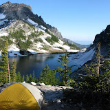
We found a nice campsite on the west side of the lake with a clear view of the mountain and the route we would tackle the following day. In the early evening, while we waited for Paul and Dean to reach the campsite we saw how fast the weather was changing. In the pictures you’ll see images with clear blue skies and others completely covered in clouds, just a couple of minutes apart.
Looking across the lake towards Assgard Pass, our route for day two

Day two, the big climbing day
After a nice breakfast and breaking up camp, Paul told us he wasn’t feeling very good and doing a five day backpack didn’t sound like a very good idea. He had permits for a second trip so he was not going to miss it altogether, so Dean, Gordon and I packed and headed towards Assgard. In paper this pass doesn’t look that bad, is just a mile (the pass section) with an elevation gain of over 2500’. Looking at it from the bottom is a bit different. You look up and the first thing that comes to mind is how are you going to get there? But first, we needed to go around the lake to get there. After a short hike, we got to the South West side of the lake where you have to descend a bit and cross a boulder field. These are the big boulders with some of them as big as a school bus. To cross that, there’s no trail, just cairns marking the route that most people do. It was a very interesting balancing act considering the big pack on our shoulders. Once on the other side, we found ourselves in a slope with granite rocks and some running water from melting snow. Looking up towards Assgard, we noticed that it was completely covered in clouds which were ideal for climbing that section.
Assgard pass

After a short break, we started our climb towards the top at a slow but steady pace. It was incredible to see the granite peaks up close and personal as we were climbing through the pass and see the lake behind us as we were quickly gaining altitude. About half way up we met with the welcoming party, a small herd of mountain goats coming down looking for food. We thought they would be a bit scared and actually keep their distance but on the contrary, they couldn’t care less that we were there. As we would learn later, there was a reason for that. Continuing up, the wind started to blow quite hard making it a bit cold which forced us to bundle up a bit. That also started to clear the clouds so we had some amazing moments when the sun was peeking through the clouds illuminating the granite peaks. Soon after, we reached the summit which felt like passing a threshold to another world. We left trees and some vegetation behind with a beautiful valley and a lake and entered into a desolated granite valley with frozen lakes, glaciers and different tones of blue.
View of the upper Enchantments after passing Assgard

We continued our hike thru the valley passing Tranquil and Isolation Lakes and all the little water runoffs from one lake to the next. From here it became apparent that each lake fed from the one above it. I guess this is nature’s way of explaining fluid dynamics. For a couple of hours we were just slowly descending admiring the different colors, ice formations, boulders, rocks, peaks and everything around us. In the distance we could see a line of trees which seemed to be the edge to a steeper incline. As we hiked to it we started passing some vegetation and some wetter ground. After exploring for a while, we decided on a small flat area behind some trees and a bit protected from the wind to set our camp. Later that evening, after we had a nice dinner, we went a bit further to take some pictures before calling the day.
Panoramic vie of our campsite on day two

Day three, exploring Little Annapurna
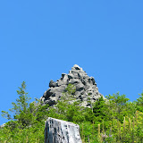
On Tuesday we woke up to a bright sunny day which was perfect for our climb to little Annapurna. This granite peak is in the southern section of the Enchantments and offers incredible views to both sides. The hike didn’t and wasn’t as bad as the hike to Assgard pass but still required some scrambling and walking on packed snow. One really incredible thing about this hike is that, as you get close to the top, you also get close to a vertical drop a couple hundred feet deep and some columnar peaks known as the Flagpole Needles right in front on the other side of the valley.
The vertical cliff from little Annapurna

Soon after and just bordering the cliffs, we got to a plateau with several rock formations that looked like lines and roads. One of them was clearly higher than the rest which was the actual summit of little Annapurna at 8440ft. Once there, the view down and ahead was outstanding. We could see the valley bellow, the Stuart range in front of us with McClellan Peak and further away the whole valley all the way to Mt St Helens. Looking back from that same place, we got a clear view of the whole upper Enchantments and the mountain range towards the east and north including what we think was Mt Baker. These two views are cut in the middle by the immense granite formation of Dragon Tail.

It took us a while to finally close our mouths and start hiking down back to camp. Once there we were greeted by our friends the mountain goats that by then were starting to get a bit annoying and weird. WE had been told that goats crave salt and the only way to get it is from urine. For that reason, it is recommended to pee on the rocks so goats will not destroy plants and soil scrapping for the salt. What stories fail to say though is that goats are so used to hikers that, as soon as you start wondering around to pee, they come after you and will not leave until you pee. I was even charged by one goat as it was trying to get ahead of another one.
Gordon trying to pee while a goat patiently waits

Later that day, after a nice lunch, we packed and started our hike towards our next campsite. This time we descended from the basin to Inspiration and Perfection lakes. These two lakes are separated by an ism and a small creek that passes water from one lake to the next. Our plan was to find a nice campsite up in the ism between the lakes, something with a view. AS we hiked down, it became clear why those lakes were given those names. Not only the clear blue color of the water is just inspiring but the reflections of the surrounding mountain and trees are just incredible. In fact, most of the pictures from the Enchantments that you can find on the web are from these two lakes. Once down, we crossed the creek and hiked up the ism until we found a couple of very nice spots to set our tents.
Room with a view!

That evening and night we were accompanied by numerous passing goats as either they wanted our spots or we were camping on theirs. We also had an incredible display of colors at sunset that seemed almost unnatural followed by a clear starry night and a bright moon.
McClellan Peak illuminated at sunset

Day four, the big loop
Wednesday was as beautiful as the previous day and even warmer. For this fourth day we had planned an exploration hike towards Prusik Pass and then the Druid Plateau. We started by hiking down to Perfection Lake and then heading off towards Prusik Pass. The most prominent thing on this hike up is not the pass itself but the Prusik Peak right next to it. Looking at it and not knowing anything about climbing we had no doubt any climber would call this paradise.

Once we got to the top of the pass, we had a clear view of Shield Lake and the Druid Plateau further to the West. Unfortunately there was still a big snow bank and no clear passage to get there so we had to discard that part of the plan. Upon hiking up on a small ridge we saw the valley towards the lower section of the Enchantments Including Lake Viviane and Leprechaun and a couple of smaller lakes and pond. From there we were able to roughly trace the route we would take on our exploration hike. We started descending on huge granite slabs that at some time in history where probably part of Prusik Peak toward a small meadow with a small lakelet with no name. From there we got a glimpse at another lake at the base of the Temple, another huge granite formation to the East of Prusik. Since that looked to be on the way towards Viviane, we headed towards Temple Lake making our way as we went. A couple of times we had to back track as we didn’t find a way to continue. On one of those, we found a small terrace with a little stream and a clear view of Lake Viviane. This terrace was big enough for two, maybe three tents and it was absolutely paradisiacal. Gordon commented that on an older map, there was a mark for something called “The Guest Room”. We thing that’s were we were.
View from the Guest Room

We continued our hike down towards the Eastern border of Lake Viviane where we had to cross to go up on the other side. This crossing was a bit treacherous as we had to go over rocks and fallen trees. Although that is not entirely rare and unexpected, what makes this particular pass different is that you have a huge lake on one side and a cliff with waterfalls on the other. As we would see later this was the beginning of what I ended calling endless waterfalls. Right after crossing we found one of the tricky parts of the area, a slick granite rock with some rebar attached to it that you have to climb. After that, we continued going up passing Leprechaun Lake which has a lot of places where you have to cross making it look more like a little group of lakes than a single one. On some of these, an specially going up, you find yourself walking on a trail, looking at the surface of the water right ahead of you, at eye level; So you are actually hiking under the lake. Shortly after we finally made it to camp on what had become already a very hot and long day. Considering that the following day was the last day of the trip and that we were still more than 8 miles away from the trailhead, we decided to pack everything and head down to a lower lake so our last hike wouldn’t be that bad. The original plan was to make it all the way to Nada Lake but we knew that was going to be almost impossible unless we did some hiking in the dark which wouldn’t have been a problem. The problem would have been finding a good campsite. So we set up our goal to get to the upper Snow Lake and find a place to spend the night. The hike down was basically re-doing what we did coming up from Lake Viviane including the pass over the slick rock with the rebar.
Climbing down the slick rock

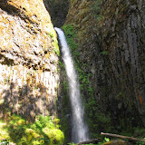
Right after passing the treacherous creek of Lake Viviane, we started descending quite abruptly alongside the Snow Creek which, I think, should be renamed “Endless Waterfalls”. Just imagine a creek with rushing water that has to get down more than 2300ft in about a mile. Unfortunately most of the waterfalls you can hear can’t be seen unless you venture yourself off trail and do a heavy bushwhack (which might be in the agenda for a future trip). Still I was able to squeeze thru some of them and take advantage of the evening light to take some pictures. As we were going down and the day was fading to black, we started to worry thinking if we would be able to find a good campsite. After a couple of hours of grueling downhill, we finally made it to the lake but found most spots already taken. About half an hour later we finally found a small spot but large enough for the three tents so we quickly set up camp, had dinner and went to bed not without enjoying the sunset reflections right in front of us
Sunset at upper Snow Lake

Day five, the hike out
On Thursday we woke up really early in the morning as the sun started shining directly into our tents. We didn’t notice the night before, but our campsite was facing straight East. That wasn’t bad at all as we new we had a long day ahead of us. It was nice though to make and have breakfast sitting on a little rock estuary on a green lake while hearing the birds.
View from the little rock estuary

At around 9 in the morning, we were already packed and ready to leave. The first part of the hike was an easy stroll around the southern shore of the upper Snow Lake towards a dam that crosses to the other side. Although the dam is just a man made rock wall that separates the upper and lower Snow Lakes, enough water goes over it that crossing is a bit tricky. For starters you need to take your shoes off and then, you need to cross, walking on somewhat cold rushing water, maintaining your balance to the other side. Once on the northern shore of the lower Snow Lake, we continued our hike down through a dense forest doing numerous switchbacks. It was a completely different feeling and scenery compared to the region we had passed in the last couple of days. At some point the trail made turn and we were back in the open, hiking down a canyon surrounded by big peaks on both sides. Although We couldn’t see much, there was clearly a creek down below with water from Snow Lake feeding the Nada Lake down bellow. At some point Gordon joked that the name of the lake was actually appropriate. Nada meaning nothing in Spanish seemed to indicate that Nada Lake was just that, an uneventful lake. We noticed also that most of the shore of Nada was just big granite boulders, so there was not much access to it. I found it to be nice, especially because we had good morning light and the lake had a nice blue/green reflection.
Nada Lake

From Nada we continued on a trail that at moments was going through dense forests and at some others under the hot sun. Most of the sunny parts where paths on granite rocks and dirt, making it feel even hotter. That was accompanied by the constant buzzing of flies and bees all around us. We did a couple more switchbacks and got close to a handful of little waterfalls on the way down until we got to the open canyon. Here the views changed completely again to something we had already seen on the first day, a drier, open canyon with the remnants of an old fire. By then it was already near noon and the sun was hot, really hot, so we just hiked down all the way to the exit point to end our incredible adventure.
Looking back at the Snow Creek Canyon from the exit point

Some of the pictures in this report (most of the pictures where I’m in) were taken by Gordon with my or his camera.
Click