I think it's time for me to move to a different platform and make some important changes to my blog. I've been using the blogger platform to share my stories for several years. In the beginning it was quite easy but as time passed I wanted to add more features and content to it which, unfortunately, is not as easy. There are a couple of other issues with other platforms I use that have changed creating some new challenges for me. For instance, Google Photos changed the way the manage photos when they got rid of Picasa. When that happen, I lost the ability to add photos to my maps which I think it was kind of cool. Now the mapping tool I use, might stop working or go away in the next couple of days If that happens all the links and maps I have won't work anymore. There are solutions to all of these things but those involve moving everything to other services. The mapping issues are going to be a bit harder as I will probably need to build something from scratch. I've started researching new options and I think I have a path moving forward. This is the main reason why my posting cadence has slowed down quite a bit in the past couple of months. So my plan it to keep posting things here now and then while I make the transition but I will tr to make it as seamless as possible. I'm keeping my fingers crossed so it works.
On other news, I just came back from a long three week trip to Norway, Faroe Islands and Iceland. As you cam probably imagine, I did a lot of hiking and brought back over 5000 pictures so I have a lot to go thru and post for the next several months. Should be interesting.
Billy Goat Trail, Mar 31st
While visiting my sister for her 50th birthday and following her recommendation, I went to check the Billy Goat trail. It’s located in the Chesapeake & Ohio Canal National Historical Park in Maryland (actually the park spans to DC and Pennsylvania). The trail is divided in three sections which cam be combined or done separately and all are connected by the Chesapeake & Ohio Canal Towpath. Like that, it offers many access points to either of the loops. Coming from Bethesda, I decided to start from Anglers Inn which gives access right between sections A and B of the trail. A short walk down the hill and a bridge placed me on the Towpath where I turned right and headed west towards Section A. I got there quite early so there were not many cars and the waters were calm and quiet. Just from the beginning, I was welcomed with some beautiful mirror images along the widewater section of the canal.
In that area I saw the exit point for Section A, so I continued to the far end. Once there, I headed West towards the Potomac River where the trail veers south and follows the river to the Mather Gorge. This section is very rocky and the path can get confusing. Rather than the normal trail signs I’m used to, the path is marked with blue stripes painted on the rocks which, at certain angles, are difficult to see. The trail does a lot of ups and downs but generally stays flat as it follows the river downstream. On the rocky section, there’s a spot I had seen in pictures before where the trail goes steeple up following a crack on a rock.
The trail continues down until it reaches a point were the river splits and goes around Sherwin Island. At hat point you follow the river back towards the canal and end section A. Back on the Towpath, I retraced my steps towards the point I started from but continued down to Section B which a found a short distance after the bridge. This section is completely different than the previous one. The rocky section and the gorge is left behind and now you find yourself traversing low lands. It’s all forested without any prominent features so it goes fast. Towards the end, the rocks appear again, and you pass a section that seems to be the place for rock climbers. I saw several groups with ropes and gear climbing and descending the rock face. Further down, another split of the river to go around Herzog Island and Vaso Island forces you to head back to the Towpath. Once there, I turned right again to continue to section C of the trail. This section was similar to section B as it goes around the Carderock Recreation Area. Along the way there are some smaller trails I didn’t explore but suppose, looking at the map, that go to the day use area and parking lot. Towards the end of this section, I found a couple of peaceful ponds right before the trail made the last turn north towards the Towpath.
Once again at the Towpath, I marched my way back to the bridge and the car. By then lots of people, bicycles and families were on the trail. On the lower section, as I was going next to the canal I noticed a lot of frogs and turtles.
It was an interesting day and hike. I’m glad I had the opportunity to do it.
You can see the rest of the pictures here
Interactive map
In that area I saw the exit point for Section A, so I continued to the far end. Once there, I headed West towards the Potomac River where the trail veers south and follows the river to the Mather Gorge. This section is very rocky and the path can get confusing. Rather than the normal trail signs I’m used to, the path is marked with blue stripes painted on the rocks which, at certain angles, are difficult to see. The trail does a lot of ups and downs but generally stays flat as it follows the river downstream. On the rocky section, there’s a spot I had seen in pictures before where the trail goes steeple up following a crack on a rock.
The trail continues down until it reaches a point were the river splits and goes around Sherwin Island. At hat point you follow the river back towards the canal and end section A. Back on the Towpath, I retraced my steps towards the point I started from but continued down to Section B which a found a short distance after the bridge. This section is completely different than the previous one. The rocky section and the gorge is left behind and now you find yourself traversing low lands. It’s all forested without any prominent features so it goes fast. Towards the end, the rocks appear again, and you pass a section that seems to be the place for rock climbers. I saw several groups with ropes and gear climbing and descending the rock face. Further down, another split of the river to go around Herzog Island and Vaso Island forces you to head back to the Towpath. Once there, I turned right again to continue to section C of the trail. This section was similar to section B as it goes around the Carderock Recreation Area. Along the way there are some smaller trails I didn’t explore but suppose, looking at the map, that go to the day use area and parking lot. Towards the end of this section, I found a couple of peaceful ponds right before the trail made the last turn north towards the Towpath.
Once again at the Towpath, I marched my way back to the bridge and the car. By then lots of people, bicycles and families were on the trail. On the lower section, as I was going next to the canal I noticed a lot of frogs and turtles.
It was an interesting day and hike. I’m glad I had the opportunity to do it.
Interactive map
To see the full map, click here
Ghost Ridge – Palmateer Point – Devil’s Half Acre, Mar 10th
Once again, a good snow day and a wonderful route to get some views. Not much to write here but I’ll leave you with some pictures
Yellow Jacket, Mar 4th
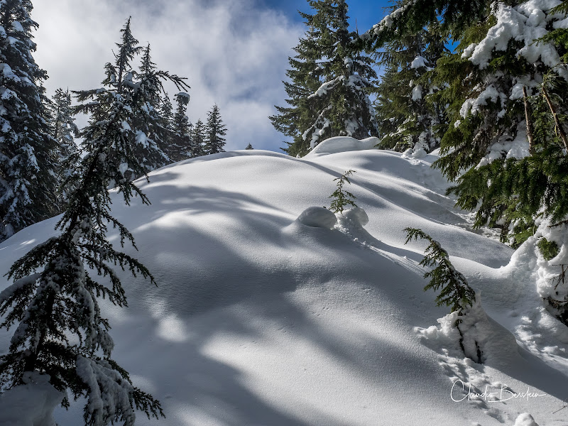
One of the key things to be able to do this route is that there’s a lot of snow on the ground, otherwise, you can’t go too far. The reason is this section of the mountain has a lot of streams. Most of them are smaller so crossing them is not an issue but there are a couple of larger streams that a good snow bridge makes them crossable in the winter. Just for that reason, I stopped going to Yellow Jacket as the last couple of years the snow level has been very low. This time though, we got a good dump so it was time to revisit the route. Weather was looking kind of iffy with forecast stating we would just have a cloud cover but precipitation. At higher elevations, this usually means a pretty closed grey sky. We started from the Snow Bunny Sno-Park following the Timberline East Leg road. From the get go we knew we would have excellent snow conditions so right from the start it was looking like a good day. We got to a fork in the road and looking at the map it seems like we needed to turn left. Shortly after that my brain started telling me we were not going in the right direction, something was off. So, rather than turning around and heading back to the fork, I decided to take the group off trail and connect with the other trail. Little did I know we were going to find a beautiful creek with no easy way to cross.
Luckily, we were pretty close to the road, so we backtracked just a bit and got to the road were a bridge took us to the other side of the creek. Shortly after we found the turn-off I was looking for. From that point on, we were off the road and on the trail following the very faint blue diamonds. Not to long after that we got to a crossing I had forgotten about. It’s a pretty descent shallow creek that you could cross almost without getting your feet wet or by plowing on top of a log that goes across it. Sky marks got just to the creek but no further, so nobody had crossed in quite some time. For whatever reason I was not feeling brave to clear the path for everyone else, but we were lucky another brave soul went ahead and did just that. From there on, we were braking new tracks, oh the joy. We went thru numerous ups and downs and creeks and openings…. It was a winter paradise.
At some of the openings we got a bit of clearer skies which gave the whole thing a very special glow. It was just fantastic and everyone was having a blast even though I knew we still had to pass the traverse. At some point, after we had gained significant elevation, the route made a right turn right before a traverse that opens to amazing views to the Salmon River below us. It’s a section that can scare people off a bit as it’s pretty steep fall if you were to slip. One of the guys in the group was pretty tired by then and did a horrible face plant as he was trying to grab on a tree for balance and the tree just bent in front of him. I felt bad for him and decided to stay close just in case. Towards the end of the ridge we came to a tight turn right that goes steeply down to the river to a potential crossing. WE had to explore a bit to find a good spot were snow was deep enough that we would have a descent bridge. After crossing it was just a steep uphill to the viewpoint I had setup as a destination for the day.
After enjoying a nice break and food with good views it was time to retrace our steps. The first part was a lot of fun as we raced down the slop but then we had to work our way out of the valley and back up to the ridge. It was hard, and we had to really kick with out snowshoes to get some traction. Then we just retraced our steps the way we came. I had to hang in the back as the guy that did the face plant was going a bit slower and we had several creeks to cross. He was tired, and his legs were not responding right. It didn’t help much that he was not paying attention to what I was telling him to avoid getting in trouble. That proved right at a particular crossing where he doubted himself allowing me to get close. When he finally went for it, he slipped and felt forward sliding back into the creek. From the other side I saw it almost in slow motion, so I just braced myself and grabbed him by the backpack to prevent him from completely falling on the water. One of the guys in front saw the action and rushed to the creek so he grabbed him from the other side, but he didn’t have a good grip. So, I jumped to the other side and we made a quick human chain to pull him out. He was now wet and tired, not a good combination but the worse was done so it was just a slow march back to the cars.
Click on the image to see the rest of the pictures
Interactive map
Luckily, we were pretty close to the road, so we backtracked just a bit and got to the road were a bridge took us to the other side of the creek. Shortly after we found the turn-off I was looking for. From that point on, we were off the road and on the trail following the very faint blue diamonds. Not to long after that we got to a crossing I had forgotten about. It’s a pretty descent shallow creek that you could cross almost without getting your feet wet or by plowing on top of a log that goes across it. Sky marks got just to the creek but no further, so nobody had crossed in quite some time. For whatever reason I was not feeling brave to clear the path for everyone else, but we were lucky another brave soul went ahead and did just that. From there on, we were braking new tracks, oh the joy. We went thru numerous ups and downs and creeks and openings…. It was a winter paradise.
At some of the openings we got a bit of clearer skies which gave the whole thing a very special glow. It was just fantastic and everyone was having a blast even though I knew we still had to pass the traverse. At some point, after we had gained significant elevation, the route made a right turn right before a traverse that opens to amazing views to the Salmon River below us. It’s a section that can scare people off a bit as it’s pretty steep fall if you were to slip. One of the guys in the group was pretty tired by then and did a horrible face plant as he was trying to grab on a tree for balance and the tree just bent in front of him. I felt bad for him and decided to stay close just in case. Towards the end of the ridge we came to a tight turn right that goes steeply down to the river to a potential crossing. WE had to explore a bit to find a good spot were snow was deep enough that we would have a descent bridge. After crossing it was just a steep uphill to the viewpoint I had setup as a destination for the day.
After enjoying a nice break and food with good views it was time to retrace our steps. The first part was a lot of fun as we raced down the slop but then we had to work our way out of the valley and back up to the ridge. It was hard, and we had to really kick with out snowshoes to get some traction. Then we just retraced our steps the way we came. I had to hang in the back as the guy that did the face plant was going a bit slower and we had several creeks to cross. He was tired, and his legs were not responding right. It didn’t help much that he was not paying attention to what I was telling him to avoid getting in trouble. That proved right at a particular crossing where he doubted himself allowing me to get close. When he finally went for it, he slipped and felt forward sliding back into the creek. From the other side I saw it almost in slow motion, so I just braced myself and grabbed him by the backpack to prevent him from completely falling on the water. One of the guys in front saw the action and rushed to the creek so he grabbed him from the other side, but he didn’t have a good grip. So, I jumped to the other side and we made a quick human chain to pull him out. He was now wet and tired, not a good combination but the worse was done so it was just a slow march back to the cars.
Interactive map
To see the full map, click here
Wilson River Trail from Jones Creek, Feb 24th
I was itching to get out even though there wasn’t a lot of snow up in the mountains and the weather wasn’t playing very nice. Looking at my past hikes, I decided to re-visit the Wilson River trail and potentially head up to Kings Mountain from Jones Creek. As I drove there, I went from clear skies to cloud cover to rain and back to cloudy. Just as I parked at the trailhead, some rays of sun where coming thru so I got hopeful that I was going to be able to make it to Kings Mountain via Coronary Ridge. That disappeared pretty quickly when I started walking on snow on my way to Diamond Mill, just minutes from the trailhead. I was wearing my normal hiking shoes and knew my feet would get wet. The question was more about how long it was going to take for them to get cold. Looking at the sky, I saw grey clouds rolling in fast and it looked like it was going to let go at any point. Since I’d driven there and was already on the trail, I opted for at least getting to Diamond Mill to take a couple of pictures from the bridge. Just as I was getting there, rain started, and I had to put on rain gear and cover my pack. I got to the bridge, took a couple of pictures and then was about to start heading back when another ray of light pierced thru the sky and illuminated the bridge.
I stood there feeling the warmth and saw as the sky cleared up a bit. It felt like it was tempting me to go further. It worked as I decided right then to continue. While traversing the forest the sky light up in blue but as I gained elevation the snow got deeper. It got impossible to hike and keep the shoes somewhat dry. It was now a matter of time until my feet got cold, but I was still trusting my wool socks. At one turn I though I was close to the fork that goes up Coronary ridge but soon I found I was off by a couple of miles. By then, the snow was about 8 inches deep and getting deeper by the step. The problem in this kind of situations, when you need to make a call and turn around to head back, is that you always want to get somewhere to turn around. Turning around mid-trail seems to make sense, like leaving something incomplete. I was looking for a view or an opening, something that would work well as a turning point. Then the trees thinned out a bit, the snow got much deeper to the point of making it difficult to see the trail and the views opened to the valley. I had found my turning point. There was a small rock outcropping with amazing views of the Lester Creek valley below me and the mountain range due south.
The clouds had come back and were menacing, and my feet were cold. It was time for one or two pictures and march my way back to the car. AS I did, the weather change again. So far, I had gone thru sun, clouds and rain. The only remaining, that I got on my way down, was hail. Yes, the weather was definitely not playing nice.
You can see the rest of the pictures here
Interactive map
I stood there feeling the warmth and saw as the sky cleared up a bit. It felt like it was tempting me to go further. It worked as I decided right then to continue. While traversing the forest the sky light up in blue but as I gained elevation the snow got deeper. It got impossible to hike and keep the shoes somewhat dry. It was now a matter of time until my feet got cold, but I was still trusting my wool socks. At one turn I though I was close to the fork that goes up Coronary ridge but soon I found I was off by a couple of miles. By then, the snow was about 8 inches deep and getting deeper by the step. The problem in this kind of situations, when you need to make a call and turn around to head back, is that you always want to get somewhere to turn around. Turning around mid-trail seems to make sense, like leaving something incomplete. I was looking for a view or an opening, something that would work well as a turning point. Then the trees thinned out a bit, the snow got much deeper to the point of making it difficult to see the trail and the views opened to the valley. I had found my turning point. There was a small rock outcropping with amazing views of the Lester Creek valley below me and the mountain range due south.
The clouds had come back and were menacing, and my feet were cold. It was time for one or two pictures and march my way back to the car. AS I did, the weather change again. So far, I had gone thru sun, clouds and rain. The only remaining, that I got on my way down, was hail. Yes, the weather was definitely not playing nice.
Interactive map
To see the full map, click here
Subscribe to:
Posts (Atom)