Rock of Ages, Apr 11th

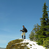
The week previous to the 11th I had so much work that I wasn’t able to plan something with the group; still I needed to go out and do some hiking. Being this the case, I took one hike of my to-do list and decided to try it out. The other thing was the weather. Forecast had announced the possibility of rain so I waited until I woke up on Saturday and look out the window to make the final decision. Rock of Ages was it. This hike starts at the Horse Tail falls which I did way back when I started hiking here in Oregon. After a short hike up and right before getting to the second fall, Pony Tail, there’s a tree on the left side with its roots form a sort of stair that gives access to a very faint trail. This trail, as the sign clearly says, is not maintained. What this means is that this is a very old trail that at some point the forest service decided to take out of the maps and close it. Obviously people still go up so the trail is still visible. The first portion is, as expected very steep with numerous switch backs and few opening with nice views. After almost every turn I had to stop and check where the trail was going. After a while, I found a tree with some markings. One was pointing towards the edge with an inscription that read “L/D”. I decided to check it out. It turned out to be the trail to Rock of Ages, an arch rock formation that has been eroded by wind. If the arch is not impressive enough, the background you get from there is breath taking. I stayed up there, sitting at the edge of the cliff for several minutes just enjoying the views of the Gorge. From that point I could see St Peters dome, a huge rock formation that has been climbed a couple of times by some very serious climbers and the Devil’s back bone, the next portion of my trip. After going back to the tree with the markings, I continued up towards the ridge. Soon after I found myself walking on a ridge with very steep drop offs on both sides, I was in the Devil’s back bone. I followed this formation to the other end where the ridge reaches a plateau and goes back into the trees. I made a quick stop to take a couple of pictures and eat a light lunch before continuing on my expedition. I did continue the hike at around 2 in the afternoon getting into the forest and trying to follow the very faint trail until I reached snow. Despite my best effort, after about half an hour, I knew I was not on the trail. In the pictures you’ll see that it all looks the same. From that point on, continued heading in the direction I though would take me to the horse creek trail which I never found. At around 3:30 it was official, I was lost. I figured that I was high enough (maybe higher than what I was supposed to be) and further east, so I started heading south-west towards where I though the trail would be. According to my map, I had to cross two creeks before getting to the Wahkeena Creek and finding my trail back. I did find two creeks which I crossed and continued until I found the third one but no trail. By that time (about 5 PM), I decided to follow the creek down thinking that I was much higher than the trail crossing so I would, eventually, find the trail. On my way down, I had to bushwhack all the way climbing and descending very un-even terrain. At some point I found some trail markers and numbers on the trees. I did follow those markers for a while but those ended up disappearing. I also found, half way down, a very old campsite that probably hasn’t been used since the 40’s or 50’s. Notice in the pictures of the fire pit all the moss on the rocks. At that point I already knew I was not in the correct creek but had a pretty good idea where I was. Being around 6PM I though for a minute about spending the night right there (I had all the proper gear to do that if I needed to) but since Shia was home, I had to get back. I continued bushwhacking down and at some point I noticed the ridge I used to go up to Rock of Ages, I knew where I was. Following a very faint animal track I was able to quickly reach the trail I used to go up and start my last descend back to the car. From the trail I took the last couple of pictures in the set with the light you get at 7:30PM.


Walk with Dogs at Dog Heaven, Apr 5th

Back by popular demand and now that the weather is getting better, I did the walk with dogs again at Dog Heaven. It turned out to be a fantastic day, with a great group of people and a lot of dogs. We started as usual by going to the Sandy River and from there crossing to the Columbia. As the day went on, some started to linger and leave while others preferred to stay and do the longer hike. In the pictures you’ll see that it was just for the pure enjoyment of the dogs.

Hunchback Mountain, April 4th

Another newly discovered trail. This trail is so close to the city that it’s often overlooked. Not only that, getting there and parking couldn’t be easier. The Hunchback Mountain is just south of the 26 Hwy in Zigzag. To get there you only need to drive to the Ranger station, park there and that’s it. What we discovered though, was an incredibly beautiful trail with amazing views of the Salmon River Valley and Mt Hood. Of course, to get to these views, you have to climb, really climb. The trail is a very steep uphill in a dense second growth forest all the way to the first view point where you reach the ridge that opens a wide view of the Salmon River valley. If for nothing more, reaching this point is worth the hike. From that point on, the trail continues on the ridge, so at all times you have the valley on one side and Mt Hood on the other. The tall trees are the only thing in the way to actually seeing Mt Hood. After another hard climb, we got a big pile of rocks from where you can get sweeping views of Mt Hood on the front and the valley behind you. Although this would seem to be the highest point on the trail, it is not but it makes a good turning point. We, being all adventurers, decided to keep going. The idea was to reach a point know as the Great Pyramid which we where never able to get to, most probable because we could not see the trail. After hiking and bushwhacking for a while, we decided to stop at a sunny spot to have lunch before heading back down. Most of the time, the hike down is uneventful as you get pretty much the same views you got on the way up, the only difference is where the sun is. What was different, and incredibly beautiful this time was that it was a very warm day after a really cold night with some snow showers. All the trees that were white on the way up due to the accumulated snow started melting. Even though it was a sunny day, it was raining in the forest and the trees were turning green in front of our eyes. You can even see the difference in the pictures where everything is white on the way up and there’s almost no snow on the way down (especially in the view point). I guess we got lucky and got two hikes for the price of one.

Hiking in Catherine Creek, Mar 28th

Catherine Creek is a shorter hike that I’ve known for a while but had not done yet. Part of it is because it requires a bit more driving to get to it as it is farther East in the Washington side of the Columbia Gorge. The advantage of going there this time of year is that, usually you get less rain (believe it or not) and flowers start to bloom earlier. So we got to the trail head and of course, it was rainy which could disprove my previous point, but it was truly raining in Portland so yes, it rains less. Most of the trail is an old road with a nice slope. After crossing a stream, the road starts to border a rock formation with an impressive natural arc at the top. The overcast sky didn’t allow me to take a descent picture, but you can still see the gigantic structure. There are also some all stables as this area was originally private. After a short ascend, the trail takes you to a rolling hill with beautiful views of the Columbia. We did a short stop for food under a tree where I decided to put my camera away which I ended up regretting on the way back. Just as we started descending the hill a herd of deer passed in front of us running down the hill. Now, every now and then, when we see deer in the trail, we see two or three. This herd was probably 40 or 50 deer. After that, it was obvious I was going to take my camera out, of course we didn’t see deer anymore but, we found a very interesting tree. Definitely nature has a way to be artistic doesn’t it?

Cascade Head, Mar 22nd

The idea for this hike was to do the same trail we did for the Hallowing party at the aquarium. What we didn’t know was that the access road to the trail head is closed during the winter. Once we got there and drove back and forth a couple of times and discover our error, we decided to park at a close by boat ramp that gives access to the Salmon River. From that point, there’s a trail that heads up to Cascade head going through the Natural Conservancy which doesn’t allow dogs. Since some of us, including me, had our four legged friends with us, we were forced to divide the group in two. The dog-less crowd did the intended hike while we went on a much shorter walk on a road towards the coast and hiked along the Salmon River Estuary. The road was a short climb and right after the turn we got to some houses with the horrible views you can see in some of the pictures. Once we got to the end of the road, we continued a bit to the water front and walked along the coast line. Further ahead, once we got closer to the sea, we saw some sea lions taking a nap and enjoying the scarce sun on the opposite shore of the river. As you’ll see in the pictures, not only the views of the river, sea, rocks and wildlife were amazing but the constant changing cloud pattern made it even more dramatic as we went from sunshine to hail and back. Although it was not much of a hike, it ended up being worth it for the views.