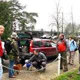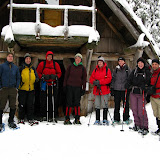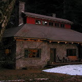
Yes I know, I always say that I try to something new every time, but going to Nesika is really nice and there’s always something new, besides, we usually have a very nice group of people. This time, instead of taking the normal route up Multnomah Falls, we drove as high as we could on Palmer Mill Road. This is a forest service road that goes all the way to the lodge but this time of year it gets blocked by fallen trees and debris. From that point, we basically followed the road all the way to the lodge. We where hopping for soft snow so we could use our snowshoes but that never happened. The snow was compacted enough that snowshoes were not necessary. The road did offer though some interesting things. You’ll see in the pictures numerous shots of ice. Some of them are close-up shots of little needle like formations on the ground that I’m still figuring out how they are made. Once we got to the lodge and had something to eat, some of us went on a loop hike up Franklin ridge back to the creek. You’ll also see some really nice night pictures of ice and all the colors frozen behind it. On Sunday we went for a more adventurous hike on a new trail that Lisa and Linda are opening up. After that loop and going to the creek, we decided to go find the car which is one of the remnants of the old houses that were in the area long time ago. After searching for a while we first found the old engine that was used to try to get the car out. Knowing that the car was supposed be close by, we continued the search until I found it in the middle of the woods. It was a very interesting sight to see the rest of a car that has been up there for many years and see that a portion of it hasn’t even lost the color. After marking the position of the car and going back to the lodge, we had a nice lunch. After that, both Madhu and I started our hike out back to the cars as we were the only ones that didn’t have Monday off.
Snowshoeing at Trillium Lake, Jan 11th
Trillium Lake is a camp ground that during the winter is converted into a snow park. It is probably the most visited by cross country skiers and snowshoers and a great place to try snow shoeing for the first time, in fact, Trillium is where I did my first snowshoe by the end of 2007. This time though, I was leading a big group of mostly first timers. Weather was not great and the overcast skies prevented us from even seeing Mt Hood. Still it was a very nice day in the company of a friendly group.
Stone House Loop hike, Jan 10th
As I have done before, this was another hike in Forest Park. For those who don’t know, Forest park in Portland is the largest urban forested park in the United States with an area of approximately 5400 acres. In it, there are numerous trails and paths for runners, hikers and bikers. The Forest Park Conservancy also known as the friends of the park is an advocacy group that helps maintain and protect this area. They have a commemorative map set of the park that show 9 different loop hikes that showcase different areas of the park starting from the southern section going north. This loop is the first in that series. A big part of the loop, if not all uses the wildwood trail which I’ve done in the past. As always, it was a beautiful hike that makes it hard to believe that you are still in the city.
Snowshoeing at Tilly Jane, Jan 4th
You might be wondering what happened after table mountain that there were no reports of new hikes or anything. Well, if you don’t live in the Northwest you probably don’t know we had a winter storm and really cold weather for more than a couple of days. That made it impossible to head out to the mountains, in fact, with all the snow we had, you could go snowshoeing out in the parking lot! After a couple of weeks with poor road conditions, it was vacation time so finally, after nearly a month, I’m back and out. So here’s the first trip of the year. We went with a small group to Tilly Jane, a trail in the Mount Hood area near Cooper Spur. It was a very nice uphill trail towards a cabin that is maintained by users. As you’ll see in the pictures, this is an area that was completely burned during the summer which gives it that eerie look. Other than that, it was a cloudy day and yours truly paid the price for not hiking in a couple of weeks…
Table Mountain, Dec 6th
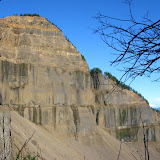
This was another one of those really long, hard and very rewarding hikes. Not only is a lengthy trail but it is also very steep. Table Mountain, as you might imagine is a mountain with a flat top, but that’s not the most interesting feature. It is located on the Washington side of the Columbia River Gorge. The south face (towards the river) is a 2000’ vertical wall that was formed when the mountain collapsed. All the debris from the mountain formed a stretch of land that for some time stopped the Columbia River forming a natural bridge that the Native Americans named Bridge of the Gods. In that stretch is where the bridge with the same name is today. Being a very long hike, we decided to start really early so we got to the trail head right after sunrise. The trail took us on the same path I had done just a couple of week ago when I went to Gillette lake and the Greenleaf Overlook so the first part of the trail was very well known to me. After walking in a relatively easy slope for about 5 miles we got to the trail junction where the “Heartbreak” trail starts. At that moment the name sounded funny but we did learn shortly afterward that is a very appropriate name for this trail. To get an idea, from that point it is a little over a mile to get to the summit but the elevation gain is over 1500’. That makes this portion of the trail very steep. After an arduous climb we got to a ridge that gave us the first really impressive view of the mountain wall right in front of us and the valley formed when it collapsed. From that point on, the trail travels away from the ridge and then turns up again through a steep rocky slope that has to be climbed using both feet and hands. Not long after that grueling section, you reach the summit and descend a bit to the actual peak of the wall. As you can imagine, the views from that point are simply breathtaking, so we decided to stop for lunch. For the return we had though doing the same trail, but on the way back we noticed a second trail on the ridge that continued north on top of the mountain. After a short walk, we came to the other side of the table with incredible views towards Mt Rainier. We continued on that trail that started descending on the east side of the mountain. This trail proved to be as difficult as the trail we used to climb up. For a long time we were just traversing on loose rocks. After that hike down and reaching the main trail (a portion of the PCT) we realized that we were about a mile further north so we had about 6 miles to go to get to the car. That hike down was really beautiful as it offered all the changing colors of the sunset until we got to the car in the dark.
Subscribe to:
Posts (Atom)