Cripple Creek and Serene Lake Loop, Nov 6th

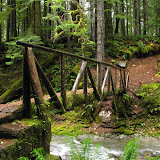
With all the crazy weather around here, I started looking for something further south to go explore and found this very nice loop in the Roaring River Wilderness. This hike combines several trails to form a double loop that climbs up via Cripple Creek, then goes around Serene Lake and the trails to the Rock Lakes and then comes back down on a different trail to the starting point. What all that means is that this trail offers a wide variety of scenery and features. The drive there was kind of tricky as this trail is not at the end of a road with a well marked parking spot, in fact, as we were driving we spotted a trail sign between the trees which made us stop, get out of the car and go check it out. So after getting ready for our 11 mile journey, we started meandering thru the forest and passing by a couple of open meadows with shallow lakes. A bit after that, we came to the much bigger Cripple Creek Lake which gave us the first fall color display of the hike. After circling one side of this lake, we continued up to a bigger meadow where a second faint trail joined our trail and then seemed to disappear. The meadow was an interesting sight with lone trees and islands of shrubs on a yellow grass field. From the guide, I knew we had to just continue straight, thru the bushes to find a campsite which is on the Serene Loop Trail. Not only we found the campsite but also the tree eating the trail sign!

Hungry tree


At that point, we had the option to go clockwise or counter clockwise. We opted for the clockwise as that would give us better views along the way. We hiked up thru a dense forest for a while until we reached a clearing and a fork. There was no indication of which way we needed to go so we kept straight as that went out into the clear. That was not the trail, but it was the viewpoint that offers the best view of Serene Lake down bellow. Even with a cloudy weather, the view was fantastic. We then traced back to the fork and took the other route which started descending on the back side of the ridge towards the North end of Serene Lake. Once there, we explored a couple of campsites and then continued North to the end of the lake where a small creek comes off. Then we started climbing again on the other ridge and passed thru several almost flooded areas and small pools that eventually took us to a four way fork where you can veer off to any of the Rock Lakes. We decided there to go check at least one of these so we headed off trail towards Middle Rock Lake which, in my opinion, was a lot more scenic than Serene. Once there, we took a break and explored around for a while before heading back to the main trail.

View of Middle Rock Lake and the pyramidal rock


The trail then continues up until it ends at the other entry point for this loop at Frazier Camp. That spot was a bit disappointing not only for the rutted trails and roads but also because the next couple of miles were on an old service road. At some point the road becomes a trail again and we you least expect it, you start getting a familiar scenery as you approach the Cache Meadow on that faint trail we saw on the way up. We did some fooling around in the area (that you can see in the rest of the pictures) and then continued down on a different uneventful trail back to the car.


You can check the pictures here

Tom, Dick and Harry and beyond, Oct 31st

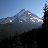
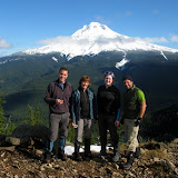
Tom, Dick and Harry is a hike I’ve done a couple of times both in the winter and in the summer. On a clear day, this hike is fantastic as it offers one of the best views you can get of Mt Hood as it towers up right in front of you. This hike also passes via Mirror Lake which, also on clear days, reflects the mountain on its waters. To spice this hike a little bit, I studied the map and noticed an old trail behind the ridge of Tom, Dick and Harry with two lakes. IN the map they show up as Slide Lake so I wasn’t sure which one was it. My idea was to hike the ridge, find these lakes and then head back out. With three other brave souls, we started our hike early in the morning and at a very brisk pace. We got to Mirror Lake almost in record time and were surprised to see that the weatherman had been a bit wrong predicting the weather. Originally it seemed it was going to be cloudy and maybe even rainy, but once in the lake, we were welcomed to patches of blue sky and sun. Since James had not seen the lake before, instead of taking the quick route that meets the trail to the summit, we did the loop around the lake and then continued up. As I remembered from past trips, the hike up is just that. A trail that circles the mountain with several nice views of the valley and the highway down bellow until it switches back on the ridge and continues to the summit.

View of Mt Hood and Mirror Lake from the summit


After a quick lunch, we continued, traveling east on the rocky ridge of Tom, Dick and Harry. This portion of the trail was all new to me so I was pretty amazed with the views of the mountain, the rock walls and the ridge itself. While traversing the ridge, I noticed a small valley down bellow with several frozen lakelets that I didn’t know about. According to the map, a creek starts from there but the lakes are just tiny blue dots. We continued on the ridge until we got to the top of one of the Ski Bowl ski lifts. In a map nearby I learned that those lakes and the basin it’s known as the five lake basin which made wonder if there was a way to hike thru there on our way back. We continued for a short while on the back side of the ridge and at some point decided to veer off and start navigating towards the lakes. At some point we discussed turning back as we were not having any luck in finding the lakes and we were descending quite a bit. Just when we were about to do that, I noticed an opening in behind some trees and there it was, Slide Lake. This was probably one of the most beautiful scenes I’ve seen as the lake was not completely frozen but had a snow cover. That gave the lake a flat grey color that was just amazing.

Slide Lake


From there, we started circling the lake looking for an easier way up back to the ridge. Coincidentally, that travel route was roughly in the same direction to the second lake so we almost stumped on it. This time though, we were not able to get close to it so we continued our way up to the ridge. After a while we finally made it back to the top of the lift and, as we were hiking back started looking at the Five Lake Basin with the same idea I had earlier in the day. We studied the map a little and decided to go off trail again towards the lakes and the cut to the west to head back towards Mirror Lake. All that sounded really good in paper so we just started heading down. That’s where the hard part of the day started. First we had to go down on a very steep, snow covered, rocky slope that eventually got us to the lake basin. On that slope we managed to sink in almost every single posthole there was, so it was not easy going. Finally at the basin we walked thru these lakes admiring the beauty of the area.

One of the lakes in the Five Lake Basin


We then continued descending thinking we were going to find an easy path towards Mirror Lake, wishful thinking. At some point we found ourselves looking down on a very steep drop off so we had to turn back and retrace part of our steps moving farther west which in turn made us go to another abrupt edge with a big drop off. By then it was already getting a bit late and the sun was quickly moving down. To make it worse, there were some menacing grey clouds moving in the area as well. So our best bet was to just bushwhack down towards the highway thinking that our worst case scenario was a long walk on the road. So after figuring out a good direction, we opted for the one that offered better chances for us to grab to something, which meant going down slopes covered in Rhododendrons. I have to say that we got to love those trees. They are flexible yet very strong and don’t snap back at you that bad. Still, a machete would have been a good thing to have for a change. We finally made it to the lower forest and taller trees which made moving much easier and quicker. By then it was almost dark so we shoot a straight line towards the creek that runs alongside highway 26 and followed that back to the car. We finally got out of our adventure with enough light to get in the car and just minutes before the rain started. That’s what I call an awesome day!


You can check the pictures here
Siouxon Creek, Oct 30th

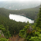
With a rainy day on the forecast, I started looking for a good forested hike and decided to visit the Siouxon Creek up in Washington. I already knew the area a bit as I hiked a portion of this trail when I did the Huffman Peak hike a while back, but back then, it was already dark and we were on our way out from a very long day. This trail, instead of doing the hard climb to either ridge on the side of the creek, just follows it for pretty much as long as you want to follow it. Wanting to do a somewhat easy hike, we started from the middle trailhead that quickly descend thru the forest and gets to the creek. This part of the hike was thru a very dense and dark forest full of ferns and the smell of wet wood. Being a gloomy day, it gave this area that eerie look that was very nice. Once we got to the creek, we started following it upstream and getting only small glimpses of it. As we meandered thru the forest, we got some nice views of the creek and some of the waterfalls but not that turquoise color you usually get on sunny days. That was compensated by the immense variety of mushrooms on the trail though. My initial plan was to head up and find a bridge to cross the creek and then continue towards Wildcat Falls to stop for lunch but we never found that bridge. After exploring possible routes to take and finding that any would have required fording the creek, we decided to turn back, stop in one of the campsites for lunch and then head back to the cars.


You can check the pictures here

Owl Point and Perry Lake, Oct 17th

Having done a lot of the hikes in the books, I’ve started to research some not so common places by looking at maps and other sources. This hike is one of those forgotten trails which are only maintained by the few hikers that usually go there. I wanted to head there for two reasons, to check out the unusually view of Mt Hood from the north side and see one of the smallest named lakes in Oregon. Also, this hike offered a chance to do some route finding and bushwhacking. So we started from the Vista Ridge Trail Head and just before we got to the trail sign, I found the very faint route to Owl Point. The first part of the hike just meanders thru the forest without a lot of views but you know they are right there as light filters thru the trees. At about a mile from the trailhead, we found our first view point which gave us a view of the rocky edge at Katsup Point. My original plan was to explore that and also the Red Hill or our way to Owl Point so we took off the trail for a while following what looked like a foot path which didn’t go where we needed it to. So after circling around for a while, we got back to the main trail and shortly after found a trail sign for Owl Point. Not only the sign was unexpected but also that it was put here recently. We followed that path to a meadow with open views of the north side of Mt Hood, the Hood River Valley and Laurence Lake in the distance. We stopped there for a while to have lunch and enjoy the views before continuing on our way to Perry Lake. After getting back to the main trail, about half a mile further, we found Alki Point, another opening but this one looking north. From here, the views extend all the way to Mt Adams, Mt Rainier and St Helens. From that point on, there aren’t many views although the trail goes by the remnants of some old fire lookout stations. To get to Perry Lake from there, we followed an old 4WD road down until we spotted water to the side. As you’ll see in the pictures, Perry Lake looks more like a pond than a lake. I guess it has a name because it doesn’t dry up in the summer. On the way back I asked the group if they wanted to try to find Katsup Point but once we got there and started bushwhacking they changed their minds so we headed back to the cars. In the end, I left a couple of things unexplored so I guess I will have to do it again


You can check the pictures here

Thomas Lake to Blue Lake, Oct 16th

This is probably the best known route in the Indian Heaven Wilderness and a route I’ve done many times, not only as a day hike but also while backpacking in the area. Still, it had been a while since I’ve done it so I took the chance of co-leading the hike with Duane who’s training to be an assistant organizer in my group. The hike was as beautiful as I remembered it although it felt shorter. As we started from the trailhead, we quickly got to Thomas Lake and then passed thru several other lakes with beautiful scenery. We took the hike slow and easy with plenty of rest stops to enjoy the fall colors and the weather. Once we got to Blue Lake, half of the group wanted to do a little bit more while the rest stayed back. So I took them on a bushwhack climb following the ridge behind the lake. As we were gaining elevation, the view of the lake became better. We also got some nice views of other lakes in the area and Mt Adams peaking over the ridge. We did climb as far as we could but at some point, getting closer to the top, the ridge got pretty steep so we had to turn around.