Silver Star: Grouse Vista – Sturgeon Rock loop, Jun 30th

I have to say that Silver Star is still one of my favorite hikes near the Gorge. Not only any approach you take is challenging and beautiful but it’s also a very rewarding hike. From the summit the views expand 360 degrees and can include several peaks in the cascades. This time Val and I lucked out with a perfect day and vistas extending all the way to Mt Rainier on the north and Jefferson to the South. The hike from Grouse Vista is one I’ve done several times before as it’s the closest to drive to. The first part though just traverses thru forested areas but soon, after you pass the Pyramid Rock everything opens up. I recall last time I was in the area on a very cold winter day that ended up obscuring everything. Even like that it was beautiful. This time though, we had a marvelous display of wildflowers all the way with clear views of the summit and Sturgeon Rock. We made it first to the summit and visited the north side for just a minute to take a picture or two. Since there was a big group resting there, we went to the South side of the summit to enjoy a more peaceful lunch with open views towards Mt Hood. On our way back instead of doing the longer ridge trail and descending to the Tarbell trail, we did the shorter Sturgeon Rock trail instead. On the way down, we found a foot path leading up to the rock so we veered of trail and went up to check it out. The views from up there are something I’d never seen before. Been able to see the south side of the summit, at almost eye level was pretty interesting. Also, the view south that glimpsed over the Gorge toward Mt Hood was also very interesting. From there we continued on the trail towards the Tarbell trail and then closed the loop returning to the car. Needless to say it was a marvelous hike in the company of my sweetheart


Interactive map

To see the full map, click Menu and select Full Screen. You can also click Terrain to change the map style

Puppy Dog Mountain, Jun 9th

This is what happens when you’re just lazy. You go out to do a known hike, a trail that you could do with your eyes closed and then, half way up you decide to turn around and go back down…. So instead of doing Dog Mountain, probably the best known hike in the Columbia Gorge next to Angel’s rest, we did Puppy Dog which is the exact same trail but just to the first view point where the trail turns back on a switchback and climbs to the top of Dog. We did the hike with Ramon, Lisa and Marcel who proved to be a great hiker and very nice company. It was a beautiful day with splendid views of the Gorge and plenty of wildflowers blooming all around.


Interactive map

To see the full map, click Menu and select Full Screen. You can also click Terrain to change the map style
Rock of Ages, Jun 1st

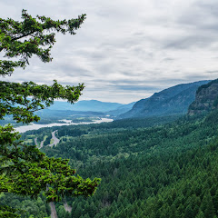
Val and I wanted to go for a good, close by hike with good distance and elevation. Looking at different possibilities, we picked Rock of Ages since none of us had done it in a while. So we went along with Mark and Carole with the intention to do the normal loop. We got there pretty early and where on the trail real quick. Without a lot of complications, we found out way to the arch where we made a quick stop to catch our breaths and take some pictures. Then we started the real climb. We followed the devil’s backbone up all the way to Benson Plateau which went without a hitch. To this point, we were on track for timing so we stopped at the junction of Rock of Ages and the Horsetail Creek trail. The idea was to take this trail and then descend towards triple falls but that’s where things didn’t go as planned. By mistake, instead of continuing on the Horsetail Creek trail, I turned on the Bell Creek trail thinking it would go straight to the bridge and then down… Big mistake. The Bell Creek trail took us for a spin thru the forest with lots of ups and downs and beautiful scenery but clearly way out of our way. At last, we found the junction with the Oneonta trail which we knew would eventually join back with the Horsetail Creek trail. We took that path down which seemed endless. Several switchbacks and miles later, we were back on track descending towards Triple Falls. By then it was later than expected so we didn’t make the accustomed stop to check out the waterfalls. Instead, we rushed down to the car completing a bit over 14 miles.


Interactive map

To see the full map, click Menu and select Full Screen. You can also click Terrain to change the map style

Bald Butte, May 11th

Not to be confused with Bald Mountain, which is also located in Mt Hood but on the north west side, Bald Butte is one of the high points on a small ridge on the east side of the Hood river basin. I didn’t know anything about the existence of this trail until I went to a presentation about a new hiking book at the Mazama Climbing Center. In that presentation I learned about this usually missed hike which, according to the author, can challenge Dog Mountain when it comes to wildflowers with the advantage of very little or no people. That by itself was reason enough for me to go explore the area. Getting to the trail is fairly easy and even though it has very few parking spots, it’s not much of a concern as not too many people go there. The trail starts going thru some heavy bush but quickly gets to an open spot that gives you a taste of what’s to come. From the trail you can clearly see Parkdale, the upper Hood River Valley and obviously the northeaster side of Mt Hood. The view at this point is pretty spectacular. Continuing up, the trail leaves the heavy and uninteresting bushes and becomes a more open trail with wildflowers and low bushes. Most of the trail faces south but every so often it will pass the ridge to the other side where Bald Butte becomes clearly visible. Once you think you’re done huffing and puffing, you get to a T junction with the Surveyor Ridge trail. As planned, we turned left here and headed towards Bald Butte. About half way there, we came to an opening where an access road reaches the ridge. We learned that this entry point is normally used by mountain bikers and motocross bikers to access the same trail. Also, from this point, the trail becomes a service road that reaches the power line. From the distance you start hearing the buzzing of the electrical lines which only grows louder as you get closer. Right under the towers, there’s a small open area that looks like a parking lot with very nice view of the valley and Hood. From that point, the trail goes up again and leaves the power lines behind. Towards the end, the trail comes to an opening with probably the best view. As you look up towards your destination, you see the road, and a field covered in yellow wildflowers resembling those manicured background pictures we have on our computers. The trail doesn’t end at the summit of Bald Butte but this is a very good destination for views. From what we could see, you can continue forward dropping sharply to regain elevation at the other side. After a nice lunch with a view, we headed back and once we got to the T junction, we decided to explore the other side for a bit. For the most part it was not very interesting as the trail was navigating thru a dense forested area. Once we reached a butte with no name, we noticed a user trail towards the west to what seemed to be another view point. We followed that path and got to a small open area with some rock formations and steep drops. Views from this point where just as good as those from the trail. We took a second short break and then headed back down the way we came.


Interactive map

To see the full map, click Menu and select Full Screen. You can also click Terrain to change the map style

North Lake via Wyeth Ridge, Apr 27th

Somewhere in the back of my mind I had the idea that I had done the Wyeth trail before. For some reason, that recollection also told me that it wasn’t a very interesting trail. I did remember that it was not easy. Well, I found out I was wrong in all counts except for the difficult part. I certainly recall doing part of this trail but at that time we didn’t reach the lake or any of the amazing viewpoints on the way. This time, with more time and stronger hikers, we did the entire out and back route North Lake and were surprised, not only by the destination, but also by the route. The first part is as any other Gorge trail; you climb quickly to the power lines, cross under them and then, start heading up. For a while, the trail doesn’t offer any views, it’s just a very forested path with tall trees that mask the sounds of the highway only enough to give you an idea you’re out there. After some huffing a puffing and several switchbacks, some views start appearing thru the trees. The first one was a clear sight of Mount Saint Helens on the other side of the river. Higher up, the trail gets to the ridge and skirts on the western side with open slopes overlooking the Columbia River and the Harphan Creek drainage. As if this is not interesting enough, wildflowers in this area are just magnificent at the right time. On our hike we saw a large variety that included wild orchids and lilies. Then, it was back to the hard, steep climb thru the forest. At some point we hit snow and following the track became a bit more difficult. For a moment we veered too much to the east and ended walking on slushy snow over Lindsey Creek which, according to the route I had was my limit. Once I realized that, I shifted direction going straight for the lake. Getting there was one of those wow moments where you see there’s a viewpoint, you know the views are fantastic but you don’t see them until you’re standing right there. When we got there, the sun was hitting that side of the lake so there was no snow making it a perfect spot for lunch and well deserved rest. I did take my time taking extra pictures of the lake while the rest enjoyed sunbathing on the rocks. Our return was following the path all the way down to the car which was as enjoyable as going up… minus the huffing a puffing of course.


Interactive map

To see the full map, click Menu and select Full Screen. You can also click Terrain to change the map style