Worm Flows, Feb 10th

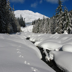
If I tell you that this route also starts from the Marble Mountain Sno-Park, you’ll start thinking that this is my new favorite place to go snowshoeing. You may actually be right or at least, it’s nice to explore a new area for a change right. So having done Chocolate falls and June Lake, the remaining loop I had to try was the Worm Flows. Originally I wanted to combine this with June Lake but I haven’t found yet a way to connect the two. This loop is a bit east of the June Lake trail and traverses an area that was pretty much created by flowing lava. I haven’t been here in the summer but supposedly, the entire hill is a lava flow that formed the wall where the water fall to June Lake comes from. Being a nice, warm day, Val and I decided to try it out by ourselves. Also, after navigating and leading some hikes, I needed a rest so I even left the GPS at home and navigated the old way… with map and compass. Is not that this area is too difficult, but you just need to make sure you’re turning where you need to. The first part was the usual forest walk heading towards the June Lake trailhead but at that point, instead of turning left, we continued straight. Soon we reached a stream big enough not to be covered in snow but narrow enough for us to jump to the other side. This was actually fortunate as we did not see any tracks after the creek leaving the entire area to ourselves. I can almost say it was a bit disappointing that most of the loop traverses new forests with limited views of St Helens or the surroundings. There are not many signs that you are walking over a lava bed. That said, we had solitude, incredibly nice weather and a lovely day.

Barlow Butte, Feb 3rd

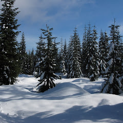
This is definitely one of my favorite’s places to go snowshoeing. You might remember that I tried this route clockwise several times without being able to find a way to come down Barlow Butte. Finally, about a year ago (or more) I tried the loop but going counterclockwise on a low snow day. That day we were able to find a route and complete that elusive circuit I wanted to do. Better yet, I was able to map it so I could do it again. This time that was my intention but weather was not cooperating much. The day was gray and cold and dark. Yet we were able to find our way to the butte albeit not the normal way. At some point we veered farther north than intended to so we ended up going straight up on the north face of the frozen ridge. It was a bit exhilarating as the slopes were completely frozen. It made the whole thing feel like a true mountaineering experience. The weirdest thing was that the slope was not a big sheet of ice but rather a slope covered with small ice pellets. At points it felt as we were going up a scree slope. Once we reached the Butte, we were able to find our way, the normal way, and continue on to the south side. Incredibly enough, that side looked much better as we could see clearly all the way to Jefferson under a cloud ceiling. The rest of the loop continued as usual navigating on the ridge and then finding our way down to the Barlow Ridge road.


Interactive map

To see the full map, click Menu and select Full Screen. You can also click Terrain to change the map style
Chocolate Falls, Jan 19th

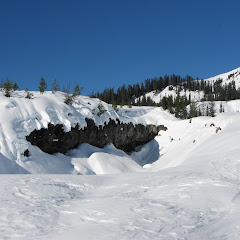
After doing June Lake, I realized there are a lot of trails and routes that start from the Marble Mountain Sno-Park. One of those is Chocolate Falls which I had read about before. As a hike it didn’t interest me that much because it was not very long and by the description, perhaps not that impressive either. The name comes from the fact thatthis is a small creek that comes from the top of Saint Helens picking up minerals and dirt. Once it reaches the rock wall, the water looks brown like chocolate. The part that hadn’t occurred to me, was this route could be done in winter. So I got there, started my slow ascend towards the waterfall and soon realized that this trail is also the winter climbing route to Saint Helens. Yes, there were a lot of people heading up. I also saw a couple of big groups doing some rescue training which was cool. What wasn’t very cool (and I didn’t know) is that it seems that the creek freezes in winter so the waterfall is dry. Still the route offered some really nice views of Saint Helens and the south cascades. Training to make the route a bit more interesting, I did a bit of backcountry going over the moguls on the lava field. It was quite eerie as you saw rocks and little crevices and cracks in the snow. It was a bit of a guessing game trying to find a safe route thru that stuff. Once on the other side, I continued to June Lake for a bit to complete the loop.


Interactive map

To see the full map, click Menu and select Full Screen. You can also click Terrain to change the map style

June Lake, Jan 12th

About three or four years ago I joined, just for a brief period of time, a photography group with the intention of learning some tricks and improving my photography skills (which I’ve gotten by simple trial and error). I went to several events with that group including a snowshoe to June Lake. That’s when I learned about this little lake tucked away in Mt St Helens. I know I had read about it before as being a short hike and a long drive which is why I hadn’t done it. With the photography group I learned that in winter, part of the access road is closed so you have to snowshoe in from Marble Mountain. This adds some distance making it more appealing. Wanting to try something different, I decided to do June Lake and maybe extend with some explorations going over the worm flows. What ended up happening was a bit more interesting. With a small group of friends we headed there and started from Marble Mountain following a trail that parallels FR83. That part of the hike is not very interesting, especially due to the noise of the snowmobiles that fly by on that road. I remembered from my first time that, at some point, we needed to cross a creek to get on the trail to the lake, but before we got to that point, we found a fork in our path. It looked like the path to our left was more direct so we took it. That led us straight to the creek, not to the bridge. At that point I checked the map and it looked like we could backcountry from that point on to the lake so we started meandering next to the creek. It was a really nice time as we plowed thru new snow on an area where there’s no trail. As we got higher, some challenges started presenting in the form of steep slopes going straight to the water. Although some of us had the right gear and experience to continue, we finally got to a point where we had to turn around. Yes, there was a bit of frustration as that was cutting the possibility of going around the Worm Flows but we managed to get back on the road fairly quick, cross the bridge and get on the actual June Lake trail. He trail was very well marked and pressed that you could have actually made it without snowshoes. Finally we got to June Lake just when the weather was starting to change and the sky was turning grey. We stopped there for a quick bite while we enjoyed the waterfall and the many ice teeth it had. In the end, even though we didn’t do the loop I had in mind, we had a fantastic day breaking trail in new snow.


Interactive map

To see the full map, click Menu and select Full Screen. You can also click Terrain to change the map style
Angel’s rest, Jan 1st

Happy New Year! --- Wow, it took me almost four months to get here. Sorry, I’ve been incredibly busy lately and haven’t got time to continue my journal. But here I am, again, this time with a very short post. Not because I don’t have much to say but Angel’s Rest is probably the best known hike in the Gorge. Don’t believe me? Just sit in the parking lot for a couple of hours and you’ll see the parade of hikers coming in and out of the trailhead. One word to clarify here, I’m calling them hikers although not all of them are. Being one of the most accessible hikes in the Gorge we, real hikers (I’m not trying to insult anybody here) often see people that really shouldn’t be hiking here. This day was no exception. January first is still the middle of the winter so you’d expect it to be cold, maybe rainy and/or windy. It was very windy and cold. Still Val and I saw at least a dozen “hikers” wearing sneakers and jeans going up to Angel’s rest. In one of the pictures you’ll notice that the trail is frozen. Although the picture doesn’t give it credit, there were parts were it was just dangerously frozen, to the point that we saw everyone in a group coming down, fall on the same spot. It seems that Val and I were the only ones there with traction devices (thank you micro spikes – best ever) and from the few with trekking poles. Anyway, it was a short hike that we did in a handful of hours just to burn a bit of what we ate the night before. It was a very windy day to the point that we were not able to reach the actual viewpoint in fear of flying of the mountain. Beautiful day and great way to start the year…. Oh, and those pictures were taken with my new camera (I’m still in the process of re-learning with this one)


Interactive map

To see the full map, click Menu and select Full Screen. You can also click Terrain to change the map style