Wilson River Trail from Jones Creek, Feb 24th

I was itching to get out even though there wasn’t a lot of snow up in the mountains and the weather wasn’t playing very nice. Looking at my past hikes, I decided to re-visit the Wilson River trail and potentially head up to Kings Mountain from Jones Creek. As I drove there, I went from clear skies to cloud cover to rain and back to cloudy. Just as I parked at the trailhead, some rays of sun where coming thru so I got hopeful that I was going to be able to make it to Kings Mountain via Coronary Ridge. That disappeared pretty quickly when I started walking on snow on my way to Diamond Mill, just minutes from the trailhead. I was wearing my normal hiking shoes and knew my feet would get wet. The question was more about how long it was going to take for them to get cold. Looking at the sky, I saw grey clouds rolling in fast and it looked like it was going to let go at any point. Since I’d driven there and was already on the trail, I opted for at least getting to Diamond Mill to take a couple of pictures from the bridge. Just as I was getting there, rain started, and I had to put on rain gear and cover my pack. I got to the bridge, took a couple of pictures and then was about to start heading back when another ray of light pierced thru the sky and illuminated the bridge.


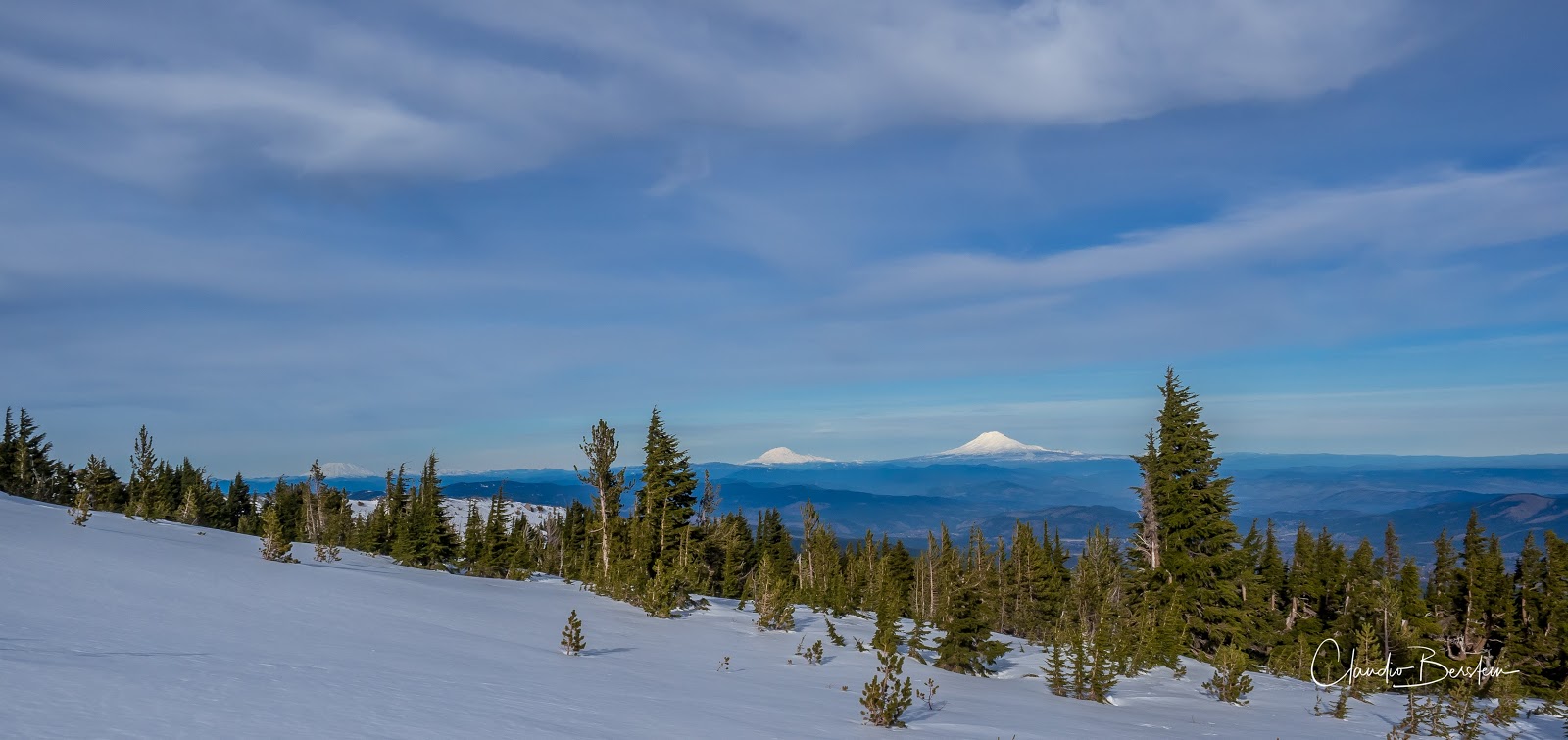
I stood there feeling the warmth and saw as the sky cleared up a bit. It felt like it was tempting me to go further. It worked as I decided right then to continue. While traversing the forest the sky light up in blue but as I gained elevation the snow got deeper. It got impossible to hike and keep the shoes somewhat dry. It was now a matter of time until my feet got cold, but I was still trusting my wool socks. At one turn I though I was close to the fork that goes up Coronary ridge but soon I found I was off by a couple of miles. By then, the snow was about 8 inches deep and getting deeper by the step. The problem in this kind of situations, when you need to make a call and turn around to head back, is that you always want to get somewhere to turn around. Turning around mid-trail seems to make sense, like leaving something incomplete. I was looking for a view or an opening, something that would work well as a turning point. Then the trees thinned out a bit, the snow got much deeper to the point of making it difficult to see the trail and the views opened to the valley. I had found my turning point. There was a small rock outcropping with amazing views of the Lester Creek valley below me and the mountain range due south.


The clouds had come back and were menacing, and my feet were cold. It was time for one or two pictures and march my way back to the car. AS I did, the weather change again. So far, I had gone thru sun, clouds and rain. The only remaining, that I got on my way down, was hail. Yes, the weather was definitely not playing nice.

You can see the rest of the pictures here

Interactive map

To see the full map, click here

Dome Rock, Feb 10th

Usually around Tuesday I start looking at the forecast to figure out what am I going to do or where am I going to go. When I do that, this time of year, I start by checking Government Camp to check the possibility of going snowshoeing. Then I check Tillamook for a closer hike and then I check Cascade Locks to see how the Gorge will be. Rain, Rain and Rain respectively. Then I check a bit further away, places like the Dalles, Detroit, etc. And that’s when I saw that Detroit was going to be mostly sunny. That’s when I remembered a hike that I really liked when I did it the first time and it’s one of those lesser known hikes even though the trailhead is right off the highway right after the bridge over Tumble Creek before getting to Detroit. When we got there, the day looked like it was going to be as predicted, sunny with some clouds so we grabbed our gear and got going. The route starts on an old access road that travels next to the creek for a while and then the trail veers from it. That’s when the climbing starts and it’s a steady up traversing back and forth the front of the ridgeline. The first third of the trail stays in the woods with almost no views even though it’s a beautiful forest. Then you traverse the first of a couple of open slopes that gives you the first hint at the views you’ll get later. Below you get a partial view of Detroit Lake and on the opposite shore Mt Jefferson peeking above the other mountains. Here it’s necessary to make a stop to enjoy the views as you get right back in the forest. Also, it’s a great spot to catch some sun.


After the obligatory pictures, we continued, and the story seems to repeat itself. You again traverse back and forth trying to stay on the ridgeline as you continue gaining elevation. Eventually the trail approaches a small dome that makes you think you are close, but rather than continue up, the trail makes a turn and goes into the shadow of the mountain. Being in the shadow, made this section not only colder but where we found most of the snow. As we traversed we did fall in some deep holes but eventually where able to go around. There are several good views in this section that open to mountains that are difficult to identify like Coffin Mountain, Triangulation Peak and Ollalie Butte, but it also gives you views of Jefferson, Three Sisters and Broken Top.


After going around this smaller butte you finally come back to the sunny side on a saddle which happens right before you start traversing the south side of your destination. Views start to open to Tumble Lake which is the actual destination of the trail as you pass some pretty massive rock formations. Shortly after a signed path indicated the detour to the top of Dome Rock. This is where saving a bit of energy comes in handy as the last push is probably about a quarter of a mile but climbs about 500’. The very last portion was rocky terrain covered in ice but then we were at the top. You can still see the remnants of the old fire lookout tower, but your eyes wonder quickly to the surrounding views. To the north you are supposed to get more peaks and mountains, including Mt Hood, but with denser clouds towards the north, it was hard to see. The views to the south were just magnificent and rewarding. We stayed there for a while eating lunch and enjoying the views. After a while we grabbed our way and retraced our steps all the way to the cars. Such a good day.

Click on the image to see the rest of the pictures

Interactive map

To see the full map, click here


Ghost Ridge, Jan 28th

We got a bit of snow, just a tiny bit and I was itching to go snowshoeing so I setup a meetup at the very last minute to go check it out. Picking a route was easy as I have a handful that I always enjoy, and probably have bored you with since I’ve done them several times. Still it was a fantastic outing even without full fluffy snow as I was expecting. We did find though some really odd shapes on the backslopes of Ghost Ridge. Our guess was due to warming temperatures and ice below the surface. Who knows. They still looked pretty cool and almost inviting to jump on them

Click on the image to see the rest of the pictures

Tilly Jane, Jan 13th

With cold weather and nice days, I was itching to go snowshoeing. The only problem was lack of snow unless you went high up, or so I thought. So, looking at my options, I decided to head up to Tilly Jane and maybe continue up to the rock shelter. What I didn’t think off though was that I would find ice which ended up being a pain for me. All the way from the trailhead, we found a thin layer of solid ice. Wearing snowshoes for that works but it’s uncomfortable and noisy. Everyone else in the group had the great idea to bring spikes besides the snowshoes except me. At first, I thought I could start without the snowshoes and put them later but that changed quickly as I slipped and landed on my ass just before the turn to get on the trail. With that clear message I put on my snowshoes and we headed uphill. My thought was that at some point we would find deeper snow but as we gained elevation the contrary was true. The ice got thinner and eventually disappeared in sections of the trail. It was quite sad to see the trail and the mountain so bare of snow in January. Rather than take the normal Tilly Jane trail up, I decided to veer off and take the Pollalie Ridge trail instead as it offers much better views as you climb the ridge line. As we climbed, we passed several viewpoints that opened to the Pollalie Creek valley. At one of those, we hear a low rumble and noticed a rock/ice slide on the other side. Towards the top of the ridge, we made a turn back towards the forest and finally got to the A-shelter. This shelter used to be open, but people were not keeping it clean and it was even get vandalized so now there’s an iron gate and you need to get permits to go in or stay the night. We stopped for a bit to have a byte and voted together to continue up towards the rock shelter. As we came out of the forest, we found ourselves in a white hard covered surface. With the sun to the south, the ice was even shinning on us as we continued up. Hard as rock. Close to the junction with the Timberline trail, we saw a couple of skiers fly down scrapping their skis. We got to the rock shelter where we took another break to enjoy the views which, needless to stay were spectacular. From our point of view, we could see clearly Mt Adams, Mt Rainier and Mt St Helens.


On our way down, we did pass again by the shelter but instead of taking the Pollalie Ridge trail we continued straight down the valley on the Tilly Jane trail.

You can see the rest of the pictures here

Interactive map

To see the full map, click here

Bridal Veil, Jan 7th

If you live in Oregon, you probably know there are a ton of trails in the Columbia River Gorge. Since I’ve been here, I’ve hiked most of those and some I have done more than once. But there are some I’ve never done before, not necessarily because I was or am not interested but because they are too short. Driving an hour to the trailhead to hike for an hour or less doesn’t seem very appealing to me. For that reason, there have been a short list of trails I’ve never seen or done before. Bridal Veil is one of those. What made me go this time though, was that I needed to do a scout repot to document the work that might be needed in early spring, and since this trail is close to he Latourell Falls, where I also had to do a scout report, I combined the two in a single day. The Bridal Veil area is two trails in one. You can certainly take a straight trail to the waterfall or combine it with the interpretive trail that goes thru several viewpoints. In total the trail is a bit over a mile and generally flat – ideal to take visitors, but you still get some really nice Gorge views and a two-tier waterfall.

You can see the rest of the pictures here

Interactive map

To see the full map, click here