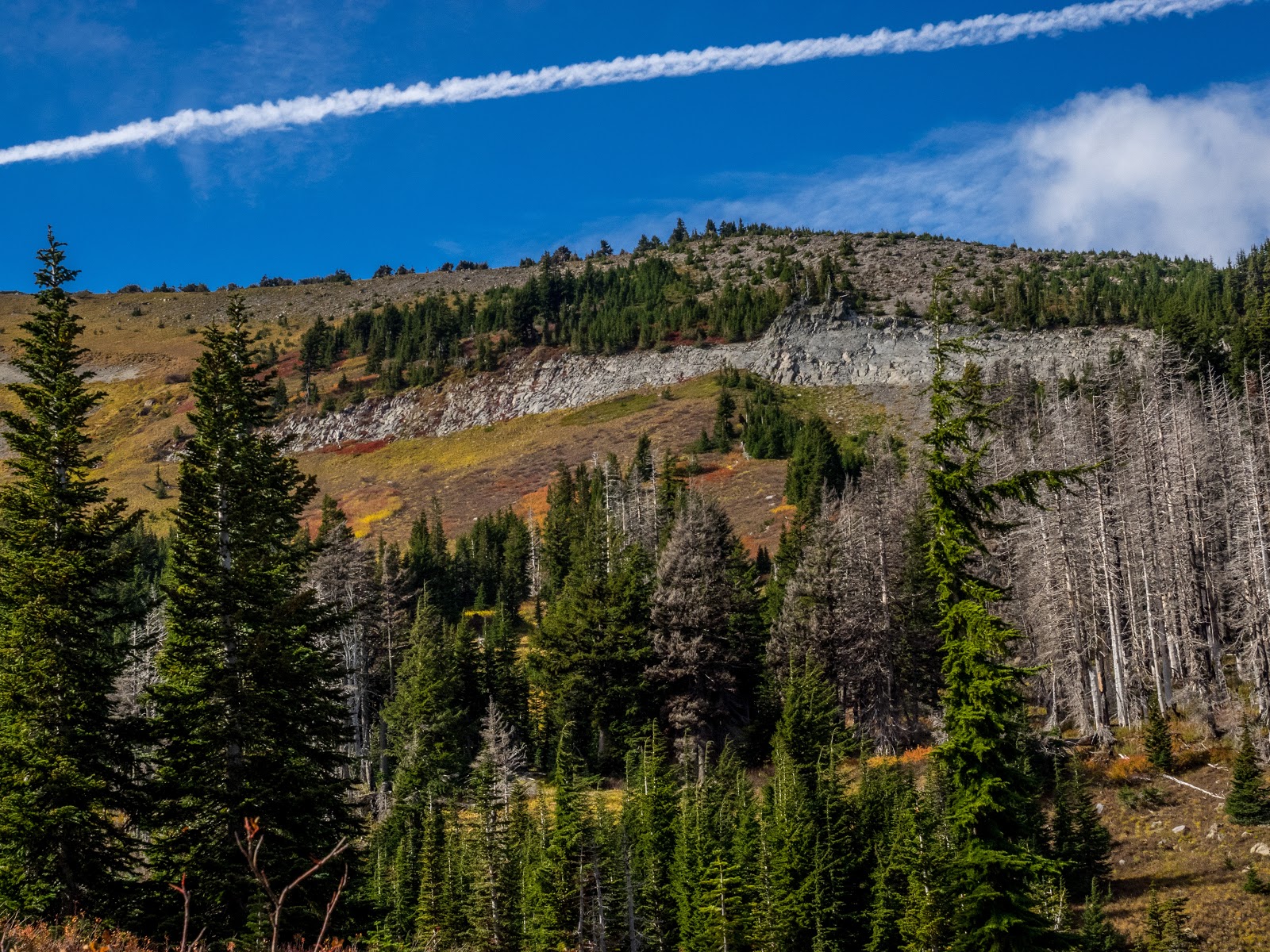
Elk Cove to Dollar Lake, Oct 8th

I was looking at a map with the different trails I’ve done and noticed that I’d gone a couple of times to Dollar lake but always from the east side, either from Vista Ridge or Pinnacle Ridge but never from the Elk Cove trail. That seemed reason enough to post it and go check it out. The trail originally started from road 650, but since the bridge is impassable, you have to park along road 2840 and hike a short portion of the 650 road to the original trailhead. Even though you start with that, the views are not disappointing as you get some views of the Pinnacle Creek drainage to the north. Then, when you find a cairn and make a turn, you get into the forest and start gaining elevation. By then you are already on the ridge with some pretty impressive views. Part of it is because most of this area was burned several years ago. Pretty soon you get your Mt Hood fix right in front of you. The trail just follows the ridge so the views are non-stopping. There’s a section of the trail where there’s a small rocky butte you come to where the trail makes a slight right turn. You know when you’re there because the rocks call you to get on top and enjoy the view. If you don’t go farther than here, you have gotten the eye candy for the day.


After that point, the trail descends a bit and continues on the ridge towards the Timberline trail. In this section you get more in the forest and some of the views disappear for a bit as you enter Elk Cove. Once you reach the unction with the Timberline trail, the views become completely different to the point that it seems you are in a different hike altogether. For starters, Mt Hood is not there and you are surrounded by a small valley with some interesting rock walls and ridges. You can almost see why this place is called Elk Cove, if you were an Elk, that’s where you’d be… As you travel south (counterclockwise) on the Timberline trail you meander a bit thru this valley before a shallow climb to a saddle where, if you look back, you get your Mt Hood view again. After the saddle the views again change as you are looking at the Pinnacle drainage. From that point on, you have to pay attention to the trail and look for the small cairns on both sides that indicate where the trail to Dollar Lake is. Yes, it looks like a user trail but that’s the way up to the lake. As with most things this year, we fund the lake pretty low but very round as always. We stopped there for lunch and while enjoying a bit of refreshing time, I walked around the lake to a small ridge on the east side where I found a couple of campsites and what looked like a rock oven. I guess is there because the views of the mountain are again pretty outstanding. Then, after our lunch break, we retraced our steps back to the cars.
You can see the rest of the pictures here

Interactive map

To see the full map, click here

Black Cap Mountain, Oct 14th

While visiting some friends in the east coast, we headed a bit north to the Conway State Forest to check out the fall colors. That’s where I learned there’s actually a term for this – leaf peepers. We did a short but very rewarding hike to the top of Black Cap Mountain that offers a bit of both, looks from within the forest and ample views of colored valleys. We started from the trailhead along Hurricane Mountain Rd. heading south. The trail is very family friendly so not easy to get disoriented or lost here. The first part of the hike meanders thru the forest which, this time of year, is covered with multicolored leaves ranging from the bright yellow to the bright red. At spots you can almost miss the trail under this carpet. Taking your time to see the different leaves reveals patterns, shapes and colors that make the whole mix. The obvious maple is the most common one but some others look like some radioactive goo is running inside them. As you gain elevation, the forest starts to clear out and you start finding rocky steps. Then, you are above the tree line and here you must stop and look around. The valleys around you are all tainted in red and yellow. In the pictures you can get an idea but it’s not even close to how it looks when you are right there. We continued all the way to the very top which is not the best viewpoint. We stayed there for a bit and then headed back down the same way making several stops at different rock outcrops to take in some of the scenery. Truly a must see
You can see the rest of the pictures here

Interactive map

To see the full map, click here


Huckleberry Mountain, Oct 1st

Huckleberry is always a fun hike with very nice rewards once you get to the saddle. If you have good weather and clear skies, the views can be quite spectacular with Mt Hood at arm’s length and several other cascade peaks in view. If weather does not cooperate, you still get views of the Salmon River valley below. So without much to lose, Val and I picked this hike for a wet and rainy day. Most of the hike is forested so you are always under the canopy of really tall trees. With all the rain we’ve been having though, the forest floor was a mushroom party and the salamanders were happy about it. As we hiked up, we had to take care not to step on the little guys as they crossed the trail or walked along it. About half way up the trail, there’s a turn with an outcrop and a pretty decent viewpoint that looks straight to Zigzag mountain across the valley. From there we could see a thick layer of clouds covering the sky and Mt Hood. We knew we were not going to get the views this time. But still, we continued up enjoying the green and the forest which we had all to ourselves. We made a short stop at the viewpoint in the saddle to eat a sandwich with no views before heading back down the same way – still trying not to step on the Salamanders.

You can see the rest of the pictures here

Interactive map

To see the full map, click here

Zigzag Overlook from Hidden Lake, Sep 16th

About a year ago I did this hike combining two trails, the hidden Lake trail and the Paradise Park trail. The loop was fantastic but the reason was to get the view from the overlook without having to retrace back to the parking lot. That time, clouds were hanging very low so we got a very limited view of the Zigzag Canyon and no Mt Hood as a backdrop. So this time, we decided to head up there via the Hidden Lake trail to check it out and then head back down. From the drive there we knew we were in luck and that we were going to get the views. The hike up meanders thru the forest without a lot of views so it went quickly until we reached the Timberline trail. By then, the views expanded around us and we saw a lot of hikers, both PCTers and hikers coming from the shorter path from Timberline Lodge. After a couple of ups and downs we got to the viewpoint where we stopped for lunch and pictures. On our way back, we retraced our steps but made a quick detour to check Hidden Lake. It looked more like a mud pond than a lake and we saw a couple of campsite on the eastern side. Since those didn’t give access or views of the lake, we went around and were able to get a glimpse of it. It’s certainly a lake you can’t seem to be able to get close to. While checking it out, we heard a family heading to one of the campsite on the other side (we had crossed path with them before). At some point the laughter and talking changed to what seemed like screams. Thru the bushes I saw the woman drop her backpack and run so we decided to go around and check what was going on. It seems the sat on a log to have lunch and were attached by yellow jackets. The poor kids were screaming in pain so we all got our first aid kits out and gave them after bite to relieve the pain. WE stayed with the for a little bit and then headed back down. While pulling off from the parking area, we saw them come out of the trail all smiling again and thankful that we were there to help them. I guess it’s part of the adventure.

You can see the rest of the pictures here

Interactive map

To see the full map, click here

Olallie Lake Scenic Area, Sep 16

Val and I went thru different ideas for this three-day weekend that included the Wallowas and some other places in northern California. The weather didn’t look good anywhere so we opted for something closer and maybe more relaxing. Originally the plan was to head to Wall Lake and hike around the area. The hike we had planned for the first day was short so we were not in a hurry to get on the trail. While driving there, we made a call to turn and head to the Olallie Lake Resort to check it out and once there, we changed the plan again.

Day 1: Olallie Lake to Averill Lake

Once parked, right outside the campground entrance, we got on the PCT heading west. The first part gained a bit of elevation and gave us a glimpse of Olallie Lake but not much more due to grey skies. AS we snaked thru the areas, multiple ponds and little lakes appeared on both sides. We followed the PCT for a while until it topped out around Twin Peaks and started descending on the other side. From there, we took our first turn heading to our original destination at Wall Lake. Part of the route was in the forest descending pretty quickly to a small chain of lakes starting with Fork Lake and the Deer Lake. A couple of minutes later, we got to Wall Lake to find the main campsites already taken so we decided to continue on and check the following lake. At this point, the trail was following a small stream that connects all these lakes and at some point we got to Averill Lake with a big, empty site on the north shore right next to the trail. We thought for a minute of staying there but being so close to the trail made us explore a bit. We found a user trail following the north side that lead to an even bigger campsite with a huge fire pit. Several user trail continued from there. One of them headed closer to the lake and on that one, we found a perfect spot for our tent just steps away from the water. By then, the sky had mostly cleared so we had a chance to enjoy the peaceful view of the rocks in the lake.


Day 2: Averill Lake to Timber Lake

On day two we woke up to a cold and foggy morning. The view of the lake was completely different from the view we had the night before. After a warm breakfast and coffee, we packet our gear and got on the trail to retrace our steps back to the PCT. All the lakes in the way had the same eerie look with fog flying slowly over the water. It almost looked like they were haunted. The trail itself looked quite different on the way up. We then took the PCT heading south to the junction with the Top Lake trail. On that short section we crossed several PCTers fast pacing north. We took the Top Lake trail for a short distance until we veered off on a less used trail towards Timber Lake. The trail itself was not very picturesque as it went thru a section of dead forest but soon it descended to the North Shore of Timber Lake. When we got there, we found nobody so we had the lake entirely to ourselves. We continued counterclockwise on the lake and found a large, exposed campsite with a fire pit. We were not very excited about the site and the little excitement we had diminished even more when we saw an abandoned outhouse. We continued on but didn’t see a trail around the lake. Later we found out we had just missed it. Still, since we had most of the day still ahead of us, we retraced our steps and decided to go look for other options around the lake going clockwise. Towards the eastern shore we found a small grass meadow that extended to a small pond with multiple deer and elk tracks. We thought for a minute of setting up there but didn’t find any firm ground so we continued on. The southern shore of the lake got rough pretty quick with a rocky shore and lots of underbrush. We thought about returning but kept pushing on and it seemed like there was a possibility ahead. We did pass several places that looked promising from the distance but ended up being not usable. Finally, we found the user trail and continue towards the north side and finally found a little promontory with a perfect spot right in front of the lake. There was space for more tents so we set up right next to where the fire ring was giving us views and access to the water. After lunch, I hung the hammock between two trees right in front of the water so we spent the rest of the day just swinging in there, reading a book and just enjoying the views.

Day 3: Timber Lake to Olallie Lake

Day three started almost with no clouds and the sun coming sideways and illuminating the other side of the lake. As we made breakfast, we saw the forest turn intense yellow and the fog start to lift from the lake surface. At one point, it seemed like a ball of fire was going to roll into the lake. It was quite spectacular. Not rushing, we packed our gear and got on the trail retracing the Timber Lake trail back to the Top Lake trail. We had the choice to head back on the PCT or a different, shorter trail, straight into Olallie Lake. Not wanting to repeat, we opted for the shorter version which took us pretty fast back down to the lakeshore. This time, we clear blue skies, we did enjoy the views of the lake, Olallie Butte and the rare appearance of Mt Jefferson behind a ridge. It was indeed a very relaxing trip were we stretched something we could have hiked in one day and made it a three-day backpack!


You can see the rest of the pictures here

Interactive map

To see the full map, click here