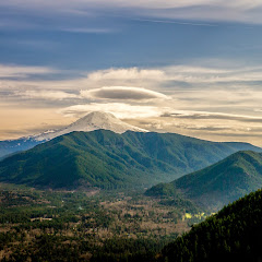
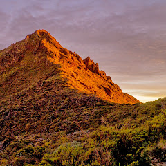
Cerro Chirripó, at 12500’ is the tallest peak in the Talamanca mountain range in Costa Rica. Its name is also the name of the National park where it’s located. I didn’t know anything about this peak or area until someone recommended me checking it out if I ever went back to Costa Rica. So I did and decided to give it a try and climb it. Getting there and getting permits was half the adventure as I wrote in my last entry about the Cloudbridge Preserve. While getting the permits though, I meet a nice bunch of people that, as me, where climbing up on Sunday. With Kurt and Ann, we planned to hit the trail very early to avoid the heat on the first part of the hard climb.
Day 1: Hike to Base Crestones
By 5:30 AM we were standing at the trailhead ready to head up. Most of the views I had seen the day before when I explored the Cloudbridge Reserve. The main difference was the sun starting to appear over the ridge and slowly painting the hills in bright yellow. There was a tiny bit of haze which added a nice touch to some of the pictures I took from the first ridge. At about midmorning we got to the park entrance just a bit above the turn off trail for the Mountain trail that I had taken the day before. We took a short break to take pictures and then continued on walking thru a dense rainforest. There were no views other than tall trees and incredible forest accompanied by the sound of birds.

As we climbed we found that every single kilometer section of trail has a different name that, in a way, tells you what’s coming… and also the distance and elevation which was nice to a certain extend (it’s good to know how much you’ve done but not as much to know what’s up ahead). Nearly at noon we reached the roughly halfway point of the trail at Llano Bonito. At that point there’s an unoccupied lodge with bathrooms and running water that serves as a rest stop for hikers. We stopped there to get a bite to eat, stretch a bit and refill our water before continuing. By then the day was getting pretty hot. From there we started climbing, and climbing and climbing. We left the dense forest behind and came to more openings and certainly not as tall trees as before. The shade was gone and the views were in. Behind us we could see we were roughly at cloud level and the view behind us was beautiful. At some point we could see what looked like the end of the long climb and some dead/burned logs.
 |
| Close to "Los Quemados" |
When we got to that turn we finally got the first clear view of Cerro Crestones in the other side of the valley. The trail leveled up a bit and we started walking thru some fog. We reached Km 11th where the trail changes name to “Los Quemados”. They translated that to “the burns” although it would be more appropriate to call it “The Burned”. This section is a high plateau at over 10000’ where a big fire left a ghost forest. Below the tall grey and black trunks dense low vegetation covers the hills. That mixed with the fog was just fantastic. We also felt pretty good thinking that, if we were already above 10000’ we were almost done with the climbing… no such luck. The trail topped at a rest stop that looked more like a bus stop than anything else. Views were magnificent but the trail ahead looked to be far down from where we were. So for the next Kilometer or so, we just went down. When we reached “El Jardin”, de garden, we realized we had descended about 2000’ which meant we had a lot to climb to get to Crestones. We passed the last water source that we found almost dry and continued on probably the hardest part of the trail. I didn’t take a picture of the sign but if I recall correctly, that section is called “Los Arrepentidos”, the repentant. Quite proper for what was ahead. From there the trail was almost like a desert. Dry and dusty and the vegetation was even lower than before. With the beating sun on top of us, it took a while to regain the 2000’ we had lost descending to the garden and then continue climbing to get to Base Crestones. Besides the amazing views towards Crestones and
 |
| Cerro Crestones from the trail |
some pretty clouds flying over it, the other companion we got on the trail was a lot of green lizards. One final turn and we got to a bench that overlooks the entire valley where the lodge is located. It was a wonderful sight to see finally our destination. Once there, we were greeted by the park ranger who wanted to show us to our room. Ann was feeling a bit dizzy so she stayed outside having a bite while Kurt and I took the pack upstairs. As you might suspect, being above 11000’ makes it a bit difficult with the oxygen and all that. I was already having trouble breathing and was feeling the elevation on every step I took, but climbing those stairs in the lodge was probably the hardest thing in the entire day. Not only I had to stop half way up to catch my breath, but once I got to the top, I almost fell backwards being dizzy. It truly felt as I had taken a couple of tequila shots. My legs were like Jell-O. So I dropped my bag, grabbed my food and went downstairs and out to eat.
Side trip to Cerro Ventizquero
After resting for quite a while and still having plenty of afternoon left, we talked about going for a short hike. I had thought about it and by looking at the different options, I had thought of going to Lake Dikevi as that route was roughly level. I was pretty much done with climbing for the day. Kurt and Ann suggested we instead went up to Cerro Ventizquero. I didn’t check distance or elevation and thinking it wasn’t going to be too bad I went with them. The first portion of the trail was the same route we needed to take to hike towards Cerro Chirripó, or destination for day 2, but shortly after leaving base camp, we turn left at a sign and started climbing again. From our point of view on the trail, it looked like we were just climbing a small hill but as we gained elevation, the surrounding hills and everything else was left below. At some point I turned around and realized I was looking straight at the rock formation of Cerro Crestones across the valley. We were pretty high. Ahead of us, just the same hill and some hint of clouds on the other side.
 |
| No small hill - Cerro Ventizquero on the left |
As the day was starting to fade away, at some point the sun dropped behind the ridge we could see and temperature dropped a bit. Huffing, puffing and out of air we continued and finally, almost to the point of fainting, I saw Kurt and Ann at the top. It was so close so I continued just to realize were not yet there. We were standing on the south side of a saddle with Cerro Ventizquero on the other side. It wasn’t much higher than where we were but we needed to descend a bit and then climb again. The descend made me feel really good and helped me catch my breath – with the little oxygen available that is. But all that weird altitude sickness feeling was masked by the incredible scenery ahead of me. The little clouds I saw when climbing were just the top of a sea of clouds that was being stopped by the ridge line. It looked like the sea beating on the shore with huge splashes.
 |
| From the saddle en route to Cerro Ventizquero |
Around us we could see all the peaks in the plateau including Cerro Chirripó on the other side of the valley and above Lake Chirripó. As we continued towards Cerro Ventizquero, the sun finally hid behind the clouds statring an amazing sunset. Behind us, clouds far in the distance started changing color from white to yellow to orange. The sky in turn started changing from blue to violet and getting darker. I don’t recall at what point I got to the summit but we stayed there for the rest of the spectacle. Once it started to get darker, we decided to head back to camp. From the saddle I took the last picture of the day when the last bit of color was still there and the moon was showing her face up in the sky.
 |
| Final shot of the day |
The rest of the hike back was in the dark under the bright light of my headlamp. Back at camp, with sore legs and before going to sleep I decided to check my GPS for stats and realized that this was certainly not the longest hike I’ve ever done, but I do believe at about 8000’ is certainly the most elevation gain I’ve done in a day. It felt painfully good
Day 2: Cerro Chirripó summit and hike out
As almost everyone else, we wanted to check the sunrise from the summit of Cerro Chirripó. With that in mind, we were up and ready to go at around 4 in the morning. My legs were sore and I was a bit tired but it was the last day. I was ready for that final push. Most of the hike was in complete darkness so there was not much to see but we did notice that sun was going to be up before we got to the summit.
 |
| Sun rissing |
Somewhere along the route we stopped and I took a couple of pictures as the first rays illuminated the clouds above us. The whole sky was a very dark purple and only a single bright yellow/orange in the horizon indicating it was about to be morning. With a bit more light we saw that day was not going to be clear and spectacular as the previous day, but we pushed on. The sky turned pink and finally the first rays hit the mountains and illuminated everything. By then I was feeling like crap. I think elevation was getting to me as I started with a weird cough and my stomach was not very good. Right before we started the final ascend to the summit we saw the rest of the people from the previous day coming down already. We had missed the sunset although we knew it was not as spectacular as it can be. When we got to the top, there was little sun left to be seen. The sun quickly went over the clouds and the day turns into a dull grey color. Views were still pretty impressive but not as much as the views we got from the top of Cerro Ventizqueros.
 |
| Las Morrenas from Cerro Chirripo |
After a while we started our hike back down and once we got to the multiway split we said our goodbyes with Kurt an Ann. Since they were staying an extra day they took the route around Cerro Crestones back to camp. I in the other hand went straight to base camp to grab a bite, rest a bit while I packed my gear and start the long hike down.
The rest of the day was just long and hard. If the climb was exhausting, I can say the second day, was even worse. Most of the hike was inside the clouds which to a point was a good thing as it kept the temperature at bay.
 |
| Hiking in the clouds |
The more I descended, the better I felt and the weird cough went away, but in that same sense, my feet started to hurt. The last 3 or 4 Kilometers were almost a torture. I do recall stopping several times to rest my feet before continuing down. The only thing I could think of was taking my shoes of and dumping my feet in cold water which I did as soon as I got to the hostel. But it was worth it.
You can check the pictures here
Interactive map
To see the full map, click Menu and select Full Screen. You can also click Terrain to change the map style