Ruckel Ridge – Ruckel Creek loop, Nov 23rd

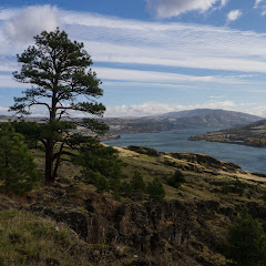
Even though half of this loop follows user maintained paths, it’s probably on the top list of those who like elevation gain on a hike. If that’s not enough, this hike has some scrambling sections and some incredible views of the Columbia Gorge. I’ve done this loop several times in the past and always get the same feeling as I’m going up… when is it going to end? This is the same feeling you get when you’re coming back down. The incredible part this time though was not the hike itself but actually being able to do it by the end of November when we’re usually snowshoeing. Normally, by this time of year, these hikes are covered in snow making it very difficult to navigate (I’ve been lost up there in the snow). As you’ll see in the pictures, there’s not even a sign of snow. We started quite early on a quite cold and crisp morning which promised some nice views from the different viewpoints along the way. Being this late in the year also meant that he sun kept all day at a lower angle giving us some nice orange colors on the cliff walls and interesting sun rays slipping thru the trees. From all the times I’ve done this hike, I think this is the first that scenery (and the pictures I was able to take) were more memorable than the huffing a puffing to get there.


Interactive map

To see the full map, click Menu and select Full Screen. You can also click Terrain to change the map style

Cape Horn, Nov 10th

A couple of years ago I did this hike with a good friend that works for the WTA when they were building this trail system. Back then, part of the loop was completed using unmarked paths and crossing over Hwy14. It did have a lot of promise as the hike takes you up on a ridge with stunning views of the Columbia River Gorge. The hike itself is not difficult by any means but it’s not for the faint of heart. There are some steep drop offs that can make you dizzy if you stand too close. Doing it again with a small group brought back nice memories and a couple of nice surprises. For starters, the whole loop is very well marked and the trail itself is very well maintained. They also added tunnels under Hwy14 at both points where you needed to cross the highway before making it a lot safer. They also built a viewpoint on the top, located at the end of the Rim Rd. It seems you can drive closer to this viewpoint for a shorter hike but being in the middle of the loop makes it a great stop for a bite to eat with pretty good views of the Gorge. Certainly the WTA did an incredible job on this trail while preserving the interesting parts of it.


Interactive map

To see the full map, click Menu and select Full Screen. You can also click Terrain to change the map style

Coyote Wall, Nov 3rd

When you drive east on Hwy84 past Hood River, you can see a huge vertical basalt wall on the other side of the Columbia. That wall is known as Coyote Wall and frequented by mountain bikers. For us hikers, Coyote Wall offers a great destination to either check out the wildflowers in early spring, or to find a dry spot when it’s pouring rain in Portland. I’m not sure if there’s an official trail that defines the loop or not, but finding your way around it fairly easy. Since weather was not looking good and while we still wait for snow, Val and I decided to hit this trail for a change. It was a crisp day with consistent winds blowing from the west which made it a bit nippy but beautiful. Needles to say, we were welcomed with pretty amazing views of the western side of the Gorge and also of our trail ahead as grey clouds moved fast above us. Fearing the rain, we climbed at a steady pace enjoying the colors of the dried vegetation contrasting the dark grey of the sky. Up at the top, we found plenty of wind that prevented us from stopping for a snack so we continued and, instead of the longer loop, we took the connector trail that descends steeply into the valley to connect with the lower trail. We did lose some time on that connector as the leaves almost hid the trail from view but were rewarded with the sight of a deer resting in the woods under a ray of sun. Even though the deer left when we passed the first time, we saw it again, in the same spot, when we went back retracing our steps trying to find the way. It was a shorter hike than what we were expecting, still a great day out there


Interactive map

To see the full map, click Menu and select Full Screen. You can also click Terrain to change the map style

Khao Yai National Park, Sep 21st

When Val and I started planning our trip to Thailand, we thought of maybe doing some backpacking in one of the many national parks. After doing some extensive research, we found that it was not that easy. The only way to backpack in Thailand, it appears, has to be with a guide. Part of it has to do with the country’s fauna which includes elephants, tigers, wild dogs, monkeys and or sorts of insects and little creepy crawlers and another because well, there’s not a lot of information. With that in mind, we chose to go to Khao Yai National Park for a couple of days and do some hiking there since it was not too far from Bangkok. Getting there was part of the adventure as we ended up renting a car without realizing that we needed to drive on the right side of the car and the left side of the road. Add to that having to read directions and street signs in Thai, negotiate traffic with Tuc-tucs and pouring rain in the dark. Needless to say, we got to Khao Yai late in the evening after passing the hotel we stayed in about half a dozen times before we actually found it.
The following day, we woke up and headed to the park for some hiking. Our plan was to hit the visitor’s center first to get some info and maps and then pick up a trail and go. We ended up doing three short hikes in the park.

Kong Kaeo Trail

When we got to the visitors center parking lot, we noticed a hanging bridge over a river right behind the building. We walked to a sign a found out it was an actual trail. Since we still didn’t have any information or maps, we decided to go first to the visitor center. One thing we noticed in the parking lot though was almost everyone was wearing something that looked like a cotton sack over their lower legs. We asked in the visitor center about it and found that those were leech socks… and that we needed them to hike in the park. Luckily they had a little store in the visitor center where we were able to get a pair. Once equipped with the proper gear, we crossed the bridge and started our first official hike in Thailand. The trail was actually a paved path that meandered thru the forest. Certainly vegetation was completely different to what we’re use to here in the states. There were huge trees covering the forest and smaller ones with twisting branches and lianas and all sorts of small palms. About half way around the loop we found an actual trail with a little wooden sign that read Heaw Suwat Waterfall. WE took that trail and things got more interesting. With all the rain from the previous night, the trail was nothing but muddy. As we were walking we started noticing little black things climbing on our shoes and then on the leech socks. A close inspection revealed that yes; the leech socks were working – kind of. We continued for a bit up to appoint where the trail made a sharp turn and went steep down. Thinking about climbing back up and the leeches, we decided to turn around at that time. By then we couldn’t outrun the darn little things. As we hiked back to the paved trail we started hearing monkeys in the distance. I don’t know what was going on but they did have a very heated argument going on. At first it was cool, but after a while it was a bit scarier as we didn’t know how far or close they were.


Once back at the paved trail, we spent a couple of minutes flinging leeches of our socks and battling mosquitoes as the sounds of monkeys died away. As we hiked back, we passed another hanging bridge towards the end of the loop and found a sign pointing to the Gon Gheo waterfall. We followed the path as long as we could and then went back to the parking lot


Nong Phak Chi trail

After walking out of the Kong Kaeo, we washed our shoes and grabbed something to eat across from the visitor center. I won’t go into details but to this day we’re still not sure what we ate. Back at the car and after a bit of back and forth, we decided to drive to the Nong Phak Chi Wildlife Viewing tower parking lot and hike around there. We found that, if you take a tour, they drive you to the tower on a very bumpy dirt road. Since we were not in a tour, we just went around the gate and walked there. At first the trail passes some trees that block the views of some wide open grass fields. At first it looked like the grass was not that tall. Later we found that it was about shoulder high. From the road it was easy to see paths in the fields that we imagine are made by elephants when the go to a nearby salt lick. We got to the viewing tower and climbed up. Even though we didn’t get to see all the wildlife you’re suppose to see from there, that includes elephants, deer, wild dogs, boars, etc. It was pretty cool to get the vistas from that perspective. From up there, we noticed a trail going around the lake and continuing pass the salt lick in to the forest which we decided to explore. Once we left the tower behind, we got back on a muddy trail but without leeches this time. While going around the lake we got the most incredible butterfly display which made this hike worth. First it was a black and white butterfly with a couple of long appendages on the back that made it look like a little person. Then we saw a group on the ground that were black and green with some very vivid and even reflective green spots. These spots were more visible when they flew but even standing on a plant they were pretty impressive. Later we saw a simple black butterfly with very faint shades of blue/grey that made it look like its wings were made of velvet. And lastly, a white butterfly with lines and yellow marks resembling the color of a tiger
After that, we passed the salt lick and continued thru the tall grass fields towards the forest. As we did, the sky started turning grey menacing with showers. We pushed on and got into a very dense forest. We didn’t get all the sounds we got in Kong Kaeo but still it felt like a thousand little colored eyes were looking at us either in surprise or because we looked tasty. We continued for a while as it started to rain up to a point where we thought we were walking in circles. By then it had gotten pretty dark so we decided to turn around and retrace our steps back to the trailhead. As we did, rain subsided but the sky never cleared. Back at the parking lot we took a break and started questioning if we had enough time for another hike.


Haew Narok Waterfall
We got in the car and started driving almost aimlessly but thinking about something we’d been told in the visitor center. It seems that wildlife is more visible at dusk as it sometimes crosses the roads in the park. While driving around we saw a lonely monkey walking on the road. We stopped but didn’t open the windows or got out as we didn’t know how or if the monkey was dangerous. After a while, we continued slowly on the road and saw the rest of the group. There must have been a couple dozen monkeys frolicking around near the road. Then we saw a sign pointing to the Haew Narok Waterfall so we drove in and parked. At first it seemed desolated so we thought the trail was already closed but a ranger told us we had about half an hour and if we were fast, we could go to the waterfall. The part that she failed to tell us was that it’s very easy to get to the waterfall, the hard part coming back. The trail was a paved path thru the forest with some bridges crossing the river in several places. We continued until we saw the water disappear in a hole in the forest as it dropped a couple hundred feet. From that point on, the trail became a winding staircase all the way down to a viewpoint right in front of the waterfall. The waterfall was pretty impressive and reminded me of a waterfall I visited in Canaima, Venezuela when I was a kid. After enjoying the views, we started our way back climbing the winding
staircase. It was a pretty decent workout especially because of the humidity.


Map

Interactive map
All three hikes are in this map. To check an individual trail, click on the icon and follow the link

To see the full map, click Menu and select Full Screen. You can also click Terrain to change the map style

High Divide – Seven Lakes Basin backpack, Aug 30th

The High Divide and the Seven Lakes Basin is an area in the Olympic Peninsula that had been in my radar for quite a while. I remember reading reports from people that hike up there from the Hoh River trail and doing some research on my own about it. Most people describe this as being like the Enchantments only bigger. Getting there is always a challenge as you need permits, which are limited and hard to get, and you have to play with the weather a bit. The Olympic Peninsula gets rain pretty much all year long. With all that, I had it in the back burner but then Matt, a good friend of Val and I, invited us as he got permits for Labor Day weekend. So the plan was set and late Thursday night, Val and I took of to meet with the guys up at a campsite near Sol Duc.

Day 1 – Sol Duc to Lunch Lake:

We woke up bright and early to a somewhat cloudy day. We met with the Matt and the other guys coming on this four day adventure and soon after getting breakfast; we went to pick up permits and headed to the trailhead. The hike started on a trail that looked almost like a highway, and it remained like that until we got to the Soleduck waterfall.


After a couple of pictures and getting our bearings right, we started climbing towards Deer Lake. The hike was pretty uneventful thru a lush forest until we got to the lake. I guess the only interesting thing was that the trail itself seemed very well maintained which we would learn later its pretty much how all the trails in this area are. We made a stop for lunch at Deer Lake and then continued climbing towards the High Divide trail. After a while, we made one last turn that finally gave us the first glimpse at the ridge and the trail going up on its side. Then, we got into the clouds. As we continued our views got limited to just about 100 feet in front of us. It was dense enough that we could barely make the trail, especially because it was a rocky section. Finally we got to our trail junction that would go over the pass and take us down to the Lakes Basin. After passing the ridge, we got somewhat views of Lunch Lake, our destination and Round Lake far below. And the switchbacks started. The descend was a bit grueling as we went thru a bunch of switchbacks on a trail that is made, yes, literally made of rocks. Every step up or down was literally like a staircase made with big boulders. Once down by the lake, we started looking for campsites. As a group, we had only one permit which meant that all of us need to set up in the same place. Being 6 of us with 5 tents made that a bit challenging but after going back and forth about 4 times, we finally picked up a large campsite on the northeast side of the lake. We had to do some mathematical calculations to figure out how we were going to set up so we could fit everything in that space – in the end; we were spending two nights there. After we figured that out and set up our tents, Val and I went for a walk towards Round Lake. Down there, we found a beautiful display of wild flowers, bumble bees and a deer that couldn’t have cared less about us being there.


We didn’t go much further that day because we were a bit tired, cold and the weather was not playing nicely. Our timing couldn’t have been better. As we got back to lunch Lake the fog just came all the way down obscuring pretty much everything. I went for a walk around the lake to snap some pictures before heading back to camp and to bed.


Day 2 – Lunch Lake, Bogachiel Peak loop with side trip to Hoh Lake:

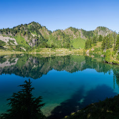
Then the most amazing thing happened. We woke up to the spectacularly clear day with just a couple of clouds in the sky. As Val and I always do, we got dressed quickly and went for a walk around the lake. I have to say that I have seen spectacular mornings while backpacking but this one is probably in the top of that long list


Once the drooling stopped, we went back to camp to have breakfast and warm up with the sun. Then we packed stuff for the day and shared our hiking plans for the day. This was the day to go out and explore the area in any direction you wanted. Val and I took off on a trail behind our campsite and took a detour to go check a little chasm I saw from the side of the lake. We hike all the way to the end where we found a little waterfall bringing snowmelt to the lake. It was beautiful yet not very impressive. I guess it looks way better in the spring when a lot more water is coming down. From there we got back on the ridge and followed the trail until it got to the upper basin where we found a small no-name lake that was the source of the small waterfall we saw down below. The surroundings where incredible with rocks and flowers everywhere. Since we had a pretty good plan for the day, we followed a straight line trail towards the High Divide which gave us really nice views almost every step we took. Once we reached the High Divide, we turned around and got a much better sense of the upper basin and all the little lake that dotted the area


From that point, we turn west and followed the trail towards Bogachiel Peak that ended up being a short adventure in itself. Close to the peak, we found a user trail that traversed a cliff with ample views of the upper basin. Yes, the views where really good, the route, not so much. At some point we had to call it and turn around to find our way back to the trail. Then, just several hundred feet down the trail we found an actual trail to Bogachiel so we headed up there… it was a bit disappointing. I guess we were expecting 360 degree views but that didn’t happen. So we took a picture of ourselves and headed back down. About a thousand feet from there, we got to the trail junction that could take us back to camp or go down to Hoh Lake. We stopped there to discuss as this was an optional side trip but since we heard that a couple saw marmots and bears down there, we decided to give it a try. The entire trail goes steeply down which made us think, every step we took, about the climb back. While going down we did stop once to reconsider but curiosity prevailed so we continued to the lake. That ended up being a good call for several reasons, one of them being that we needed more water. Just a bit before we got to the lake Val spotted a black dot on the other side of the lake moving…. a black bear. Shortly after we reached the lake and went to filter some water and there we spotted another bear on the other side of the lake. Yes, they did look like little black spots, very round and fluffy black spots. Berries were very abundant so bears didn’t have any interest in hikers


With full bottles of water, we then climbed back to the High Divide trail which, for some reason didn’t seem as hard or strenuous as we thought it would. From there we closed the loop going back to Lunch Lake in time to make dinner, enjoy the evening and go to sleep

Day 3 – Lunch Lake to Heart Lake:

The third day also started crisp and clear, not as the second, but still very clear. Our morning walk was very short as the plan was to have breakfast, pack and hike to Heart Lake. In the original plan, when we met with Matt to plan this trip out, he mentioned the idea of leaving the packs half way and doing Bogachiel peak this day, but since we had already done it, we voted for getting to Heart Lake and then exploring around. The hike started on the same trail we took the day before to the upper basin but before we started the park ranger encouraged us to explore of trail while minimizing our impact. So once we got to the upper basin, Val and I veered off and went around some of the little ponds we saw the day before. I couldn’t say is there were more ponds or we just saw some that we didn’t see the day before. Either way it was as spectacular as before with fields of green and spots of yellow around the crystalline blue of the ponds.


We continued up until we got to the High Divide trail but instead of turn right, we turned left towards Hear Lake. It was more uphill. The trail followed the ridgeline to the highest point on the trail where we got our first glimpse to what would be our next incredible view. From that knob, we descended thru several switchbacks where we made numerous stops to gram more blueberries. But then, we got to a saddle where another couple was taking a break and taking pictures. When we got there we learned why. The views towards Mount Olympus from that point are just breathtaking. Even though the mountain range is on the other side of the Hoh River valley, it almost feels like you can touch it. Yet you know it’s higher up and much colder as you see the hanging glaciers


We then continued down and veered of towards Heart Lake. The first section of the trail seemed that it was going to reach the edge of a cliff and then dropped from there but as we got closer to it, we noticed the valley opening up in front of us. Right at the edge before the trail start going down steeper you finally get a god view of Heart Lake which obviously is named after its shape


When we got there, we found that Matt had already staked out a spot for our tent high up on the side. We huffed and puffed with our packs until we got there, set up camp, had lunch and then went out to explore a bit. For that we just went back up to the High Divide trail and continued on it going east towards Cat Peak. After a while, the trail got pretty desolated and very brushy. It also started descending pretty quickly so we didn’t go that far as we didn’t have a lot of time left in the day and we were already a bit tired. When we got back to camp temperatures had dropped considerably and wind had picked up quite a bit as well. A Park Ranger had indicated that weather was turning and that we could get some rain. Then, as clear as the day was it got cloudy and then everything went dark and we went to bed


Day 4 – Heart Lake to Sol Duc:

Last day. The hike out day. We woke up to a cloudy, cold and almost rainy day. Considering we had to hike out and then drive home we woke up fast, had breakfast, packed our gear and got ready to go pretty quickly. Then we hit the trail going down. It was misty and cloudy all the way and soon we were back in the forest plowing thru mud in some sections. The hike was fast and uneventful as rain was pretty much chasing us but we were able to get to our cars just before it started.


You can check the pictures here

Interactive map

To see the full map, click Menu and select Full Screen. You can also click Terrain to change the map style