Eagle Creek, Feb 26th

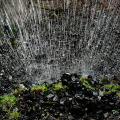
If you live in the area and like to go hiking, you already know Eagle Creek. This is probably one of the most scenic and easy to access trails in the Columbia Gorge. You get plenty of waterfalls, yaw dropping cliffs and stunning scenery. It’s so nice that some tend to repeat this same trail numerous times a year to enjoy the change in colors as flowers bloom in the spring and leafs turn brown in the fall. For us, it was a perfect choice for a hike leader in training to take a group all the way to Tunnel falls. Weather was fair for Portland which means it was cloudy and rainy. Being late winter though, the creek was carrying a lot more water than usual that adds to the already spectacular waterfalls. So bundled up with rain gear we started going up enjoying all the little seasonal falls on the side of the canyon as we gained elevation. Punch Bowl looked amazing as expected although it was difficult to take a descent picture of it. With so much water and a grey ski, we only got a big, white blob, but further up, little streams looked perfect for some good shoots. In sections of the trail, the water was coming from the side, thru the moss and landing directly on the trail. We did find some of the crossings a bit challenging as the logs were very slippery and some of the usual crossing points had washed out a bit, but we finally made it Tunnel Falls were we stopped for a quick lunch break. Then, on the way down, weather gave us a good sample of the changing seasons. First it got gray and started snowing. It wasn’t heavy snow but it came down fast enough to paint the hillside white as we walked thru it. But then, half way down, they clouds and snow dissipated enough to give us some glimpses of blue ski and even some sun rays hitting the ridge on the opposite side of the canyon. It was a very nice reward for getting wet I guess.

Newton Creek – Take two, Feb 4th.

So nothing happened between the previous attempt to Newton Creek and this one other than me being sick and some other stuff. Feeling better and with a wonderful forecast, I decided to give it a second try. This time I was a lot more specific on the dangers and difficulties of this trip trying to avoid having people that didn’t know well what they were getting into. Everything started well and we marched on a beautiful sunny winter day towards Newton Creek. We were so energetic that in no time we reached the bridge, crossed it and continue all inline, all together. Then we started climbing towards Gnarl Ridge which, as expected was a bit grueling but doable. Finding the route was easy enough to the point that we got directly to a fork we needed to take. On the ridge we enjoyed both, views of Mt Hood right in front of us and Mt Jefferson to the south and a nice lunch at a very sunny spot. By then I was very confident we were going to make the loop and erase the sour taste of the previous time. As with the previous intersection, we found the second one spot on that indicated the trail that traverses down the slope back to Newton Creek. We took this trail and soon after things went south. I do recall hearing comments like “this is not the way” and “this is too steep”. The comment I don’t remember hearing is “let’s go back”. So after a couple of minutes of me finding a descend route I turned around and to my surprise, I was by myself, no group, nadie. Instead of retracing my steps to go back trying to find everyone, I decided to stay put and admire the canyon views from where I was standing. In the end, I had the map and all the details. After several minutes people started appearing when they finally noticed that I was not with them even though I was leading this event. After a bit of discussion, I realized that even though no one was telling me anything, I had two or three people that were not feeling very safe or strong to traverse the steep slope. After a bit of deliberation (mainly with myself) I had to call it and turn around to go back the way we came. This made the return safer and easier as we just retraced our own steps back to the parking lot although it added a bit of distance as we were already pasty the mid way point. I still want to do this loop so maybe there will be a third attempt later, but for now, I’m putting this to rest, still undone.

Newton Creek – first attempt, Jan 14th

Some time ago I went to Newton Creek on an exploratory Snowshoe that ended up being quite great. On that instance, we hiked all the way to the creek and then followed it upstream, on the west side as high as we could and then circled back on a ridge next to it to come back down. This time my idea was to cross Newton Creek climb towards Gnarl Ridge on the other side and do a bigger loop. Weather was not cooperating a lot but it was dry so the first part of the hike went without any hiccups. Even crossing over Newton Creek went pretty well as we found some logs that were sturdy enough. From there it was a steep climb to the ridge and then some navigation thru the woods. At some point weather turned on us and we got sideways rain/snow which forced us to turn around and go back retracing our steps. Yes, it’s a short story and certainly I could blame someone for not doing the entire loop (those who were there know what I’m talking about) but Weather was a big factor so I’ll leave it at that, besides, if this was a first attempt, you can be sure there’s a second attempt later.

Barlow Butte - Barlow Ridge loop, Jan 8th

If you’ve read my posts, you might remember that I’ve written about Barlow Ridge several times. In most of them, if not all, I’ve mentioned going off trail towards the ridge and finding some splendid views and then coming back down using different ways. All those times, my intent has been to find a way to get to Barlow Butte and then come down on that side of the mountain completing a loop rather than doing an out and back trip. According to the maps, this is entirely possible, tricky but possible. The weird part if that in all those attempts, I was never able to figure out the route. This time, counting on a much lower snow level, I decided to try the route in reverse. Go to Barlow Butte and then find my way down to Barlow Ridge. Part of it was because I knew where the Barlow Butte connects to the Mineral Jane so I knew where I had to start from and also because, with a lot less snow, any existing trail is a lot easier to find. Luckily we had perfect conditions for this as we had a mild day with plenty of sun and light and one of the best groups I’ve had in a long time. The first part was the normal warm up as you go downhill from Barlow Pass to the Mineral Jane trail. After meandering thru the forest for a while, we got to the fork and took the Barlow Butte trail. I originally thought it would be easier but it turned out to be fairly steep. Not surprisingly, Barlow Butte itself is not a desirable destination. The views are quite limited even though it’s a nice place to stop for a while. What comes after is the best part though. Once you come out of the forested top, you find yourself on an open ridge with plenty of snowdrift. The views are short of spectacular with the undulating lines in the snow and views that extend to Jefferson and beyond. The traverse is not difficult but you need to keep in mind the border and stay away from it. A fall from up there would not be fun. After that comes a bit of experimentation as three big rock formations appear on the ridge. None can be traversed over so you have to find a way around them. This, in a couple of places is very tricky. After the third one, we found an open spot with plenty of sun that was perfect for lunch. Right after that, some of us decided to take the snowshoes of and climb the rocks to the top. It was a pleasant surprise to find a big enough area to sit at the top and a magnificent view of the White River basin and Mt Hood. Certainly a view we can’t get tired of. From that point on, it’s a lot of route finding as you steeply descend thru the woods searching for the Barlow Ridge trail. Luckily that is not difficult to find if you keep your bearing correct so after a while, we just bump into it. From this point on and all the way back to the cars, is a route I very well know and still love but now that I completed the loop, I can try it the way I’ve always wanted to.


Interactive map To see the full map, click Menu and select Full Screen. You can also click Terrain to change the map style
Ghost Ridge and Palmateer Point, Dec 17th

I think this is the snowshoe I remember the most from last year but strangely enough, it’s not for the snowshoe itself. I’m not saying it was not an enjoyable outing with fantastic weather and views but for the price I paid for doing it. In the days prior to this hike I had a little cough going on which ended up making it really hard for me to do this loop which, in normal conditions, I can do almost backwards. But even before that, I had a bit of equipment malfunction. One of my snowshoes had a broken link that holds the platform to the pivoting binding. At first I tried a small key ring but that only worked for about 10 minutes. When that happened I opted, since the snow was pretty packed, to go without snowshoes. That’s when the cough got a worse and I even started having problems breathing. After a couple of puffs with Albuterol, I started feeling a bit better but was getting tired really fast. When we finally made it to the top of Ghost Ridge, I decided to take a quick break to fix my snowshoes. After thinking for a bit, I decided to use the lift bar to hold the binding in place (this fix is in the pictures). I think MSR never thought about doing something like this and actually making it work. In any case, that fixed one problem so I was able to continue on the loop towards Palmateer point that we reached without major problems. We made another short stop to enjoy the views and take some pictures before we started bushwhacking down the slope back to the PCT and then to the cars. The pictures will show you the scenery we had. It was fantastic. The price I paid? I ended up getting sick with a cold that I wasn’t able to get rid of for about three weeks!


Interactive map To see the full map, click Menu and select Full Screen. You can also click Terrain to change the map style