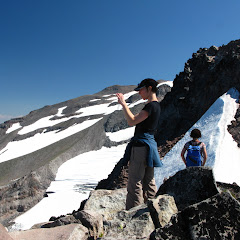
Hamilton Mountain, Sep 17th

Hamilton Mountain is one of those classic hikes in the Gorge that gives you very nice views and a descent amount of exercise. It’s definitely a weird summit though. Most times, the word summit comes accompanied with 360 degree views which is not the case of Hamilton. This summit actually “point” to the east so you can only see that way. Better than the summit itself though, is the actual hike up there and the walk thru the saddle after the summit. Both of these offer great views of the Columbia River, Bonneville Dam and Mt Hood on the other side (only visible on clear days). This hike was like any other time I’ve done Hamilton in the fall. Great colors and amazing scenery. The only unexpected thing that threw me off a bit was finding a group of about 200 kids up at the saddle. I talked to one of the “leaders” and he told me it was a group from a Christian school that hiked all the way from the horse camp. Other than this “encounter”, the hike was very nice with a fun, small group of people.


Interactive map To see the full map, click Menu and select Full Screen. You can also click Terrain to change the map style

Trapper Creek, Sep 10th

With many things going on, I was about to post a hike on my own when Zach, one of the hike leaders in the group, posted a hike in Trapper Creek. Since he had been doing some really nice hikes that involved considerable distance and elevation gain and I needed a bit of exercise, I decided to join him instead. I’m not sure what was it but the day did not start very good. I guess I might have been a bit dehydrated which combined with the high temperature and humidity triggered a headache that left me walking almost by remote control. I was not happy. As if that was not enough, my well worn hiking shoes gave out and started bothering me. About half way thru the hike I opted for taking them of and hiking barefoot. That didn’t work well in the long run as I couldn’t find a god way to keep my socks and insoles in place (despite the duct tape) to protect my feet. At some point Val came to my rescue (thank you sweetie) and gave me her shoes which worked nicely for the rest of the hike while she wore mine. I guess the way I break shoes didn’t affect her at all… go figure. Anyway, despite all of the above, the hike was not terrible at all. The Trapper Creek wilderness is wonderful and incredibly beautiful forest with some old growth sections, many creeks and streams and some great scenery. It does offer some trails for backpacking adventures and explorations as many spur trails cross the area giving you more than a couple of options to reach different destinations. Zach’s choice was great as it gave us a good sample of all that and left the possibility open for future hikes in the area.


Interactive map To see the full map, click Menu and select Full Screen. You can also click Terrain to change the map style
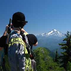
Battle Ax, Sep 3rd

I did Battle Ax about three years ago and was fascinated with the views from the top as well as the wintery scenery on the back trail coming back down. For some time now, I had been thinking of re-doing this hike but stayed away from it as it requires a long drive for a not so long hike. For this weekend though, I had not planned anything with the group so, considering the good weather forecast, I took of with Val to do this great little hike. Views were as expected with the added bonus of being able to see the big smoke cloud hovering over Mt Hood due to the Dollar Lake fire which was, coincidentally, the place we visited two weeks before. Looking at it from the distance gave us mixed feeling. ON one side it looked incredible but on the other, it was hard to imagine the destruction it was coming from. This hike is still one of my favorites for some reason and being able to share it with Val was the icing on the cake.


Interactive map To see the full map, click Menu and select Full Screen. You can also click Terrain to change the map style

Table Rock and Rooster Rock, Aug 27th

This is a hike I did a long time ago but then, I was not able to get to Rooster Rock. Part of the reason was that we found considerable snow which made the hike a lot more difficult than expected. This time though, being the middle of the summer, not only we had spectacular weather but also time and energy to do it. The hike itself is not too hard although it certainly has more elevation gain than what the books say. The reason is that, between Table Rock and Rooster rock there’s a deep valley you have to descend to before climbing on the other side. The first part of the hike was pretty much as I remembered although this time, without snow on the ground, we were actually able to follow the trail. I remember last time we took a higher path thru the forest which made the rock traverse a bit more difficult but still doable. Views from the top of Table Rock included Jefferson and Hood with very faint views of other volcanic peaks. From there to Rooster Rock was a bit of a jaunt with a steep climb but we found it to be well worth it. I can certainly see why Table Rock has that name but for the life of me, I can’t see any resemblance in Rooster Rock to anything


Interactive map To see the full map, click Menu and select Full Screen. You can also click Terrain to change the map style

Dollar Lake and Barret Spur, Aug 20th

This area might not look like this anymore. A few weeks after I did this trip, a forest fire broke up and burned most of the area. Located in the north side of Mt Hood, this is one of those trails that offer a different perspective of the mountain. I can safely say that the first part of the hike, from the trailhead until you reach the Timberline Trail is like any other forest hike. You meander thru the woods with limited views, but this trail offers some nice streams and creeks that add to the beauty of the place. But then, just before you reach the Timberline trail and, in our case find our way thru mud, you get some interesting views of the cascade peaks to the north. Once on the Timberline Trail you have to look for a small cairn and a user trail to the right that climbs to Dollar Lake. Incredible enough, this is not an established trail despite the fact that a lot of people go that route, primarily to spend the night at the lake. From the Lake, that is located in a small basin, you don’t get a lot of views although you can clearly see the route you need to take if you pretend to climb to Barret Spur. After a short break and lunch we tackled that route with the intention to reach the saddle. That climb was arduous as it was hot and we were on an exposed trail. AS you gain elevation though, the views keep getting better and better. In the pictures you’ll also notice the dramatic change of scenery that goes from lush greens and valleys to rocky ridges and slopes. From the saddle we got an incredible view of the Ladd Glacier, Pulpit Rock and the top of the mountain. With the group, we decided to climb a bit more to the ridge to a higher point on Barret Spur. I had read you could go further than what we did but that would have been a bit dangerous. Still, from our return point we got some magnificent views of the Coe Glacier to the east and some amazing crevices down below. Indeed a hard hike but very rewarding with the views and scenery. For me it was even more rewarding. That’s the day I really noticed Val.


Interactive map To see the full map, click Menu and select Full Screen. You can also click Terrain to change the map style