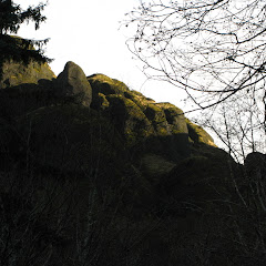
When you look on almost any guide for a flower hike, you’ll find McNeil Point near the top of the list. Certainly you have to wait a bit to go there as flowers tend to bloom more towards the summer when it gets warm enough. On those days, this hike is simply spectacular. During the colder months though, doing this hike can be a bit of a challenge. Part of it is getting to the trailhead (as we proved this time) and another is being able to hike the trail. I wanted to see this trail with some snow so I decided to go after one of the first snows we got this season. As I mentioned, getting there was a bit of a challenge. The road was already snowed with a thin layer of ice. Everything was cool while we kept moving but at some point I had to stop and that was it. The car started to slide by itself so we had to control as we could until it actually stopped. All that sounds easy until you picture the steep ravine to the side. Once we stopped, it was time for chains. I have to say chains are great despite the pain to put the on. Then, we finally made it to Top Spur, geared up and started hiking. As you’ll see in the map, there are a couple of ways you can do this hike. I opted for doing the trail around Bald Mountain first as the day was clear and we didn’t know how it would be later. After the quick ascend thru the forest we came to the open path overlooking the Muddy Fork. As expected the views were fantastic with Mt hood wearing a white hat. After circling Bald Mountain, we took the shortcut to get back on the McNeil trail and started climbing steadily. This trail passes an open side hill that on clear days also offers splendid views and flowers (in season) but the weather had completely turned on us so when we got there, it was pretty much a white out. It almost seemed like a complete different day than what it looked like when we started. We pushed on and further up we found the direct path that follows the ridge line straight to the shelter. We took this trail and continued on a mantle of grey that enhanced some of the features you find on the trail. Finally we made it to the shelter for a well deserved lunch and possibly the best timing ever. As we got our lunch out of our packs, the clouds parted to give us an incredible sight of Mt Hood and our surroundings. Looking towards the Muddy Fork we could see the cloud being held in place by an up current like a gigantic wave. At that point wind started blowing so we got cold pretty quick indicating it was time to move. We continued our hike on the trail towards Cathedral Ridge and then connected with the McNeil Point trail to hike back down. As we did, the clouds started moving in quite fast menacing with another white out that never came. Certainly this is one of the cool things about hiking in Oregon. You can do a trail many times but if you just wait until the season change, is like getting a brand new route
Interactive map
To see the full map, click Menu and select Full Screen. You can also click Terrain to change the map style