Table Mountain, Dec 6th

This was another one of those really long, hard and very rewarding hikes. Not only is a lengthy trail but it is also very steep. Table Mountain, as you might imagine is a mountain with a flat top, but that’s not the most interesting feature. It is located on the Washington side of the Columbia River Gorge. The south face (towards the river) is a 2000’ vertical wall that was formed when the mountain collapsed. All the debris from the mountain formed a stretch of land that for some time stopped the Columbia River forming a natural bridge that the Native Americans named Bridge of the Gods. In that stretch is where the bridge with the same name is today. Being a very long hike, we decided to start really early so we got to the trail head right after sunrise. The trail took us on the same path I had done just a couple of week ago when I went to Gillette lake and the Greenleaf Overlook so the first part of the trail was very well known to me. After walking in a relatively easy slope for about 5 miles we got to the trail junction where the “Heartbreak” trail starts. At that moment the name sounded funny but we did learn shortly afterward that is a very appropriate name for this trail. To get an idea, from that point it is a little over a mile to get to the summit but the elevation gain is over 1500’. That makes this portion of the trail very steep. After an arduous climb we got to a ridge that gave us the first really impressive view of the mountain wall right in front of us and the valley formed when it collapsed. From that point on, the trail travels away from the ridge and then turns up again through a steep rocky slope that has to be climbed using both feet and hands. Not long after that grueling section, you reach the summit and descend a bit to the actual peak of the wall. As you can imagine, the views from that point are simply breathtaking, so we decided to stop for lunch. For the return we had though doing the same trail, but on the way back we noticed a second trail on the ridge that continued north on top of the mountain. After a short walk, we came to the other side of the table with incredible views towards Mt Rainier. We continued on that trail that started descending on the east side of the mountain. This trail proved to be as difficult as the trail we used to climb up. For a long time we were just traversing on loose rocks. After that hike down and reaching the main trail (a portion of the PCT) we realized that we were about a mile further north so we had about 6 miles to go to get to the car. That hike down was really beautiful as it offered all the changing colors of the sunset until we got to the car in the dark.

Hike to Angel’s Rest, Nov 30th

Weather was looking pretty good for the weekend so I decided to do the classic Angel’s rest hike. Instead of doing it in the morning as usual, we started it in the afternoon. My idea was to get to the viewpoint at the top, make some hot cocoa and enjoy the sunset. The hike up was very nice with great views of the Gorge as you can expect from this trail, but once we got to the ridge, we were almost blown away, literally. Although it was mostly calm at the trailhead, it was windy enough at the top that we were not able to go all the way to the viewpoint. We ended up sitting behind a big boulder so we could get some cover from the wind and light up our stoves to heat some water. After the hot coca with marshmallows and whipped cream, we decided to head back down rather than wait for the sunset with those conditions. Once back at the trail head, with a smaller group of people, we decided to head to the Vista House and enjoy the sunset from there. As you’ll see in the pictures, the sunset from Angel’s rest would have been much better although it was still very good.

Mt Mitchell, Nov 29th

Not much to tell about this hike except it is the second time I’ve been there and still haven’t got the famous views your are supposed to get. The trail to the top of the mountain goes through a very dense forest that opens up at one point with a supposedly, great view of Mt Saint Helens. Further up, once you get to the ridge, there’s a big rock formation where an old fire lookout used to be. Some remains are still in the area. What’s most impressive is the view from the top. Looking north you are supposed to see Mt Saint Helens right in front of you and the Swift Reservoir down below. As you will see in the pictures, we didn’t get to see anything. I guess I will have to do it again; maybe third time is the charm.

Hike to Gillette Lake and the Greenleaf Overlook, Nov 23rd

This was a little hike that Mike organized and I decided to join. This trail is located in the Washington side very close to the Bridge of the Gods and is actually part of the PCT. The hike itself was very moderate passing by a small lake before reaching Gillette Lake. After a short stop to let the dogs go for a swim, we continued up through a dense forest to an opening that was not very pretty. We didn’t know at the time, but this trail crosses a section of the forest that’s being logged. That open area, besides being kind of ugly, was very windy. After that, the trail continued into the forest with a very mild ascend and offering some really nice views of the Gorge. At some point we decided to stop for lunch and head back out. We don’t really know if we got or even passed the overlook since there was no sign or indication of it. Besides almost loosing a hiker on the way back, I made a second stop at Gillette Lake just to let Shia swim some more. In the end it was a nice day with an ok hike.

Hike to Silver Star, Nov 15th

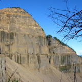
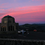
This is a hike I had in the books for a long time and finally got the chance to do. Silver Star is a peak in the Washington side that offers great 360 degree view of the cascades. I did try this peak once before but on a much larger and difficult trail, this time; I took a rather large group of people up on Ed’s trails. This route is by far the most traveled to the summit. What makes this hike interesting is that after a short hike up, you reach the mountain ridge and the trail mainly continues on the ridge with great views of the Star Creek to one side and the Columbia Basin to the other. On the trail, we passed through some interesting rock formations which include a natural arc. Once at the summit, we stopped for lunch and to enjoy the great views. Even though it was mid November, we were blessed with a spectacular day. In the pictures you’ll see that we had complete views of St Helens, Adams, Rainier and Hood. After that break, we continued further for a bit less than a mile to the Indian Pits. These are holes in the ground made from rocks. Nobody knows for sure what or how they were used, but certainly they were made by Native Americans as they went to this place on a vision quest. To get back, we did the same trail which, besides offering great views, gave us some really nice afternoon colors.